Alfarnatejo
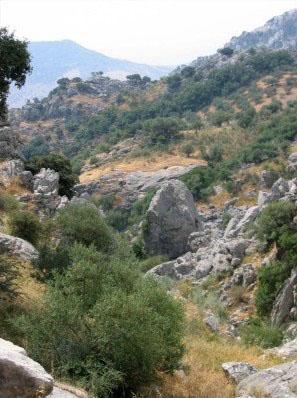
Standing on the road that links Periana Corridor with the old road to Granada, this small village is most notable for the rugged landscape which surrounds it, the spectacular Sierra de Camarolos and the views that it affords of the north of the Axarquia region.
History
As in other northern areas of the Axarquia region, a wealth of prehistoric remains bear witness to man's presence here since time immemorial, such as human footprints in the valley of the River Sabar and in Peña Hora caves dating back to the mid Palaeolithic period.
As their names suggest, Alfarnate and Alfarnatejo share common origins, as both were once known as Los Alfarnates, a denomination of Arabic origin meaning "flour mill".
Alfarnatejo was dependent on Alfarnate until the 18th century, when it was granted independent village status.