
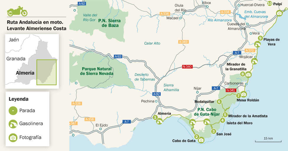
Ruta en moto Levante Almeriense Costa
The last unspoilt corner of the Mediterranean
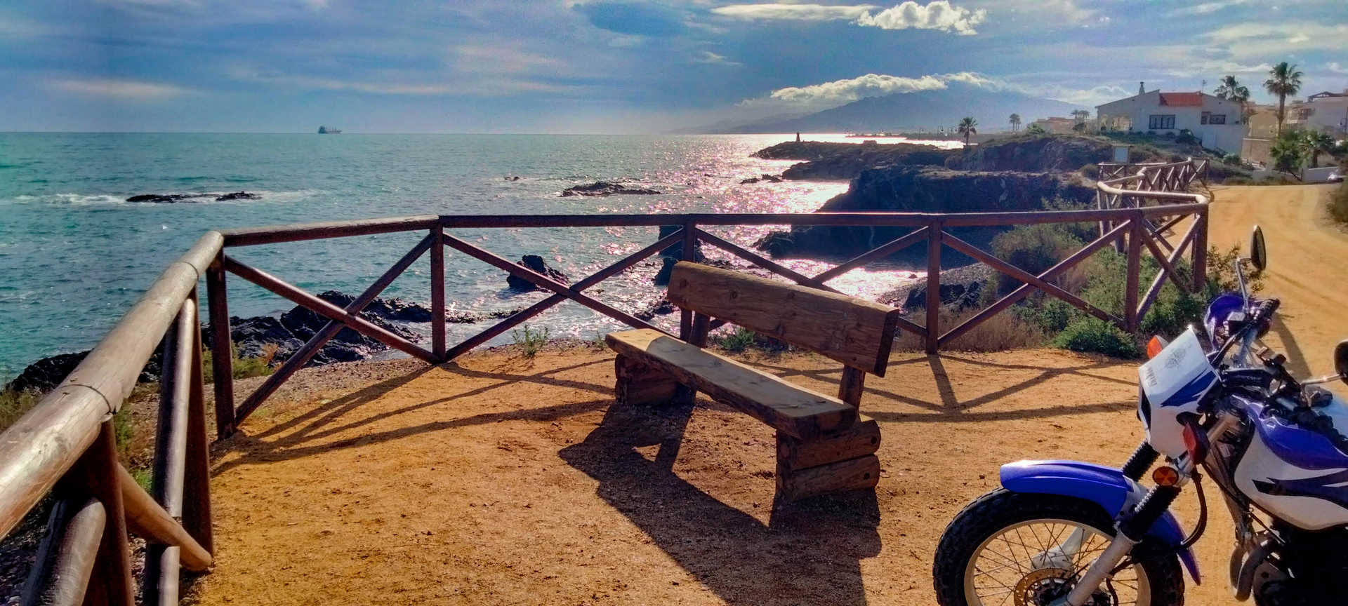
The Levante Almeriense Costa route runs along the last unspoilt portion of the Mediterranean Sea. Parallel to the coast, it is a homage to ‘slow travel’: a few kilometres enjoyed intensely. This coast is magical, enveloped as it is by a distinctive, serene atmosphere that will captivate you. It is dotted with small fishing villages and hamlets, criss-crossed by narrow, quiet roads, and it is a destination for nomadic travellers who enjoy a pleasant climate all year round. At times, the road meanders inland and at others you can almost touch the foam of the waves: beaches, vantage points, natural spots, industrial heritage... a landscape that is sometimes literary and always film-like. Some coves, a little terrace overlooking the sea, everything invites motorcyclists to stop. Around any bend, or hidden behind a cliff, you will discover an empty cove or a beach untouched by mass tourism. Eastern Almeria reminds you of what the Mediterranean was like during our childhood.
On route
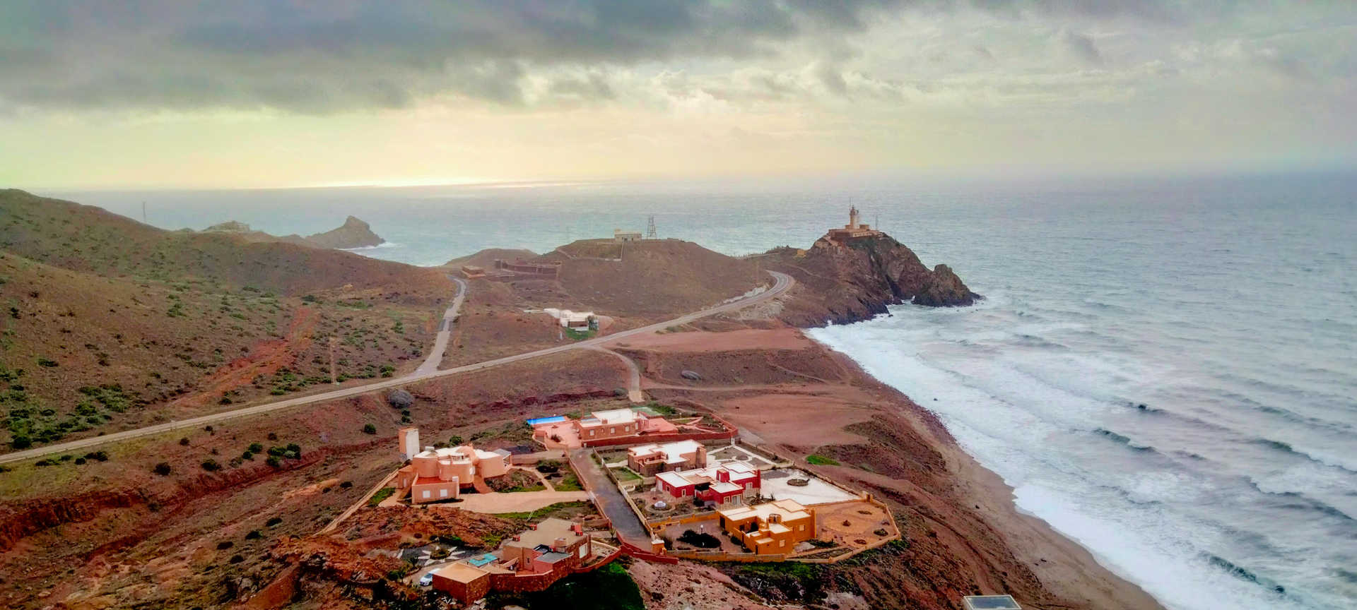
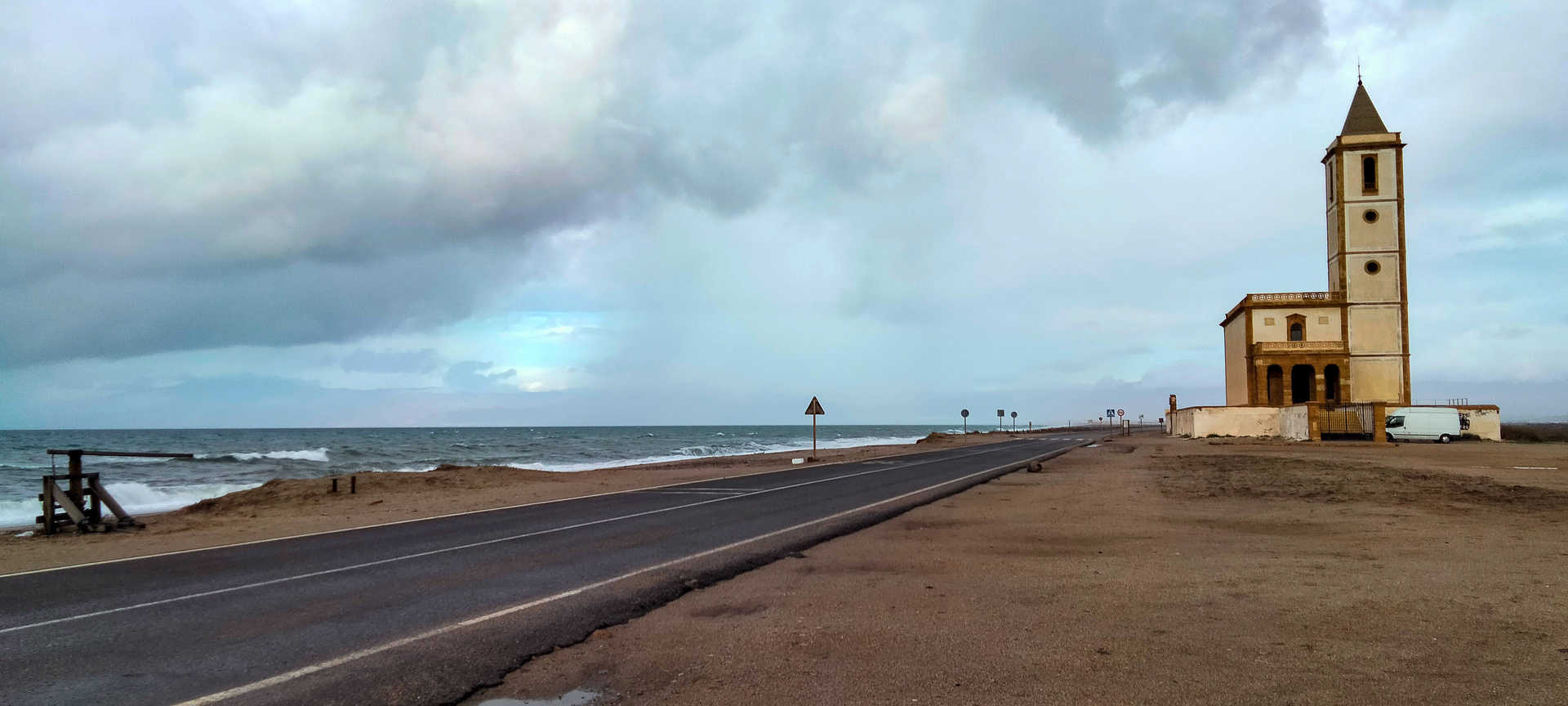
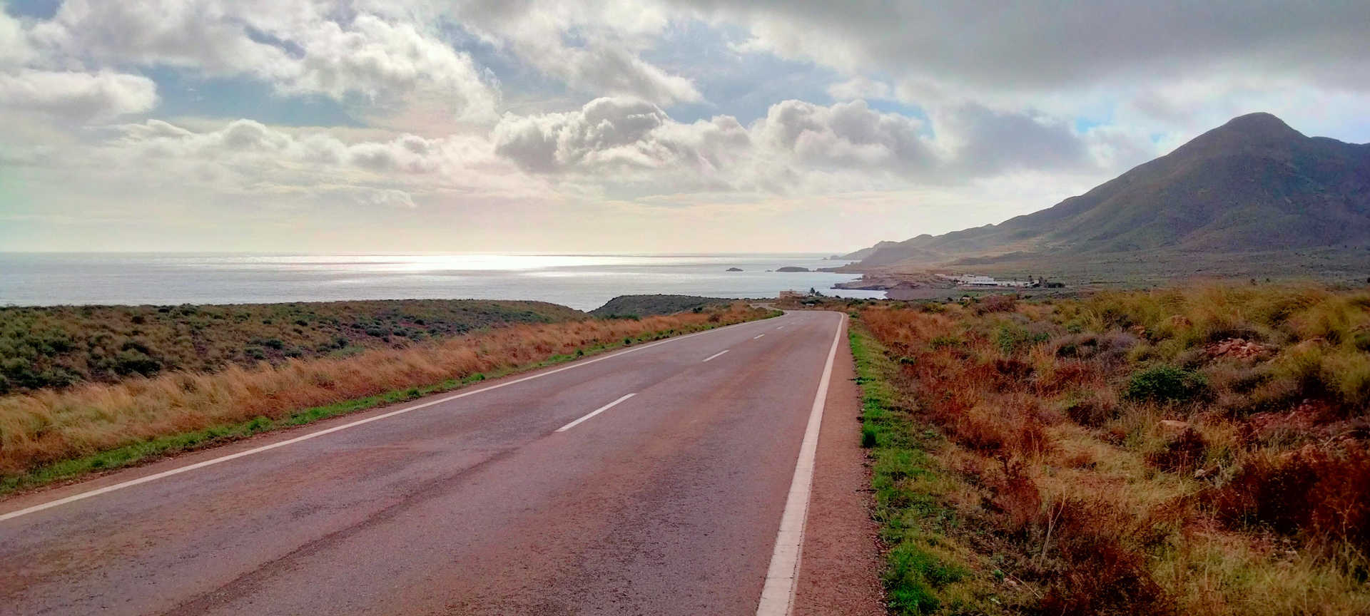
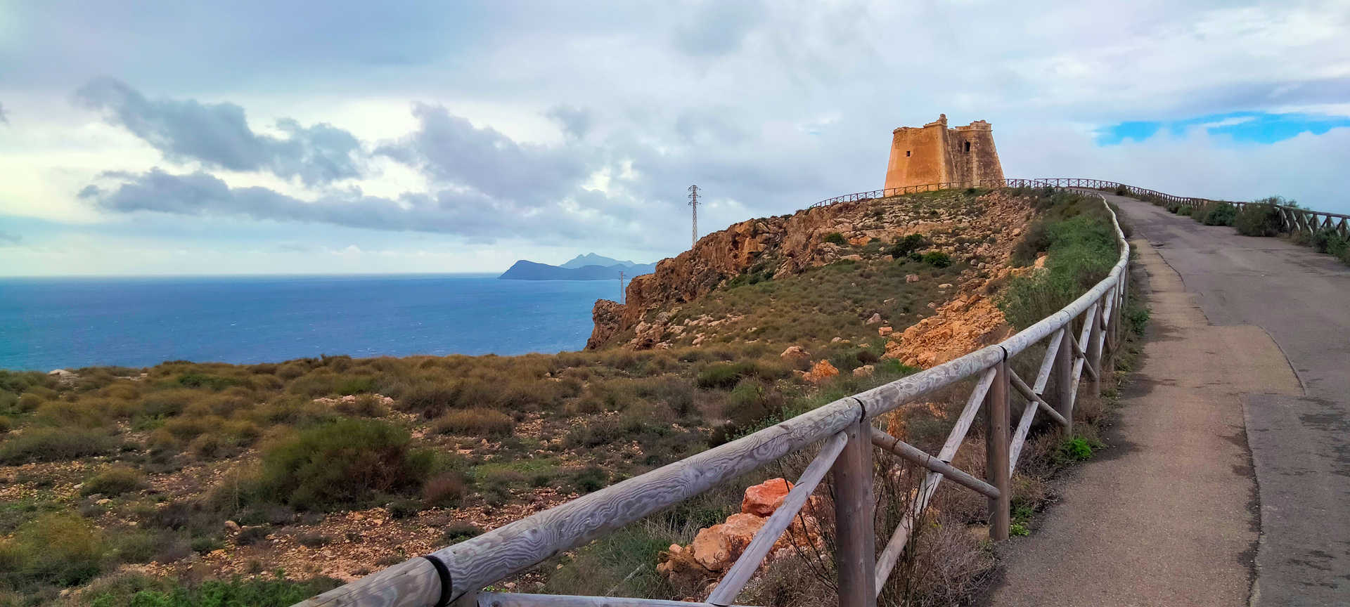
You will depart from the capital, Almería (stop 1), via the coastal road AL-12, travelling along the bay and enjoying the magnificent panoramic view of the mountainous massif surrounding the little fishing village of Cabo de Gata. After leaving behind a unique agave forest and marking the alternative route in your satnav, you can visit the beautiful and unique geographical feature, the Cape, which is of volcanic origin. You now drive along an evocative road, between the salt marshes and the beach, which enables you to enjoy an ornithological paradise and fishing villages that appear to be anchored in another era. The lighthouse (stop 2) sits proud on a promontory as its age-old function requires. To the east, the emotive Arrecife de las Sirenas (Mermaid’s Reef) rises up with its suggestive legend.
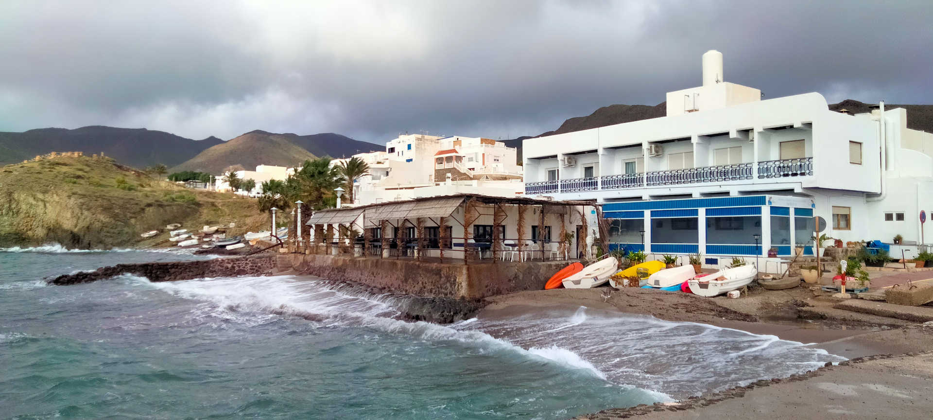
Returning to the main route and using various district roads, you will skirt the Cabo de Gata-Níjar Natural Geopark as far as El Pozo de los Frailes. There you can take the signposted turn-off, which will lead you to the small tourist and coastal village of San José (stop 3). Just a stone’s throw from this interesting place, you can bathe in such unique and famous beaches as Mónsul and Genoveses. You will then continue to the next stop, La Isleta del Moro (stop 4), a small and peaceful fishing village. Hardly touched by tourism, it is an excellent place to have lunch or a coffee while listening to the sound of the waves.
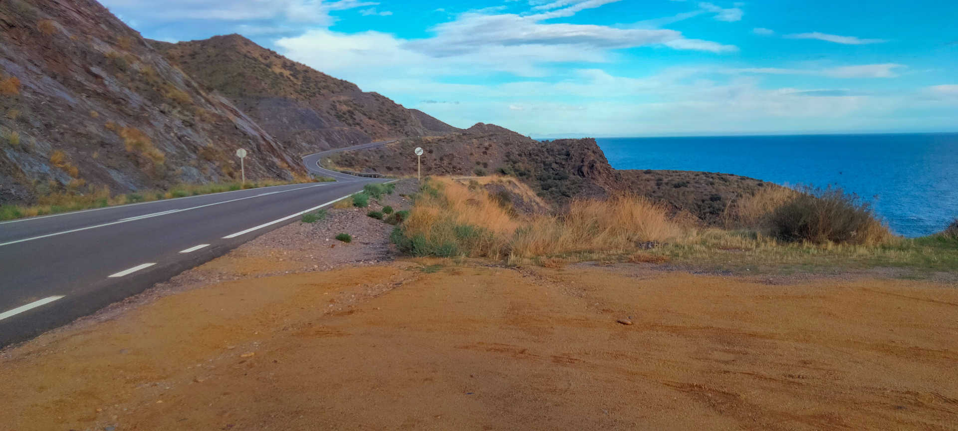
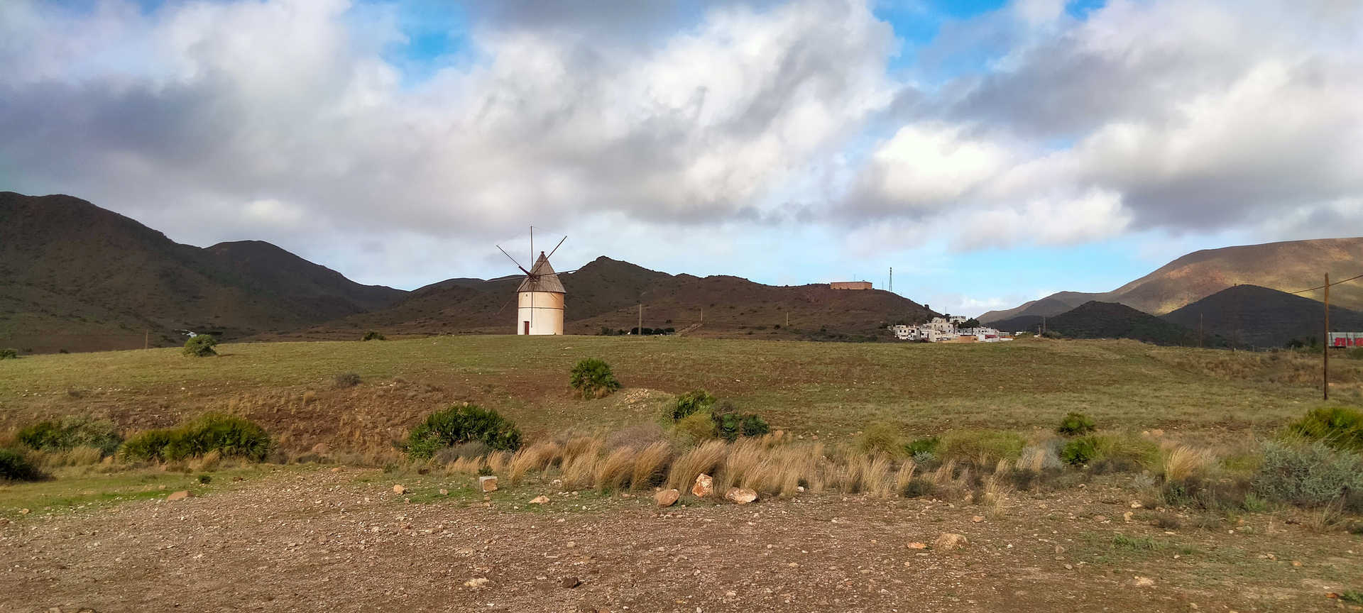
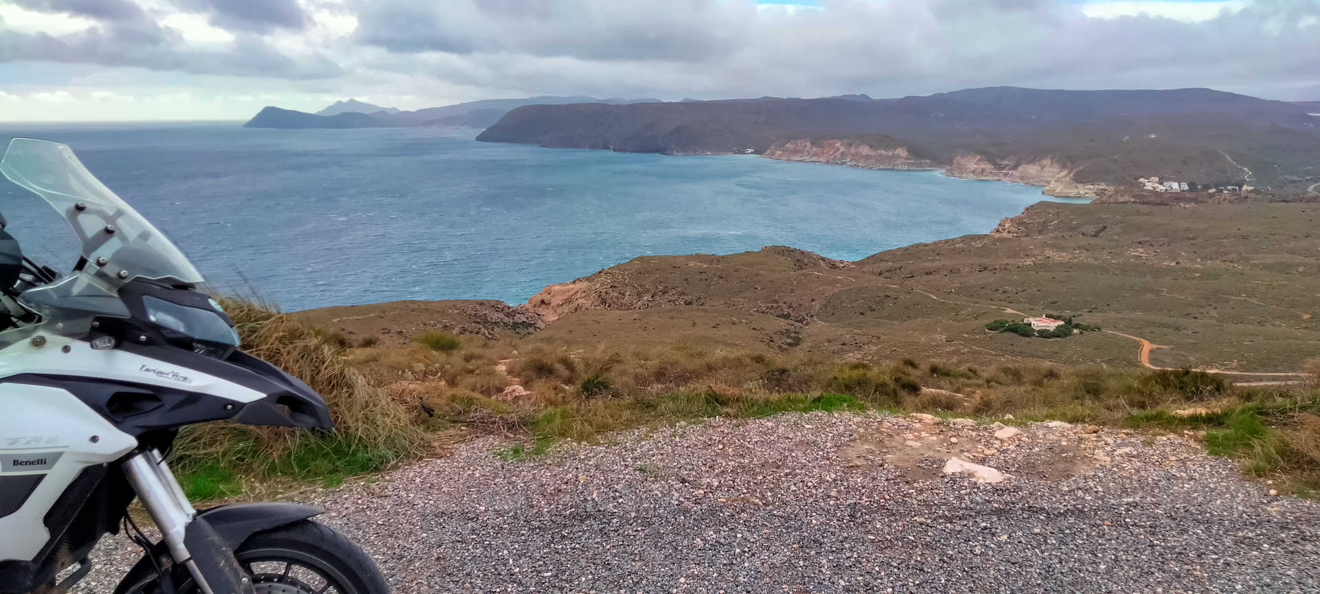
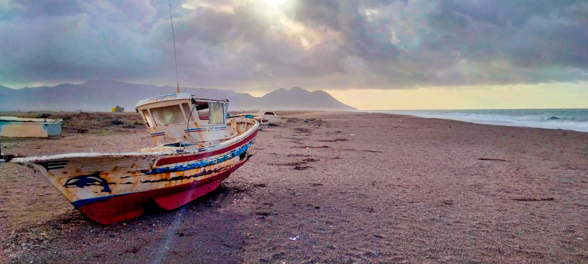
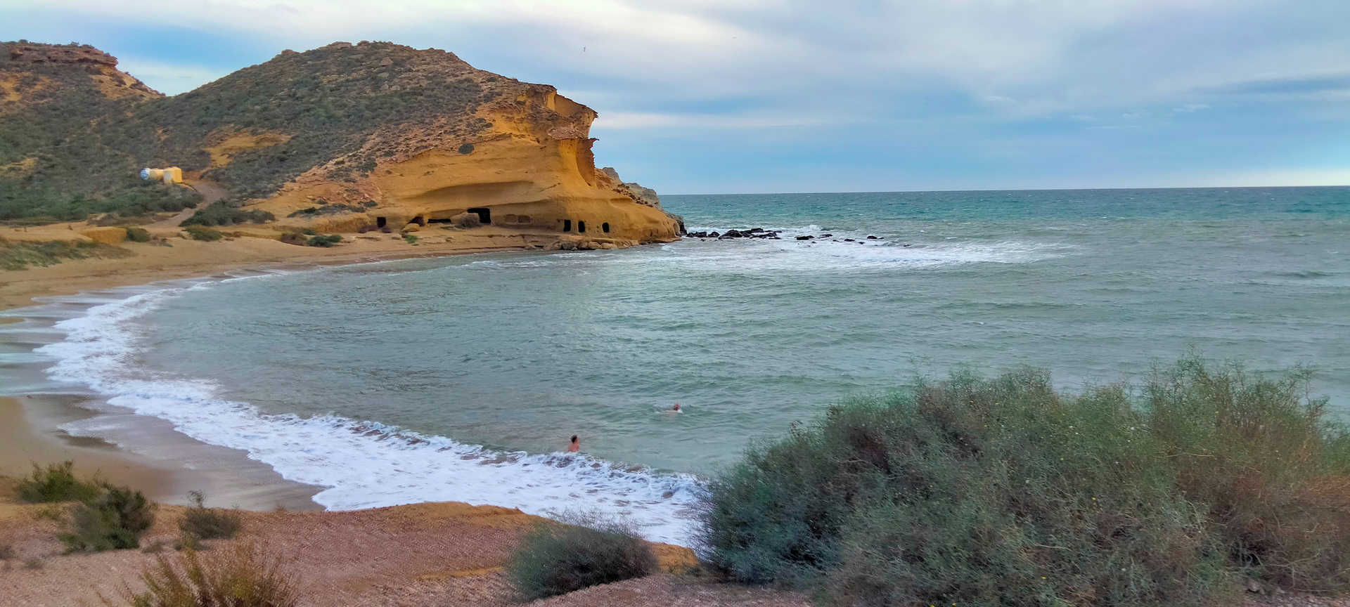
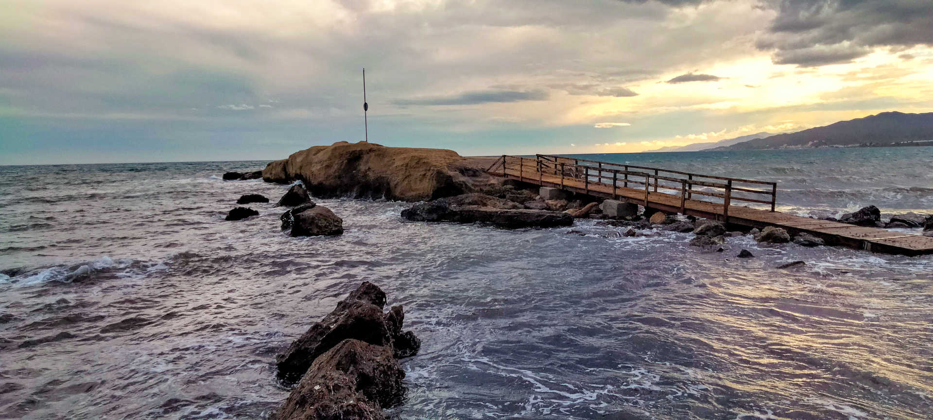
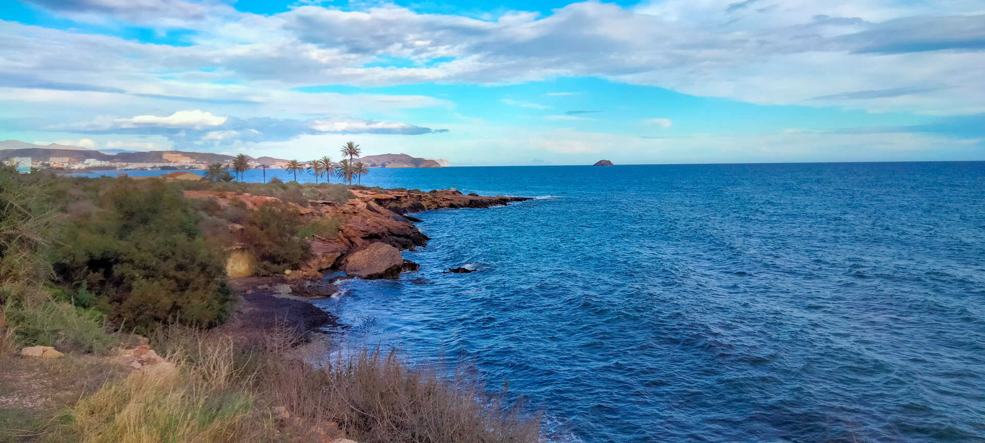
Stopping at the Amatista vantage point (stop 5), where the sea merges with the bluest sky imaginable, the route then continues along the AL-4200. It will lead you to the volcanic caldera and village of Rodalquilar (stop 6), a paradise for lovers of geological and mining history. Far from the madding crowd, peace and quiet envelop this former gold mine in a veil of peace. Hugging the coast, El Playazo has witnessed Phoenicians, Romans, Andalusians, pirates, gold diggers and even Hollywood has even filmed there. The place is a distillation of the vast history of this light-filled land. A small detour along the AL-3106 will take you to Las Negras. Its coast features a splendid cove sheltered from the frequent winds. The roads are in very good condition, they are straight and easy to drive on, except for one, more winding section. Traffic is scant, pleasant, except in the summer season.
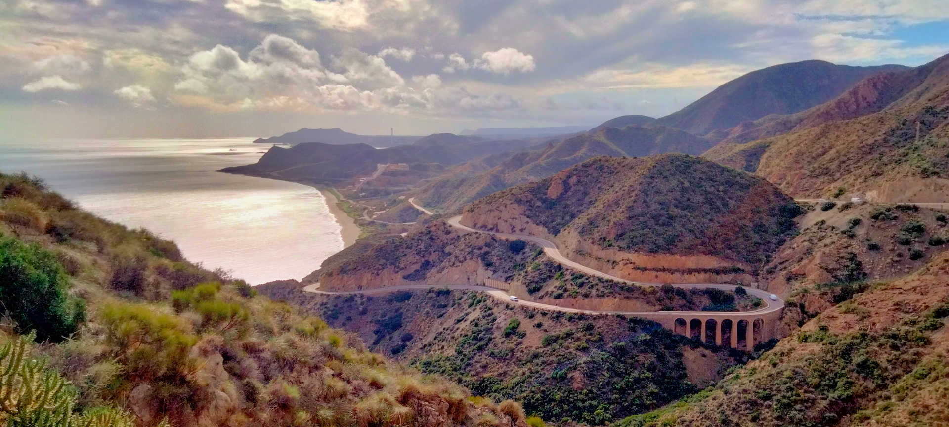
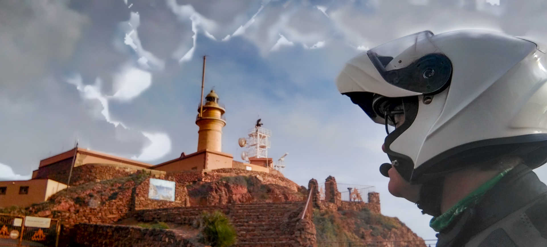
Following the AL-3106, the route will lead you away from the coast, rolling between the hills that demarcate the natural park. You then arrive at the small village of Fernán Pérez to, before turning back to the east and returning to the Mediterranean through Agua Amarga. As you approach the coast, you can climb up to Mesa Roldán (stop 7), a volcanic meseta crowned by a fossil-studded coral reef. Beside its watchtower is one of the tallest lighthouses in Spain, offering impressive views. Be careful on the way up and, above all, on the descent because of the steep slope and the poor condition of the asphalt.
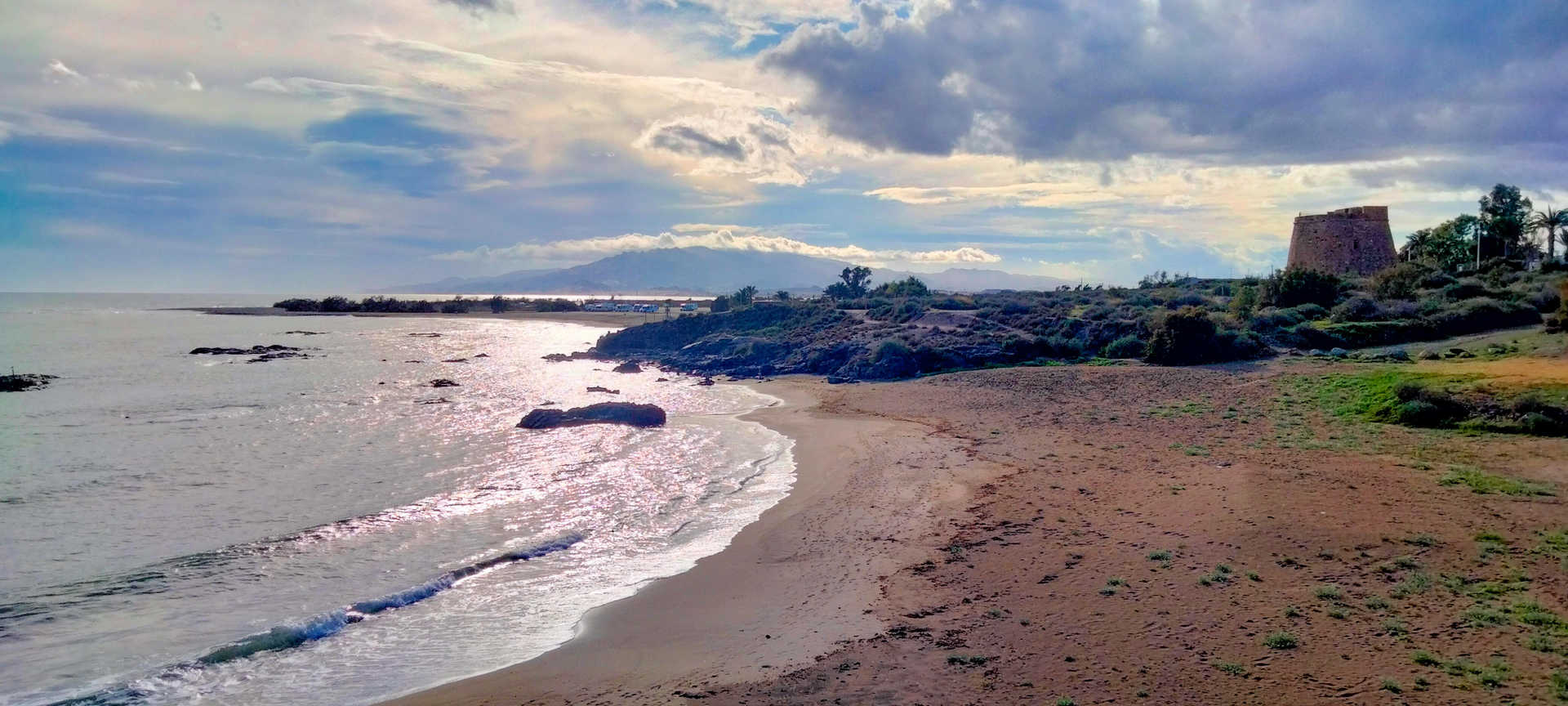
You will soon be greeted by the industrial, fishing and tourist village of Carboneras, which you will shortly leave behind as you cross the Sierra Cabrera along an impressive stretch of road. It is recommended that you stop at the Granatilla vantage point (stop 8), since it offers a fantastic panoramic view, of both of the road and of the coastline. After a few winding kilometres you will reach the beaches of Mojácar. Inland, watchful, stands its magnificent historic quarter. It should be recalled that, for more than 250 years, this territory was a victim of Barbary piracy and its coastline is peppered with defensive structures: citadels, forts, towers and castles. Further on, Garrucha and the beaches of Vera, the most populous area on the route, await you (stop 9). Here you will have a major dilemma, since its cuisine is so varied and tasty, and there are so many restaurants, that you will not know which to choose. Its culinary delights are embodied by its fish, grilled and with garlic, its seafood, such as the famous Garrucha red shrimp, and its seafood stews, with local rice and vegetables. But the interior has the last word and a wide tradition, with dishes such as gurullos– a very unique type of pasta – with rabbit, meatball stew, olla de trigo (chickpea and wheat stew) and anchovy pies. For dessert, the ‘Padres Mínimos’ drunken torte is a must-try.
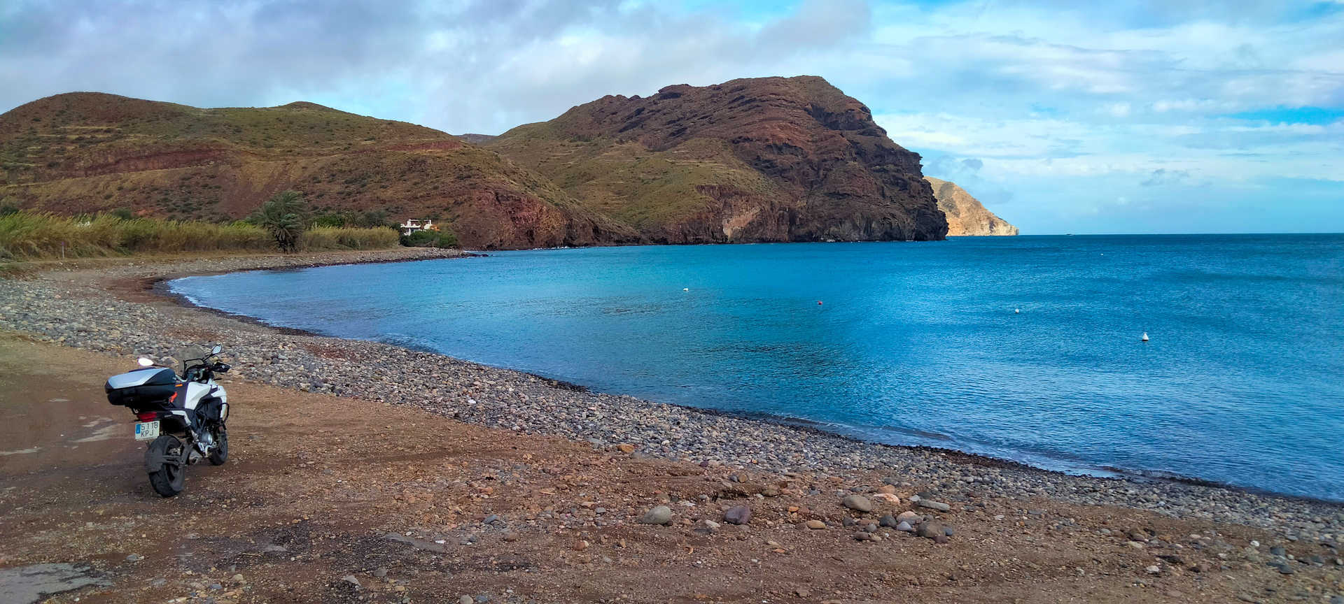
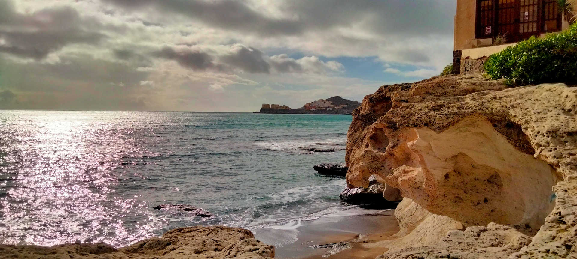
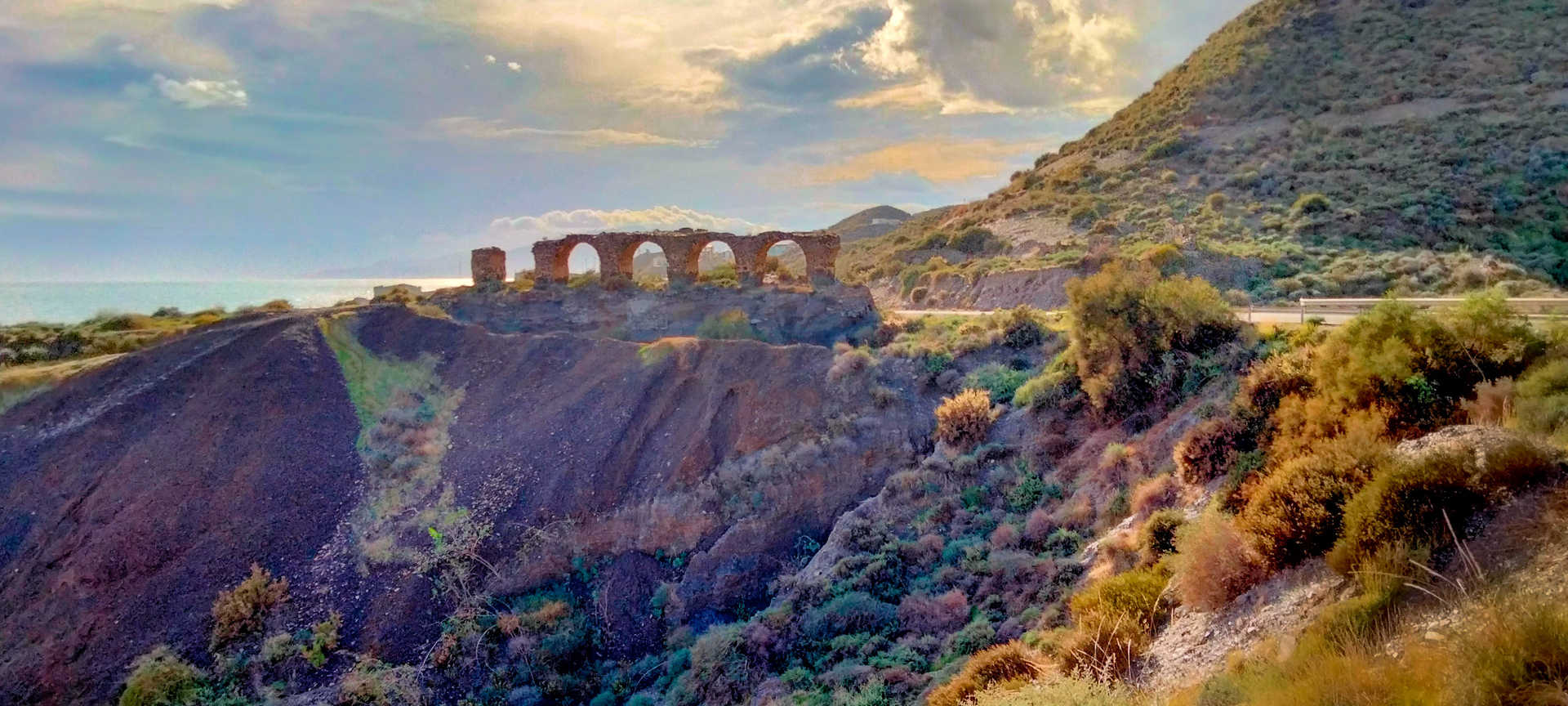
From the small village of Villaricos, where its Phoenician site stands out, you will ride along the last stretch of barely inhabited or built-up coastline. A series of small coves with turquoise waters, easily accessible and dotted with old mining mills, a very interesting example of archaeo-industrial heritage. The road is meandering and lonely, echoing the geographical forms of the coastal relief. Finally, you will reach San Juan de los Terreros after passing through Pulpí and visiting its famous geode (stop 10). After leaving the city behind, you will reach your final destination: Los Cocedores beach. It is a picturesque shell-shaped cove with caves inhabited since ancient times, on the north-eastern border of Andalusia, marking the border with the Kingdom of Murcia.
#cabodegata selfie point
It is one of the peninsula’s cardinal points, a magical place. Here there is an imposing lighthouse almost entirely surrounded by the sea and battered by the winds. It is accessed via a narrow road, hugging the cliff, overlooking an impressive volcanic landscape.
Dienstleistungen und Infrastruktur
Zielgruppe
Segmente
Spezialitäten
Jahreszeit


ENTDECKEN SIE ANDALUSIEN
ERFAHRUNGEN


