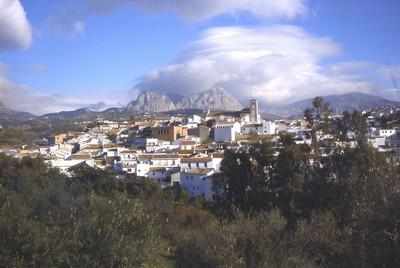
Riogordo

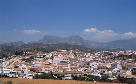
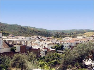
This village is located in the Periana Corridor, near Colmenar, in the hollow formed by the River de la Cueva between the mountain ranges of Sierra de Camarolos to the north and Los Montes to the south. Its largely gentle landscape consists primarily of cereal fields and olive groves.
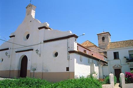
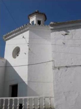
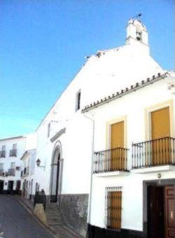
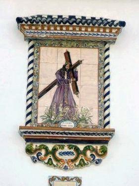
The village is typically Arabic in appearance, its architectural highlight being Our Lady of Grace Church. The most interesting feature for the tourist is the performance of el Paso (Christ's Passion) and the Easter story by villagers on Good Friday and Easter Saturday.
History
The name of the village, formerly known as Aprisco de Majianza, is taken form the River which flows through it, the Riogordo, which in turn owes it toponym, literally "fat river", to the abundance of minerals to be found in its waters. The existence of these minerals may well have been an important factor in the appearnce of the first settlements in the area, which date back tot he Bronze Age, as witnessed by the remains found at Gómer Cliffs and Capellanía Hill.
Phoenicians burial grounds have been discovered in the Sierrecilla del Rey mountains, and, nearby, -in Cortijo de Auta, Llano del Rey and Capellanía- archaeological relics pertaining to the Roman era have been found.
As is the case with so many other areas of Málaga, Riogordo enjoyed greatest prosperity during the Andalusí-Arabic period, due above all to the effective exploitation of natural resources -primarily agricultural- and their commercialisation. An important figure in this long period in our recent history was Omar Ben Hafsun, whom some authors believe may have been born in this area, on the site which is today occupied by Auta Farm but might once have been home to Bobastro Castle. However, most historians are adamant that Bobastro fortress, the muladí (Christian convert to Islam) leader's refuge and headquarters, stood on the Villaverde Plateaux, between Álora and Ardales.
In 1487, Riogordo -then Aprisco de Majianza- was captured by the Catholic Monarchs, and placed under the jurisdiction of Comares, with most of its land being given to Don Francisco de Coalla, formerly Governor of Málaga, shortly afterwards.
At the start of the 16th century, it was known as Puebla de Riogordo, and in 1552 it received full municipal status.
Another historic episode in the village's chronicles and popular tradition is the role played by its inhabitants in the military units put together to harrass French troops during the War of Independence. A key figure in this was the Priest of Riogordo, José Muñoz Sánchez, leader of the bands of guerrillas which inflicted such heavy casualties on the French army. In November 1811, a large group of guerrillas led by the Priest of Riogordo was attacked by French infantrymen sent expressly for the purpose from Granada, and 20 Spanish lives wreer lost.
The village and its municipal area were also affected by the major tremor known as the Andalusian Earthquake on Christmas Day 1884; though damages in Riogordo were slight, 58 people perished and the village was devasted in the worst affected location, neighbouring Periana.
Eminent citizens
Francisco de Rojas, Governor of Málaga.
D. Salvador Morales, adjutant at Saint Gregory's Castle in Orán.
D. José A. Muñoz Sánchez, priest, who led a cavalry squadron in the War of Independence.

- Max 19
- Min 17
- Max 66
- Min 62
- °C
- °F