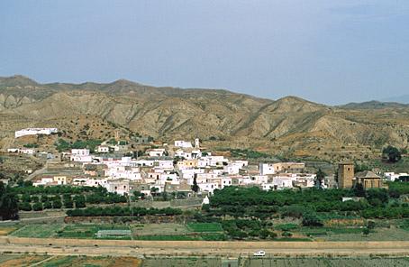
Alsodux
Village situated in the area of Valle del Medio Andarax, on land dedicated to the cultivation of fruit trees and vines, surrounded by dry desert-like hills.
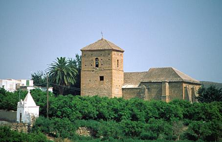
The village stands among the hills with its characteristic flat-roofed houses of Moorish origin, among which the Parish Church is a focal point.
History
Historians have traditionally translated its name as "sixth". It is thought to come from the Arab word "al-sadis" or from "sodux" in the Andalusí dialect, in reference to the place it occupies within the Taha de Marchena region. There are today some Arabists who do not agree with this thesis.
The 12th-century Muslim geographer and chronicler Idrisi speaks of Alsodux as a farmstead located in a strategic place between the Nacimiento river and the access to Guadix.
With the Christian conquest, after the surrender of Baza and the capitulation of Almería, the Taha de Marchena was surrendered to Don Gutierre de Cárdenas y Chacón.
Before the expulsion of the Moors in 1570, Alsodux had 80 houses, a mill, an oil mill and about 75 Moorish inhabitants. After the expulsion it was repopulated in 1574 with 29 people from Castile, western Andalusia and Levante.
The XVIII and XIX centuries were characterized by an increase in the population and an economical revival. With the abolition of the estate in 1835 it acquired an independent council.
A principally agricultural village. During the Al-Andalus period raisins, oil and silk were exported. In the XIX century the Ohanes grape was introduced. Today the largest cultivated surface area is dedicated to citrus fruits, followed by horticulture and fruit trees.

- Max 21
- Min 19
- Max 69
- Min 66
- °C
- °F