
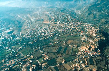
Cájar

Cájar is geographically located in the AREA known as the Campana Granadina, which in the past referred to the jurisdictional lands of a parish church. La Campana was said to cover the lands where the bell struck from one of the Alhambra Towers (Torre de la Vela) could be heard. According to this, Cájar would come under La Campana, since it is situated between Sierra Nevada and Granada, just 6 km away from the city of the Alhambra.
History
According to the survey carried out under the reign of Phillip II in 1572, it was founded in the 16th century. The earthquakes in 1884 affected the farmhouses extremely.It was previously named Caxar de la Vega.
Its proximity to the capital makes it a residential AREA.
Cájar
Municipio

The weather today in Cájar
- Max 16
- Min 9
- Max 60
- Min 48
- °C
- °F
Cájar
Tourist area
Distance to the capital (km)
6
Altitude above sea level (m)
730
Extension (Km 2 )
2
No. of Inhabitants
2828
Demonym
Cajareños
Postal Code
18198
en
Read more


