
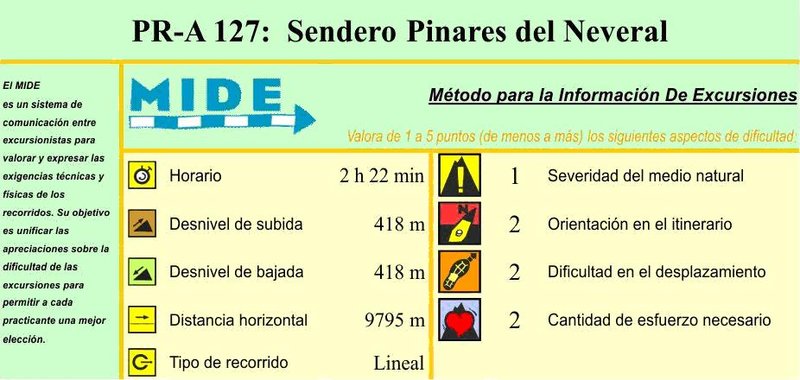
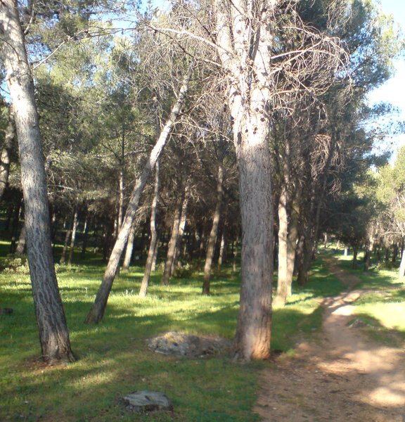
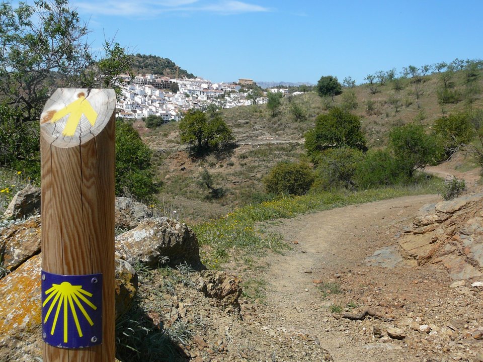
Pinares de Neveral Trail - PR-A 127
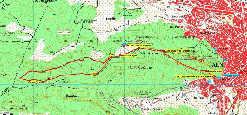
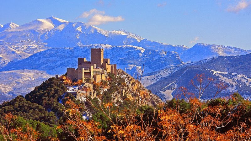
Jaén has grown and developed throughout its history, under the shadow of the Cerro del Castillo de Santa Catalina which defended the city for many years. One of its neighbourhoods is that of El Almendral, at the foot of the south face of the hill. The upper part is bordered by the ring road and this is the start of the Pinares del Neveral Trail - PR-A 127, a narrow path that climbs diagonally through an abandoned almond grove, already, towards a water tank we skirt around and which runs through the peri-urban Park of Santa Catalina.
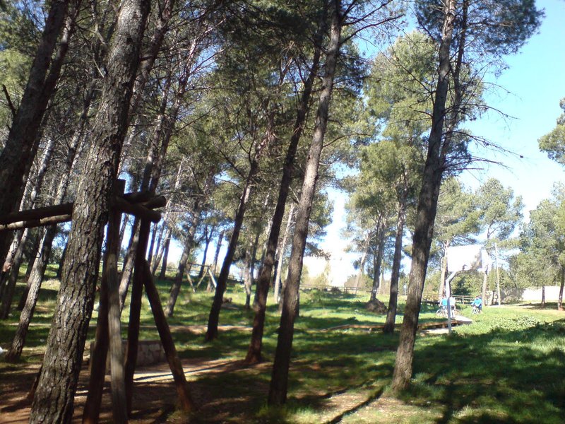
After the narrow, winding path, we enter the pine forest, passing by two huts and on up to the road, just a few metres from the fountain of Caño Quebrado, which is the start of the road to the Castle and the Parador luxury hotel.
At Caño Quebrado our route merges with the PR-A 126 - De la Muralla Trail until we reach the Neveral Recreational Area, where they then go their separate ways.
We then go towards the Hospital del Neveral along the left hand side of the road for a short distance. After the Casa Forestal de Caño Quebrado car park and to avoid walking on asphalt, we take a path which follows the road. We cross over a forest track, and arrive at the Neveral Recreational Area, and separate from the PR-A 126, the Trail of the Wall. We should then continue straight on towards some swings and a pathway with railings that lead to the border between pine forest and the olive grove. Where the pathway with railings separates from the pine trees we turn left along a narrower path alongside the pine trees, and immediately skirt around the water deposits which supply the hospital.
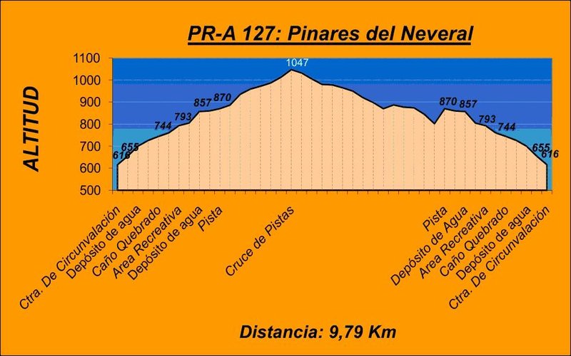
The climb is continuous, to the right there is a picnic area and shortly after a forest track. This is the starting point for the circular section of the trail to which we will return from the pathway to the right. We cross over the track, take the pathway in front of us which connects with another forest track further up. Continue to climb up to the right.
The pathway continues along the track and does not stop climbing until crossing another track at a sharp bend. Here we are at the highest point on the trail. We take the pathway to the right, which descends sharply. The path does not leave room for any confusion. We return to the point where the trail crosses over the pathway, which then completes the circular section. Once here, we take the path to the left again passing through a picnic area and we return down the pathway we took on the way out as far as the starting point in the district of El Almendral.
Type of Trail: Circular. Trail Status: Approved and Signposted 2001. Total Distance: 10 Km. Legs: 1 Accessibility: It can be done on foot. Download Brochure
Itineraries


Services and infrastructure
Target audiences
Segments
Season
You may be interested


EXPLORE ANDALUSIA
EXPERIENCES


