
Estación de Vuelo Libre de Los Villares
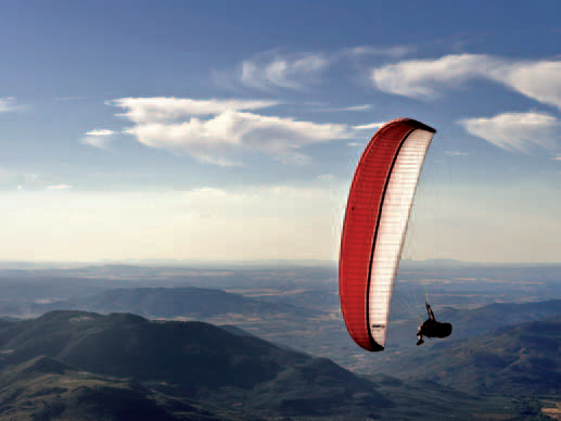
The flying site of the Los Villares municipality, a town located 10 km to the south of Jaén, the area is the gateway to the Sierra Sur de Jaén district, just 2 Km. from the town. The spot is a splendid natural viewpoint; from here you can see the summits of El Jabalcuz and La Pandera, and enjoy great views of Santa Catalina Castle, which crowns the city of Jaen.
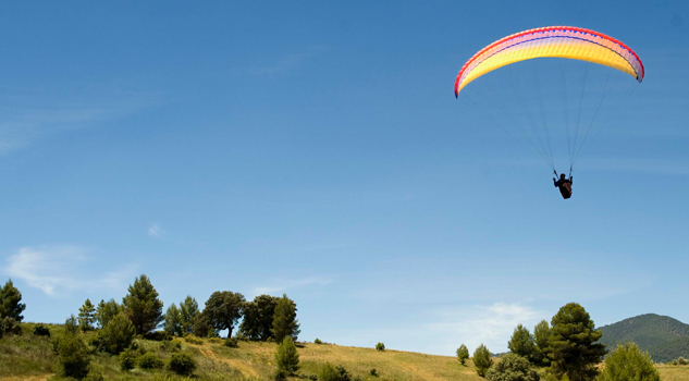
The launch site is very easy, good for learners, with a gentle slope and a large surface area. It is possible to prepare your wing 10 metres behind the launch site, where there is a flat area sheltered from the wind.
Climate
Los Villares is surrounded by different zones of relief, it has some major differences, with cold winters and summers when the temperature difference between night and day is significant.
The most common types of flight are slope soaring or thermal soaring in the afternoon; the launch site is excellent and provides the opportunity to perform sweeping manoeuvres at ground level, since the launch area is so large. This also provides the possibility of top landing.
Pilots can soar in a northerly direction, enjoying the great views of the Cañones area, a gorge formed by the River Eliche. Going south, pilots can reach the spurs of La Pandera, a total of 7 Km. of soaring along a rising slope.
Launch sites West launch site Coordinates: 37º 41’ 04.90’’ N / 03º 47’ 27.30’’ W. Orientation: West facing; since the launch site is at the end of a small valley made up of the Sierra de la Grana-Jabalcuz ridge on one side and the Sierra Arana-Pandera ridge on the other, the breeze almost always comes from the west, even though the prevailing wind goes from north to south. Altitude: 920 metres. Drop: 255 metres. Dimensions: Approximately 300 square metres. Access: From Los Villares, follow the A-6050 inthe direction of Valdepeñas. At Km 9.7, there is a the La Carrasquilla housing development (the turn-off is 100 metres away, past the petrol station). Once on this road, which is concrete at the beginning, continue for 2 Km until the fork, going right and continuing until you reach the summit of Las Cimbras. Parking just 40 metres from the launch site, with room for as many vehicles as necessary (the only slight problem is the presence of bushes). Facilities: There is a fresh water spring, the Cueva del Contadero spring. Precautions: * Take care in a strong west wind. Landing sites Landing site Coordinates: 37º 41’ 17.4’’ N / 03º 48’ 32.0’’ W. Access: Through the Las Olivillas housing development: on the A-6050 at Km 9.3, going from Los Villares to Valdepeñas, taking the first turn-off on the left, which goes into theLa Carrasquillahousing development. Altitude: 736 metres. Obstacles: There are a number of lampposts that must be considered when landing.

Services and infrastructure
Target audiences
Segments
Type of activity
Season


EXPLORE ANDALUSIA
EXPERIENCES


