
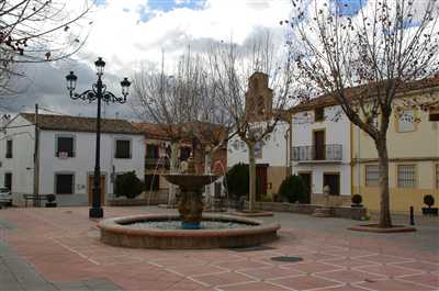
Montizón
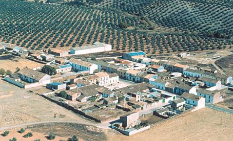
This village is situated in the Sierra Morena mountains, to the north of the province, in a landscape which alternates AREAs covered with pine trees and oaks, meadows (of great cynegetic importance) and vast olive groves. It originated within King Carlos III"s colonization plans, which explains its regular grid-pattern street plan , where we can find the Church of the Inmaculada and the Casa Grande House.
History
In the 16th century, it belonged to Santisteban del Puerto.With the Plan of New Colonization Villages of Sierra Morena, by decree of King Carlos III in 1767 and implemented by his minister Olavide, the village of Montizon was occupied by new colonists.
The first colonists came from central Europe: Germans, Flemish, Swiss, Alsatians, French and Italians who were given a house, farming tools and several fanegas of land to grow cereals and re-plant olive trees.
It became an independent village, with its own Town Hall, in 1814..
In 1888 it passed to Castellar"s jurisdiction until 1906, when it became independent again.
Montizón
Municipio


Montizón
Tourist area
Distance to the capital (km)
128
Altitude above sea level (m)
643
Extension (Km 2 )
212
No. of Inhabitants
2017
Demonym
Montizoneros
Postal Code
23266
en
Read more


