
Estación de Vuelo Libre de Padul
The Padul Flying Site is right in the Sierra del Manar hills, in the west of the Sierra Nevada National Park. These hills have a maximum altitude of 1,520 m above sea level on the Cerro de la Silleta summit. Other, lower peaks nearby include El Alto de las Vacas (1,305 m), Los Albatrales (1,304 m), La Cruz de la Atalaya (1,242 m) and Las Rajas (1,225 m).
The Lecrín Valley, where Padul is to be found, constitutes one of the most singular geographical areas in Granada province, largely because of its nature as a frontier with the Vega de Granada plain and the El Temple area. It is characterised by its agricultural nature, located among high peaks, surrounded by the Sierra Nevada massif and the Sierra de Albuñuelas hills.
It is a profoundly agricultural district, where fruit trees play an important role, with many olive groves and orchards for the cultivation of almonds and citric fruit. This area provides contrasts and beauty wherever you look, with great opportunities for leisure, relaxation and tranquillity.
Climate
The climate reflects the difference in altitudes between the surrounding mountains and the valley floor. There is also a clear contrast between the north of the district, with its colder, more continental climate, and the middle and lower valley, with its warmer climate, where no frosts fall in winter. Little rain falls on the valley floor.
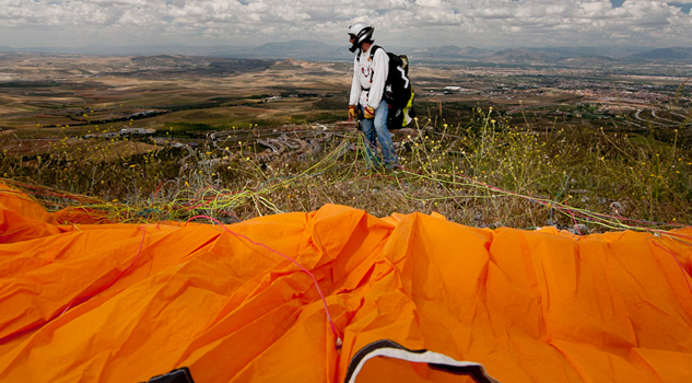
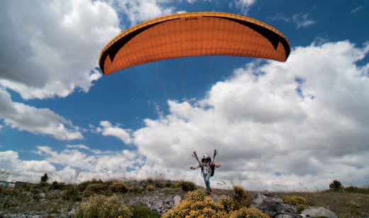
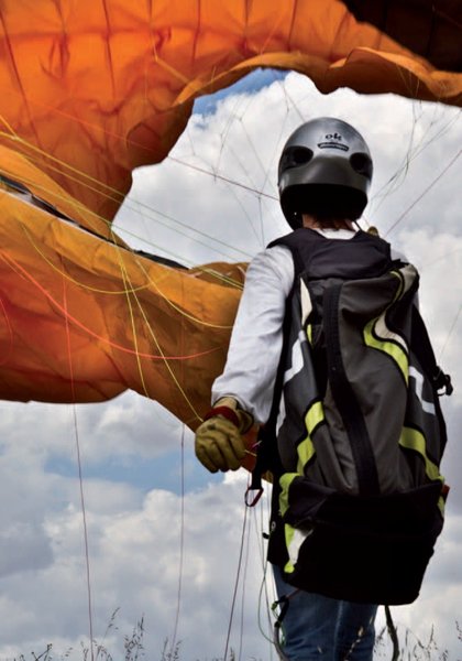
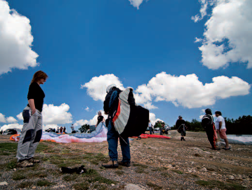
Launch sites La Cruz de La Atalaya launch site Coordinates: 37º 02’ 13.25’’ N / 03º 36’ 59.71’’ W. Orientation: North – south. Altitude: 1,100 metres. Drop: 400 metres. Dimensions: About twenty metres wide by fifteen metres long, with a gentle slope. Access: To reach the flying site exit the coastal motorway at the Padul-Otívar exit, going in the Padul direction. Take the N-323 road as far as the “Prefabricados La Romera” factory. The town of Padul is 3 Km. At the start of the launch site there is a preparation area and a car park. Facilities: Its condition is excellent. Precautions: There is nothing here that represents a particular danger, as long as pilots do not go too close to the slope during flight. It is necessary to be aware that the Granada-Motril motorway runs along the south face. Launch from La Silleta Coordinates: 37º 02’ 38.86’’ N / 03º 35’ 58.44’’ W. Orientation: Southeast – north – northwest. Altitude: 1,532 metres. Drop: 590 metres. Dimensions: About twenty metres wide by twenty-five metres long and with a moderate slope. Access: To reach the flying site exit the coastal motorway at the Padul-Otívar exit, going in the Padul direction. Take the N-323 road as far as the “Prefabricados La Romera” factory. The town of Padul is 8 Km. At the start of the launch site, there is a preparation area and a car park. Facilities: It is in excellent condition and ready to use. Precautions: There is nothing here that represents a particular danger, as long as pilots do not go too close to the slope during flight. It is necessary to be aware that the Granada-Motril motorway runs along the south face. Landing sites Landing site : Coordinates: 37º 01’ 03.87’’ N / 03º 36’ 21.57’’ W. Access: To get to the landing area, take the Laguna de Padul road. Altitude: 640 metres. Facilities: It is in excellent condition and ready to use. Parking: By the side of the road. Precautions: There is nothing here that represents a particular danger, as long as pilots do not go too close to the slope during flight. It is necessary to be aware that the Granada-Motril motorway runs along the south face.


Services and infrastructure
Target audiences
Segments
Type of activity
Season


EXPLORE ANDALUSIA
EXPERIENCES


