
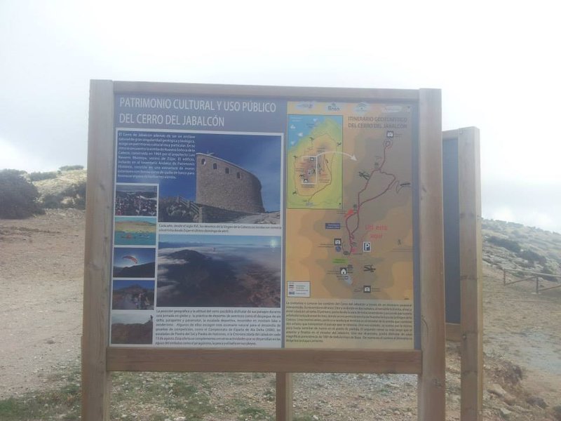
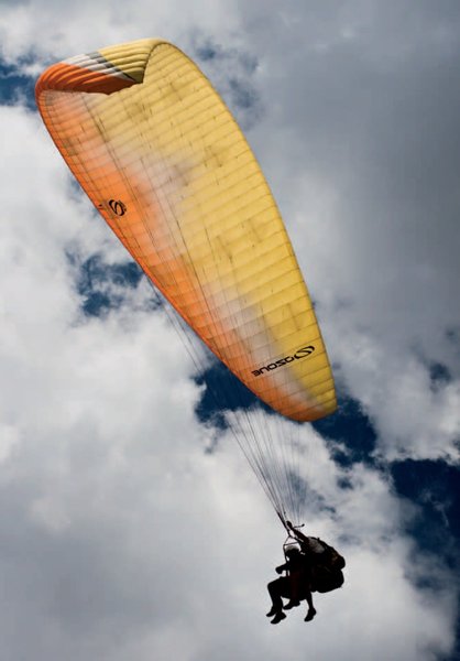
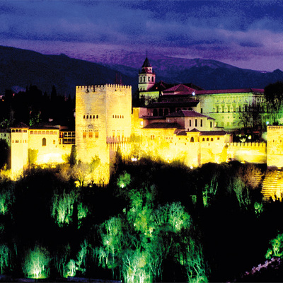
Estación de Vuelo Libre de Jabalcón (Zújar)
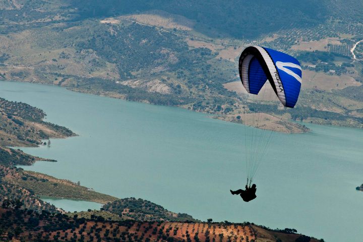
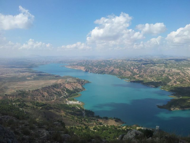
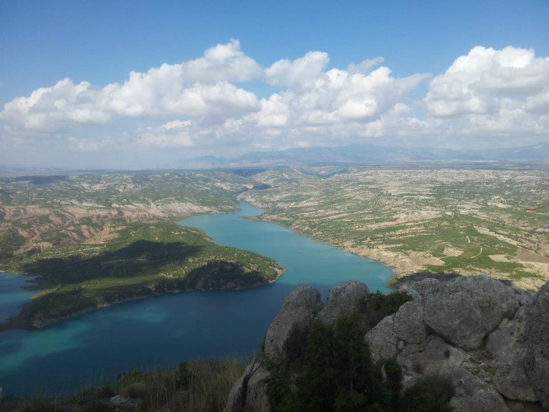
On the Hoya de Baza plateau stands the dolomitised limestone hill of El Cerro de Jabalcón, is located next to Negratín reservoir and is surrounded by wide, flat spaces. It is a limestone formation and when it warms up rising currents of humid air are produced. This, along with other factors such as the large drop from the launches to the landing sites, makes this place ideal for flying. At the foot of the hill, on the south side, is the town of Zújar. The hill is the source of hot springs that, over the centuries, have been used for the town's baths.
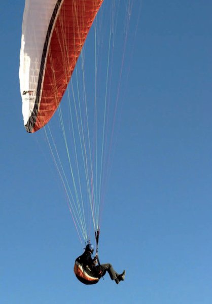
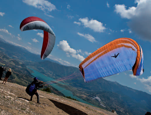
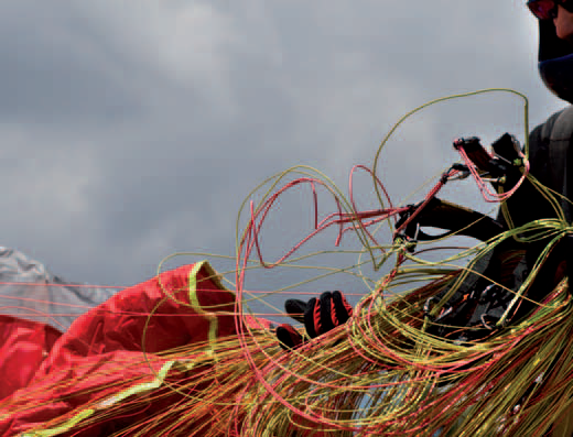
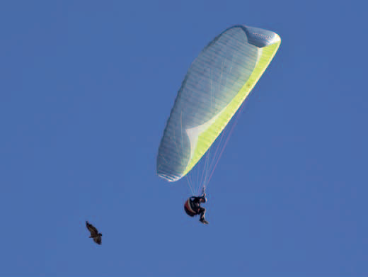
The Jabalcón hill has two launch sites for hand gliding, paragliding and paramotoring. Flying is very popular in and around Zújar, so there is a flying club called the Jabalcón which has a number of experienced pilots. Furthermore, the place has held a number of official competitions.
Climate
The geographic situation, with influence from both the Mediterranean and the continental interior, together with the high altitude of the plateau (1,000 metresabove sea level), means that the climate here is extreme, with freezing, dry winters and very hot summers. During winter, there is a strong north wind that cancels out the Mediterranean influence and makes for a long, cold winter (from November to March), but with many clear days. Summers are hot and dry, although this season is limited to the months of July and August.
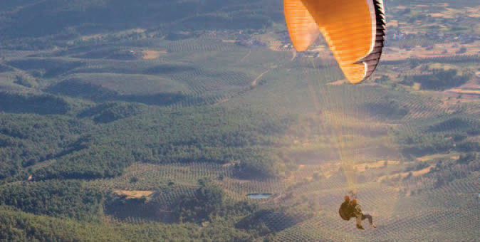
This is an area with many thermals, ideal for long glass-off flights in the evenings of the long summer days. The site is very technical with strong conditions in the summer months due to the average strength of the thermal currents and the intensity of the winds. It is recommended that paragliding pilots pay particular attention to flight conditions at this time. These factors make it an even more attractive site for hang gliding.
On days with an east wind, as the hours pass the sun heats the southern face of the hill. At around 2 o'clock in the afternoon, rising breezes start to occur at the south launch site. If pilots are flying on the leeward side, this may cause problems for novice pilots who have not received appropriate advice.
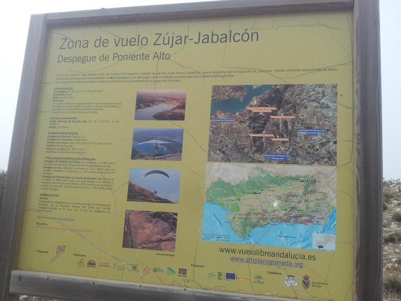
Launch sites Lower west launch site (forestry hut) Coordinates: 37º 34’ 43.36’’ N / 02º 49’ 22.23’’ W. Orientation: West facing. Altitude: 1,102 metres. Drop: 387 metres. Dimensions: 30 x 50 metres. Parking: Use the rear part of the launch area. Access: Along the A-92 motorway, exit 335 for the A-315, direction Zújar/Cuevas del Campo/ Pozo Alcón. Once in Zújar, the road to the Cerro Jabalcón is signposted. Continue along the track which is signposted with arrows. Facilities: There are windsocks. Precautions: No visible obstacles. Upper west launch site Coordinates: 37º 48’ 47.43’’ N / 02º 31’ 20.62’’ W. Orientation: West facing. Altitude: 1.480 metres. Drop: 765 metres. Dimensions: 25 x 30 metres. Parking: There is a car parking area for 50 vehicles located60 metresfrom the launch site. Access: Along the A-92 motorway, exit 335 for the A-315, direction Zújar/Cuevas del Campo/ Pozo Alcón. Once in Zújar, the road to the Cerro Jabalcón is signposted. Continue along the track which is signposted with arrows. Go along the track that climbs up to the radio masts and the chapel. Facilities: It has a windsock and an information panel. Precautions: At the rear of the launch site there are large rocks. Be careful when there is strong winds, as it is possible the wind will drag pilots towards them.There is a power line at the very foot of the slope. East launch site (La Curva) Coordinates: 37º 48’ 47.44’’ N / 02º 31’ 20.60’’ W. Orientation: West facing. Altitude: 1,160 metres. Drop: 409 (hang gliding) and 181 (paragliding). Dimensions: 10 x6 metres. Parking: Please use the side of the road. Access: Along the A-92 motorway, exit 335 for the A-315, direction Zújar/Cuevas del Campo/ Pozo Alcón. Once in Zújar, the road to the Cerro Jabalcón is signposted. Continue along the track which is signposted with arrows. Go along the track that climbs up to the radio masts and the chapel. Facilities: There are windsocks. Precautions: The launch site is not suitable for paragliding, due to its short length. South launch site Coordinates: 37º 33’ 48.81’’ N / 02º 48’ 33.75’’ W. Orientation: South facing. Altitude: 1.272 metres. Drop: 545 metres (hang gliding) and 294 metres (paragliding). Dimensions: 12 x 40 metres. Parking: At about 100 metres from the launch site there is a car park for about 30 vehicles. Access: Along the A-92 motorway, exit 335 for the A-315, direction Zújar/Cuevas del Campo/ Pozo Alcón. Once in Zújar, the road to the Cerro Jabalcón is signposted. Continue along the track which is signposted with arrows. Go along the track that climbs up to the radio masts and the chapel. Facilities: It has a windsock and an information panel. Precautions: Precautions: On the right of the paragliding landing site, looking towards the launch site, is a power line.Take care; if launch is aborted, there are large stones below the launch ramp. Landing sites West landing site (upper and lower) Coordinates: 37º 34’ 15.37’’ N / 02º 51’ 06.8’’ W. This site is located on a private property. Altitude: 715 metres. Access: Access is along the reservoir road; Zújar is located just 3.5 Km away. Facilities: There is a windsock. It is agricultural land with dimensions of 30 x 100 metres. Parking: Next to the landing site; it is not marked. Precautions: There are no obstacles present. East and South landing sites (hang gliding on even-numbered years) Coordinates: 37º 33’ 52.40’’ N / 02º 46’ 38.52’’ W. This site is located on a private property. Altitude: 762 metres. Access: Is along dirt tracks. The town of Zújar is 9.5 Km away. Facilities: It has wind direction streamers. It is agricultural land with dimensions of 90 x 100 metres. Parking: No marked space, but there is a very large area for parking. Precautions: There are no obstacles present. East and South landing sites (hang gliding on odd-numbered years) Coordinates: 37º 33’ 26.58’’ N / 02º 46’ 39.09’’ W. This is a privately-owned area. Altitude: 715 metres. Access: Is along dirt tracks. The town of Zújar is 9.5 Km away. Facilities: It has wind direction streamers. This is agricultural land with a triangular shape and dimensions of 200 x 200 x 200 metres. Parking: No marked space, but there is a very large area for parking. Precautions: There are no obstacles present. East and South landing sites (paragliding) Coordinates: 37º 33’ 05.39’’ N / 02º 48’ 28.72’’ W. This site is located on private property. Altitude: 979 metres. Access: Is along dirt tracks. The town of Zújar is 9.5 Km away. Facilities: It has wind direction streamers. It is agricultural land with a rectangular shape and dimensions of 90 x 200 metres. Parking: No marked space, but there is a very large area for parking. Precautions: There are no obstacles present.

Services and infrastructure
Target audiences
Segments
Type of activity
Season


EXPLORE ANDALUSIA
EXPERIENCES


