
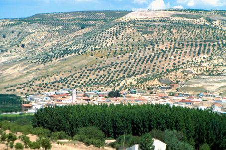
Cacín

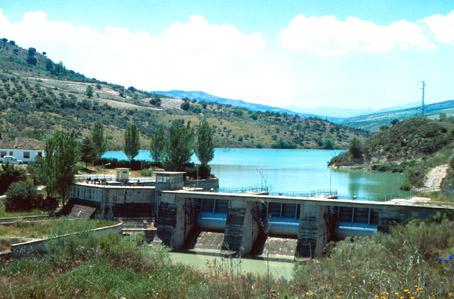
Cacín belongs to the series of villages of the Poniente Granadino (west side of Granada), which are becoming appealing to tourists thanks to the characteristics of its location. Nearby the reservoir named Embalse de los Bermejales, visitors can experience the magnificent scenery of the north face of Sierra Tejeda mountain range, a striking reddish-brown rock surrounded by the greenery of vineyards, yews and pines, which in winter is capped by a white layer of snow.
History
Its name derives from the Arab term Abul Casim. It was called Cásim in the old route of large farms between Granada and Alhama de Granada.Although it was founded at the end of the 18th century, the AREA isolated.
Cacín
Municipio

The weather today in Cacín
- Max 17
- Min 14
- Max 62
- Min 57
- °C
- °F
Cacín
Tourist area
Distance to the capital (km)
39
Altitude above sea level (m)
702
Extension (Km 2 )
40
No. of Inhabitants
820
Demonym
Cacineños
Postal Code
18129
en
Read more


