
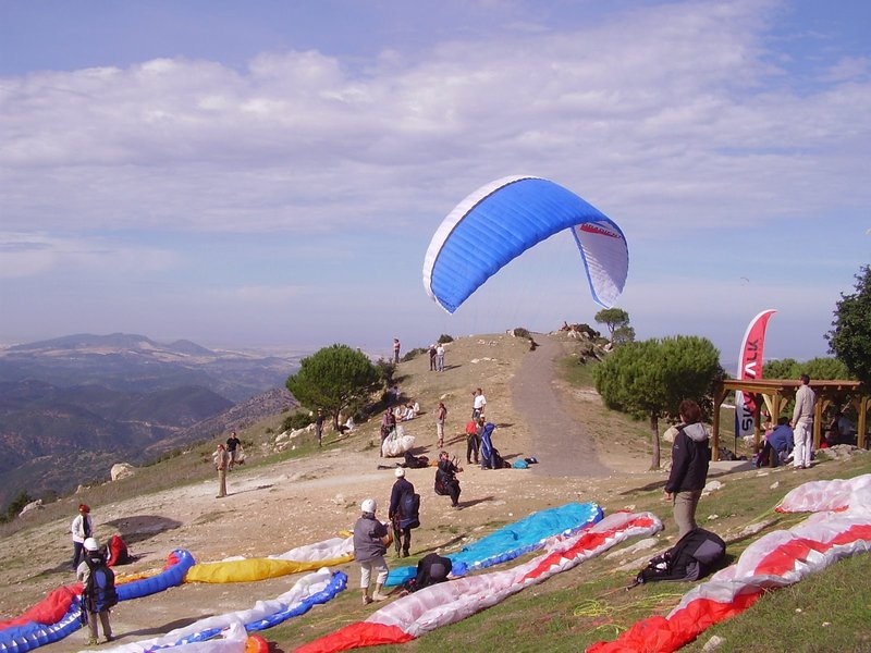
Estación de Vuelo Libre de Algodonales
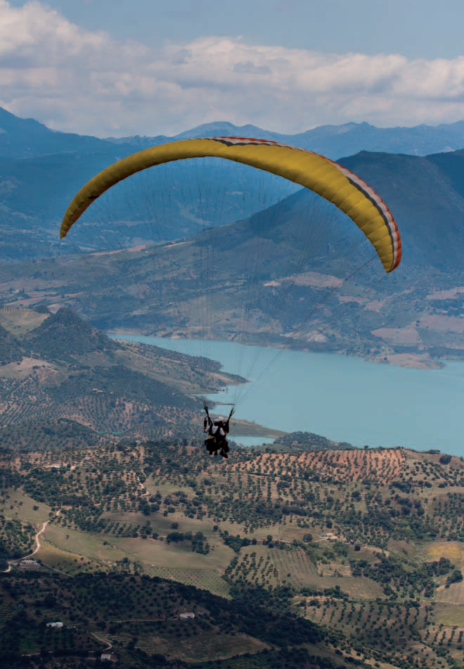
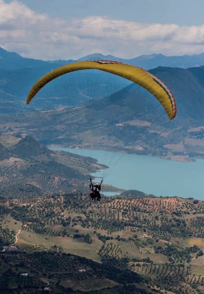
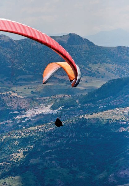
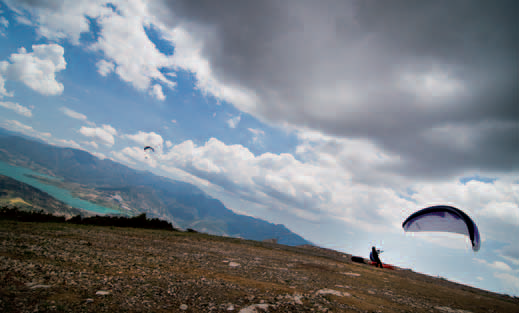
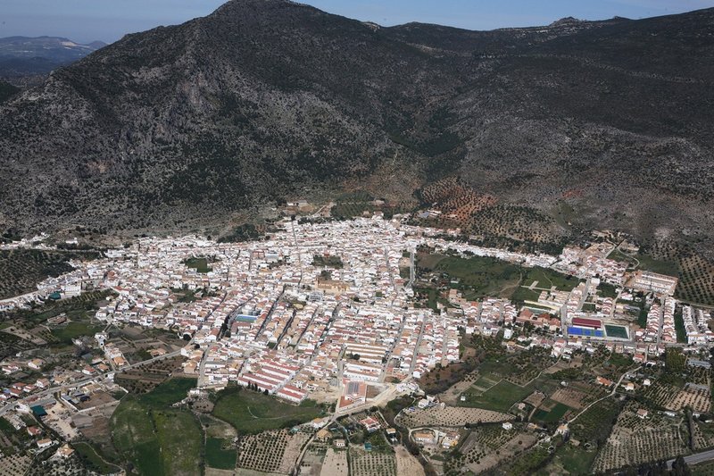
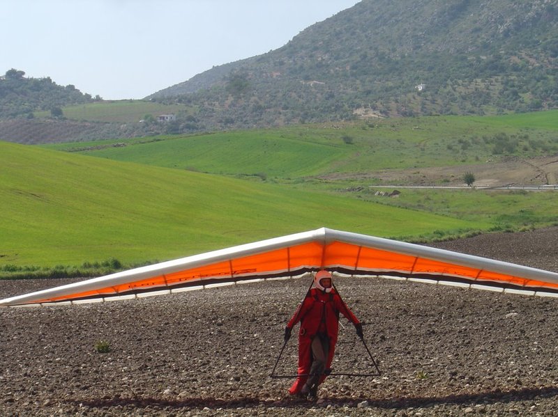
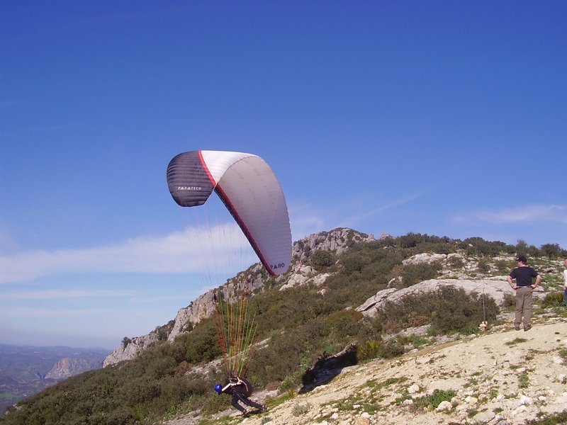
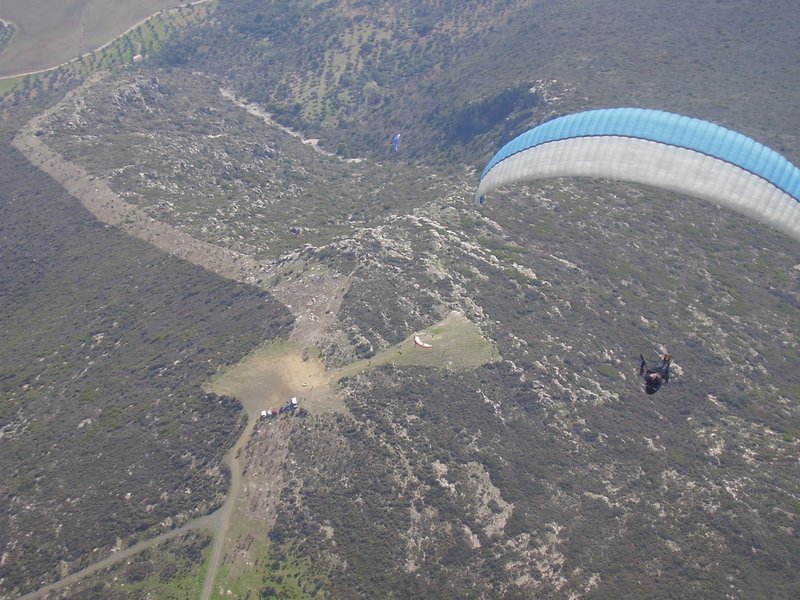
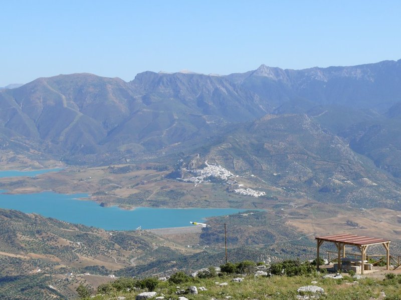
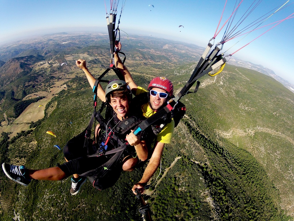
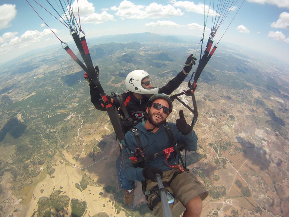
The town of Algodonales is located in the northwest of Cádiz province, between low countryside and the Sierra de Grazalema. The town is surrounded by a number of isolated ridges separated by valleys with streams that feed the waters of the River Guadalete. This means the area has a number of spaces that offer excellent possibilities for leisure and recreation. This is the case with the Sierra de Líjar ridge, a place that is ideal for air sports, particularly hang gliding, paragliding and gliding.
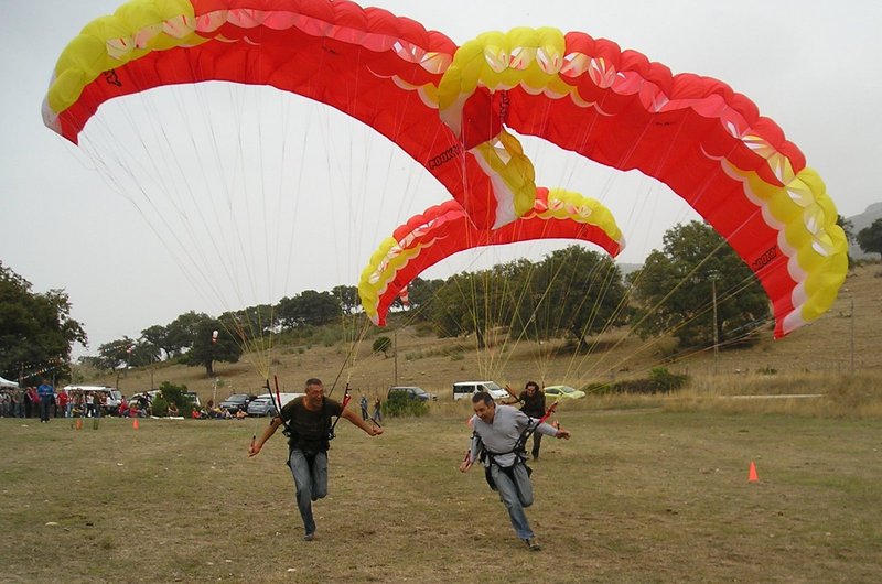
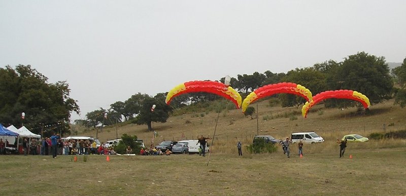
This is one of Spain's most international flying zones, mainly due to the wide range of launch sites available, the excellent climate conditions and the number of foreign operators who are familiar with the facilities and who work in the area. A factor that has made a major contribution to this situation is the number of regional, national and international air sports events that have been held here, such as the: World Air Games, World Hang Gliding Championships, Sierra de Cádiz Hang Gliding International Open, Spanish and Andalusian Hang Gliding and Paragliding Championships. These circumstances mean that it is becoming common to use the area for training national teams from around Europe.
Climate
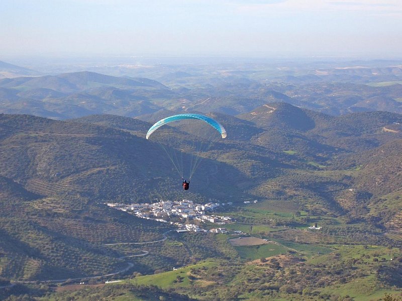
Its best climate is during autumn, winter and spring, although there are good flying possibilities all year round. The climate in the summer months is very intense, and so an advanced flying level is required.
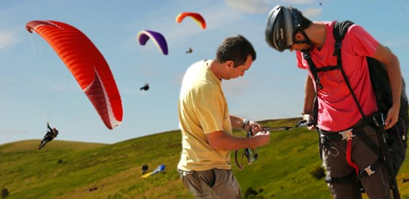
The facilities are very well looked after and the drops are very attractive, offering flying possibilities for pilots of different levels: beginner, intermediate, expert, etc.
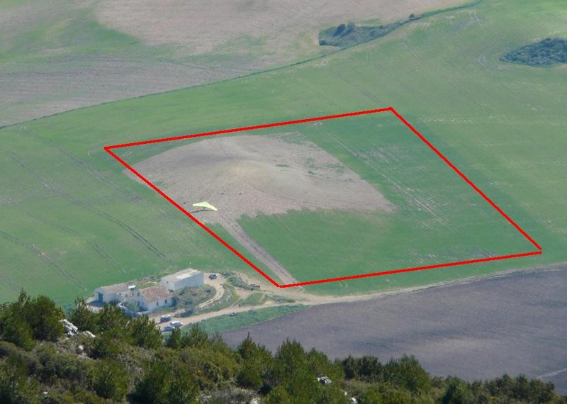
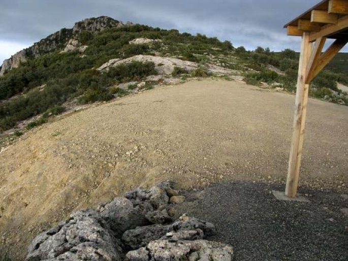
Launch sites West Coordinates: 36º 53’ 41.1’’ N / 5º 24’ 57.2’’ W. Orientation: Southwest. Altitude: 890 metres. Drop: 415 metres (paragliding) and 648 (hang gliding). Dimensions: 15 m x 40 m. approx. Parking: There is no car park, but there is space for about 7-8 vehicles at the sides of the access road. Facilities: It has a weather station and a windsock, located in the upper part of the launch site, with streamers for ascertaining the wind direction along its side. It has a pre-flight area, but this is not enclosed. There is a viewpoint with tables and some shade. North Coordinates: 36º 54’ 19.80’’ N / 5º 24’ 16.06’’ W. Orientation: Northwest. Altitude: 909 metres. Drop: 434 metres (paragliding) and 767 metres (hang gliding). Dimensions: 20 m x 7 m approx. Parking: No marked car park, cars should park by the road. There is room for about 3-4 vehicles. Facilities: Weather station and shady area with tables. There is no pre-flight area, but the road can be used. Precautions: * Stones and low vegetation in front and to the right of the launch site. East Coordinates: 36º 53’ 55.74’’ N / 5º 23’ 37.54’’ W. Located after the fire watch tower. Orientation: Southeast. Altitude: 1,000 metres. Drop: 614 metres. Dimensions: 30 m x 40 m Parking: The upper part of the launch site area can be used for parking; it has some shade. When this is full, the side of the access road can take a row of parked cars. Facilities: It has a weather station with streamers for ascertaining the wind direction along its side. There is an enclosed pre-flight area and a viewpoint with tables and some shade. South Coordinates: 36º 53’ 53.25’’ N / 5º 23’ 39.55’’ W. Located after the fire watch tower and to the right of the east launch site. Orientation: South. Altitude: 990 metres. Drop: 604 metres. Dimensions: 30 m x 40 m Parking: The upper part of the launch site area can be used for parking; it has some shade. When this is full, the side of the access road can take a row of parked cars. Facilities: It has a weather station with streamers for ascertaining the wind direction along its side. There is an enclosed pre-flight area and a viewpoint with tables and some shade. Landing sites West and North Landing Sites(paragliding) Coordinates: 36º 55’ 02.49’’ N / 5º 25’ 16.61’’ W. Access: Located next to the bullring, by the junction of roads CA-9101 and A-8126. Altitude: 474 metres. Facilities: --- Parking: There is a large open space next to the junction for parking vehicles. It is not signposted. Obstacles: Near a high-voltage electricity line. West and North Landing Sites (hang gliding) Coordinates: 36º 56’ 34.98’’ N / 5º 22’ 12.72’’ W. Access: Take the A-384, in a northwest direction and, at the Algodonales petrol station, go along the surfaced road in front, behind a public house and just before you get to the river, turn right. The landing site is on a flat piece of land surrounded by olive trees and next to the river bank. It is a distance of 2 km from the petrol station mentioned. Altitude: 242 metres. Facilities: It has wind direction streamers. Parking: There is no car park, so please use the side of the road. Obstacles: The area next to the river is surrounded by trees. East and South Landing Sites Coordinates: 36º 53’ 29.31’’ N / 5º 22’ 12.34’’ W. Located in the “El Imperio” estate, on the “Las Pedrizas” road, 2 km along the road. opposite the launch site. Access: From Algodonales, take the A-384 in the Olvera direction. Once past the tunnel, after about 1,200 metres, take a dirt track that turns off to the road on the right. After about 200 metres you will reach a farmhouse, and behind it is the landing site. Altitude: 440 metres. Facilities: There is a windsock. Parking: It is possible to use the space next to the road as well as the open area next to the farmhouse. Obstacles: No visible obstacles.

Services and infrastructure
Target audiences
Segments
Type of activity
Season
You may be interested


EXPLORE ANDALUSIA
EXPERIENCES


