
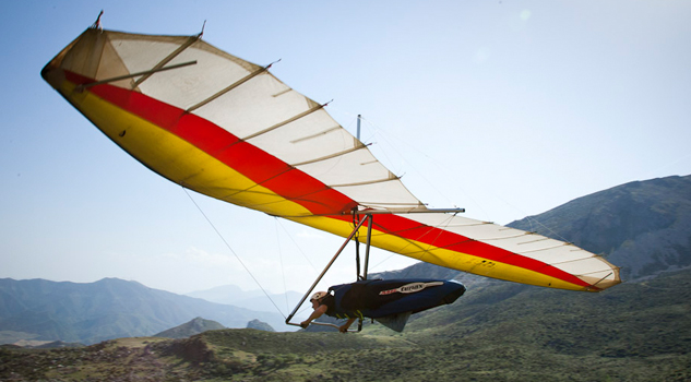
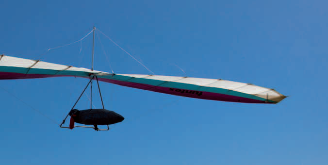
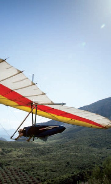
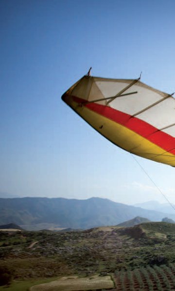
Estación de Vuelo Libre de El Bosque

Located in the heart of the Grazalema National Park, this natural space is a storehouse of outstanding natural and ethnographic features, pilots must be aware of, and follow, the rules governing the sport here; the most important of these is that the only part of the National Park set aside for flying is the Cerro Albarracín zone, where the launch sites are located. El Bosque is located just 6 Km away.
From the time when the first flights were undertaken here, pilots specialising in hang gliding have been giving the area very positive reviews. For this reason, a competition in this sport is held here every year at Easter. The event has been running for more than twenty years, and since recently has been an official International Open.
Climate
The area is the first upland zone encountered by the winds that hit the Iberian Peninsula from the west, proceeding from the Atlantic Ocean. For this reason, the winds tends to be laminar, especially on summer evenings, when broad restitution winds occur, usually extending throughout the valley.
The area's climate behaves similarly to that of Algodonales, which is only18 kilometresaway as the crow flies. It is clear that the best climate occurs during autumn, winter and spring, although there are good flying possibilities all year round.
Launch sites Lower west site (hang gliding) Coordinates: 36º 45’ 26.23’’ N / 5º 29’ 28.85’’ W Orientation: West facing Altitude: 648 metres. Drop: 411 metres. Access: Take the road from El Bosque to Benamahoma (A-372), and after about 2.5 Km. take the road on the right. To reach the hang gliding launch site, drive for 3.5 Km; and half a kilometre more for the paragliding launch site. Dimensions: Approximately 300 m2 Parking: There is no set area for parking; visitors can use the far end of the pre-flight area and the side of the access road. Facilities: There is little signage, and the terminology is rather out of date. The pre-flight area is not enclosed, and is located on the other side of the road. The sides have wind direction streamers. Precautions: * This site is only recommended for hang gliding, since there are two hills below that make launch more difficult. * There is a power line at the foot of the slope. Upper west site (paragliding) Coordinates: 36º 45’ 16.41’’ N / 5º 29’ 15’’ W. Orientation: West, northwest, southeast. Altitude: 791 metres. Drop: 554 metres. Dimensions: Approximately 200 m2 Parking: There is no car park here, so pilots should use the lower west site's car parking area, or the side of the access road. Facilities: There is no signage; furthermore the pre-flight area is not defined since it is joined to the launch site.The sides of the launch site have wind direction streamers and there is a windsock to the rear.There is little signage, and the terminology is rather out of date. The pre-flight area is not enclosed, and is located on the other side of the road. The sides have wind direction streamers. Precautions: * This launch site is only recommended for paragliding. There is a power line at the foot of the slope. Landing sites West landing site (hang gliding and paragliding) Coordinates: 36º 44’ 31.24’’ N / 5º 30’ 48.84’’ W Access: This is located on the “El Imperio” estate, on the “Las Pedrizas” road,2 kmin front of the launch site. Altitude: 252 metres. Facilities: There is no signage, although there are wind direction streamers. Parking: No set area; use the side of the access road. Obstacles: None.

Services and infrastructure
Target audiences
Segments
Type of activity
Season
You may be interested


EXPLORE ANDALUSIA
EXPERIENCES


