
Gallardos, Los
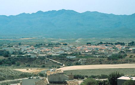
Recent village (its independence from Bédar dates from 1924), situated in the area of Bajo Almanzora, in a valley equidistant from the beach and the mountain. Its origin is in the exploitation of the mines of the Sierra Almagrera at the beginning of the XIX century.
History
In 1924 it was constituted as a municipal AREA of Los Gallardos. But the settling of the main nucleus of population of this village is from the XIX century, with the workings of the mines of the Sierra Almagrera, and more specifically the discovery of the lead and iron seams in the Sierra de Bedar. The men worked in the mines and the women, old people and children looked after the land. There are still remains from this period such as fragments of the overhead cable from el Pinar to Garrucha or the bridge of a mining railway which joined Los Gallardos, Bedar and Garrucha.The crises of the beginning of the XX century, the Civil War and the postwar years caused a progressive decrease in its population. The mines closed in 1970. Its population works principally in the service sector on the coast in Vera, Garrucha, Turre and Almeria.
Gallardos, Los
Municipio

The weather today in Gallardos, Los
- Max 17
- Min 14
- Max 62
- Min 57
- °C
- °F

Gallardos, Los
Tourist area
Distance to the capital (km)
80
Altitude above sea level (m)
122
Extension (Km 2 )
35
No. of Inhabitants
1738
Demonym
Gallarderos
Postal Code
04280
en
Read more


