
Aracena - Corteconcepción – PR-A 45 Trail

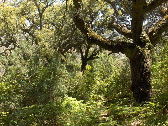
To begin the trail, in Aracena we must find the local road to Carboneras and Cañaveral de León (HU-8126), which branches off the N-433, opposite San Roque chapel, heading northeast. About five hundred metres on, to our right, the Fuente del Rey path begins, which marks the start of the Aracena - Corteconcepción – PR-A 45 Trail. We will see gall-oak and dense scrubland with terebinth, strawberry trees, brushes and other species. In the sunniest areas, rockrose, Spanish lavender and tree germander are most common. We soon reach the spring known as Fuente del Rey, partly explaining the surrounding orchards, now somewhat neglected, but which not too long ago were a basic mainstay of the local economy.
In the sierra de Aracena mountains there is a dense network of paths, associated with a population that is more dispersed than in the rest of the Sierra Morena. They are, therefore, old paths that preserve a traditional style in harmony with the landscapes that they pass through and connect. The stone walls that often line the paths are their most characteristic feature.
We carry on, always in the same direction, along the main path, ignoring several other paths on either side. On our right, we soon reach a stream called Arroyo de la Fuente del Rey. If the water levels are right, a growing murmur of water will reveal the presence of a small waterfall, which is sure to draw us towards it.
The stream called Arroyo de la Fuente del Rey is a tributary of another called Huelva which, a little further on, flows into Aracena reservoir It therefore contribute to the drinking water supply of Seville and its metropolitan area. The climate and geology of these mountains are conducive to such gains for others, but they have also been beneficial for local uses, such as the orchards.
We continue parallel to the watercourse, shaded by riverbank woodland of black poplars and eucalyptus, as well as poplars of over 20 metres in height. Further on, we cross the stream by way of stepping stones.
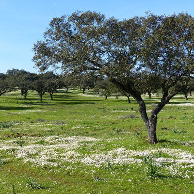
Behind the walls that line the path, there is a holm oak forest with thick undergrowth that stretches alongside us to the top of a hill, from where we can see Aracena reservoir, some four kilometres to the northeast.
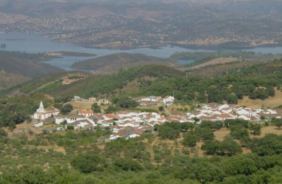
We now reach some more gentle slopes, and the last section of the path passes between chestnut trees and then olive groves as we approach Corteconcepción, where our trial ends.
Corteconcepción comprises two adjacent settlements: La Corte and Puerto Gil. Although it has few monuments, it does have a traditional farmhouse typical of these mountains, which have earned it the status of an historical site, within the catalogue of Andalusian Historical Heritage. In a place where it is not exactly easy, it has a notable cold cuts industry, especially cured hams.
Type of Trail: Linear Trail Status: Approved and Signposted 1994. Total Length: 5 Km (one way) Sections: 1 Accessibility: Suitable for walking, horseback and mountain bike. Download brochure
Itineraries

Services and infrastructure
Target audiences
Segments
Season

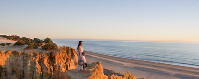

EXPLORE ANDALUSIA
EXPERIENCES


