
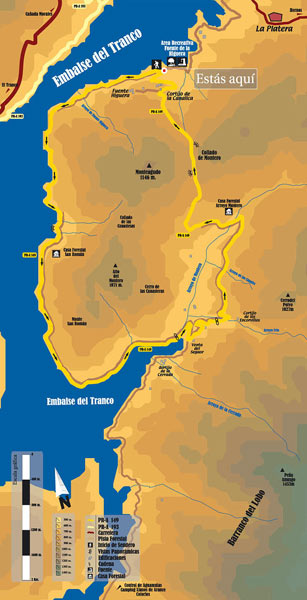
Alto del Montero Circular Hiking Route - PR-A 149
The Sendero Circular Alto del Montero circular path - 149 PR-A begins half a kilometre after passing through the Fuente de la Higuera Recreational Area, to the right of the information panel.
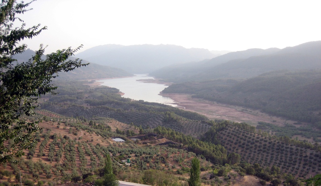
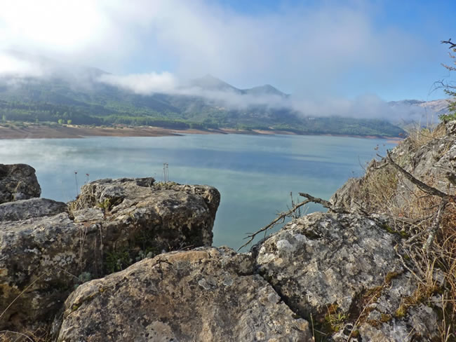
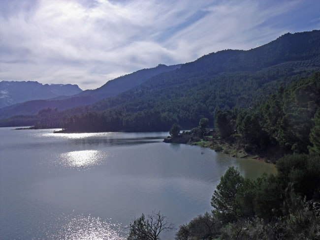
This route, which is mainly covered by forest track, flattens out for 11 km along the Tranco reservoir and then ascends some 300 m to the Collado Montero.
Much of the route runs along the Bujaraiza Reserve Area, whose special protection is, according to the Natural Park of the Sierras de Cazorla, Segura and Las Villas mountains' Natural Resources Plan “the confluence of extraordinary geomorphologic, botanic, landscape and cultural values, whose combination determines one of the most characteristic and excellent landscapes of the Natural Park”.
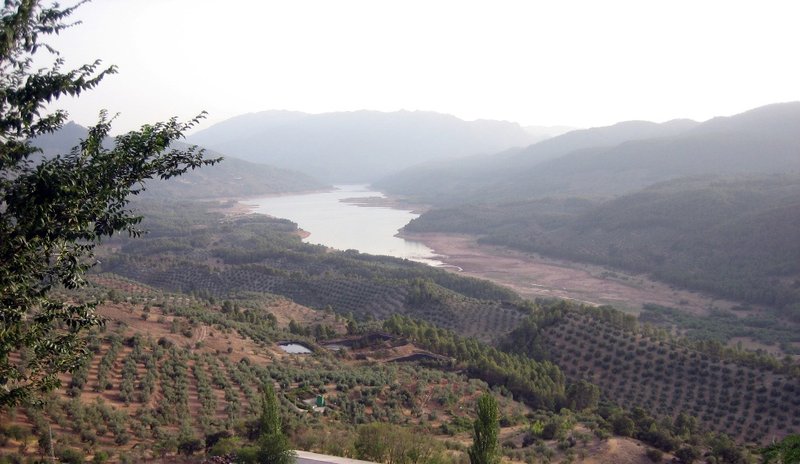
You can see the calm waters of the reservoir, with the peaks of the Beas and the Sierra de las Villas mountains in the background.
The route passes through mountain olive groves cultivated in a very traditional manner, with the remains of the ancient buildings of the inhabitants of the Arroyo Montero valley.
You can almost always see the unmistakable and prominent silhouette of the Peña Amusgo rock.
From Collado Montero you can enjoy the beautiful views of the Hornos de Segura and Yelmo villages, from the highest peak in the area.
The route crosses through a stretch of the Coto National reserve, created in 1960 for hunting and which is now a well preserved closed forest. Alepo pine forests are in abundance in the area, filled with mastic, phillyrea, rockrose, kermes oaks and some wild olive trees.
There are many deer, whose mating call can be heard at the beginning of autumn, in addition to boar, foxes, squirrels, wood pigeons, thrush, buzzard and turtledove in the warmer months.
Type of Hiking Trail: Circular Status of the route: Approved and signposted 2004. Total length: 18.9 km. Stages: 1 Accessibility: It can be done on foot. Download Datasheet
Itineraries
Services and infrastructure
Target audiences
Segments
Season


EXPLORE ANDALUSIA
EXPERIENCES


