
Estación de Vuelo Libre de Huécija-Bentarique
This flying site is located in the Medio Andarax district, in the eastern Alpujarras. It is an impressive landscape of great contrasts, characterised by sudden changes of altitude, creating a variety of vistas and unique microclimates. The views here are magnificent: the sea, the Tabernas desert, the Alpujarras mountains and orange groves in the Andarax valley.
Huécija is the town that has the strongest aristocratic and monastic influence in the district, which derives from its position, for four centuries, as the main town of an aristocratic domain. This means that there is many monuments in the town, such as the Augustinian convent and the Church of the Annunciation. By contrast, Bentarique is strongly linked to its Islamic roots, a white brush stroke against the green of its irrigated fields. Here, the visitor can visit the 15th-century church of Nuestra Señora de la Asunción or San José square (in the neoclassical style).
Climate
The climate of Huécija and Bentarique, as is the case throughout the Almerian Alpujarras, is typically Mediterranean, with hot, dry summers and cold winters. Precipitation is scarce and irregular all through the year, with an annual average of less than 200 mm. The average annual temperature is around 20 degrees centigrade.
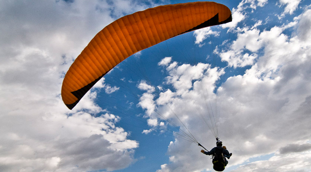
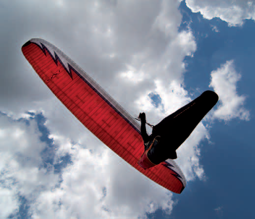
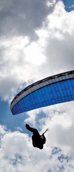
During the winter months, the climate is good for gliding. When the wind blows from the east, it arrives gently on the Almerian coast, so this is good flying weather.
One thing that does constitute a difficulty is the very strong weather in summer, which means that high skill levels are required due to the strength of the thermals; another issue is that the two launch sites are somewhat technical, due to the steepness of the slope and lack of vegetation.
Launch sites Launch site Coordinates: 36º 57’ 16.73’’ N / 02º 37’ 08.15’’ W. Orientation: North-northwest, east. Altitude: 1.086 metres. Drop: 782 metres. Dimensions: 10 x5 metres (both launch sites). Access: Coming from Almeria along the A-348 inthe direction of Guadix, before reaching the Alicún turn-off, take the exit on the left, signposted Roquetas de Mar, near which is a cement factory. After eight kilometres is a tight bend to the left, and on the right is a road for Ermita dela Cruz. Go 4 Km and when you get to a junction, take a right. After a kilometre you will reach the Ermita dela Cruzchapel, which is the launch site. The access road is not signposted. Since this is a pilgrimage site, there is a large area for parking. Facilities: Although the condition of the area is good, it could be better. There is a picnic area with wooden tables and benches, a barbecue and rubbish bins. Precautions: * The weather is very strong in summer, so high skill levels are required due to the strength of the thermals. * The presence of a steep slope and the lack of vegetation means that the launch sites are rather technical;something that needs to be improved, particularly at the east site. Landing sites Landing site : Coordinates: 36º 59’ 09.27’’ N / 02º 37’ 10.53’’ W. Access: Located next to an orange cooperative farm and the El Molino bar-restaurant. This is a surfaced road in good condition. Altitude: 304 metres. Facilities: A large space, of approximately 80 x 30 metres. There are shady areas here. Parking: The car park is located about100 metresfrom the landing site. Precautions: The area where the landing site is situated is next to the river, although the flow is very low for most of the year.


Services and infrastructure
Target audiences
Segments
Type of activity
Season


EXPLORE ANDALUSIA
EXPERIENCES


