
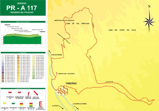
Taberno El Picacho Trail - PR-A 117

The Taberno El Picacho Trail - PR-A 117 starts in the Town Hall square in Taberno, goes along the Avenida de Andalucía to the first information panel on the “El Picacho” trail; goes up a little slope and turns left; takes the trail paved with flagstones, which is the way to the Calvario chapel or shrine.
Along the way, you can see the geological detritus of reddish conglomerates and sandstones that make up all of this region in the Bajo Almanzora. The vegetation comprises various bushes, where we distinguish the hastate orach (Atriplex hastata), albardine (Lygeum spartum), esparto grass (Stipa tenacissima), fennel (Foeniculum vulgare), albaida (Anthyllis cytisoides) and the mountain rue (Ruta montanaone) amongst others.
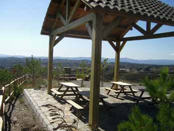
On the way down, we pass by terraces of olive trees, almond trees and some vines. The trail continues along a little path next to some almond trees until it almost comes down to the Barranco del Tollo, which we will cross passing over an earthen dyke that prevents the run-offs of water, and we will continue on the opposite side, going up now amongst debris and conglomerates of abundant clasts. Between an incipient repopulation of pine trees, it reaches the Mirador de Las Morras, where there is a fountain and a beautiful view of Taberno and its unusual outlines.
It continues along a wide earth track, where we can see large plantations of almond trees, until it descends into a gorge that comes out at the Rambla del Aceituno; we reach the information panel for the trail in an area of great scenic interest on account of the great flagstones of hard conglomerate in the river, which have allowed the softer materials below to be dug out, forming a waterfall with profuse vegetation in the surrounding areas.
The trail continues down through a kind of canyon with beautiful, high walls of detritus of red conglomerates. The trail widens and its walls get lower; it passes next to the Los Mundos farm, now nearing El Picacho, and then goes up to see the Rambla from above–there is another trail information panel here.
There is a landmark from which you can make out Taberno again, but from a different perspective. It crosses the ravine and continues straight along a narrow side ravine with high walls of red conglomerates until it comes out at another information panel opposite the cemetery that marks the end of the trail.
Type of Trail: Circular. Trail Status: Approved and signposted 2004. Total Length: 8.1 km. Stages: 1 Accessibility: It can be done on foot. Download Brochure
Itineraries
Services and infrastructure
Target audiences
Segments
Season


EXPLORE ANDALUSIA
EXPERIENCES


