
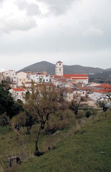
Tahal Circular Trail - PR A 121

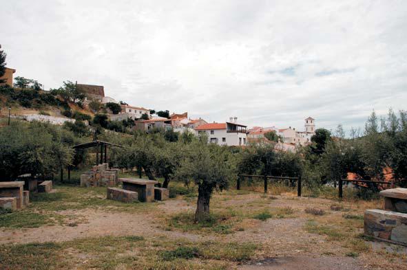
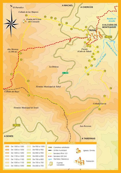
The Tahal - PR A 121 Circular Trail starts at the roundabout at the entrance to Tahal and goes down the hill next to the School towards the Public Swimming Pool and the Recreational Area. From here, it crosses a gorge near the Caño de la Fuente and begins to ascend slightly crossing the Tahal meadow along a paved path to the Zanja gorge.
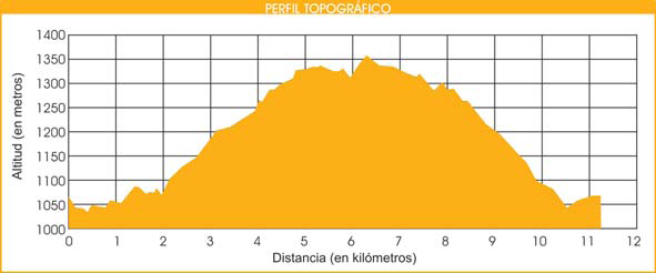
After crossing the gorge, the path starts to ascend, first among pine trees and then along a track gaining altitude until we reach the Collado García, where we cross the A-349, to continue on the other side, climbing a firebreak, which leads to the highest point of the trail at 1,368 m.
From here, we start to descend going down a dirt track all the time amidst pine trees and small farms until we reach the Collado de las Mujeres, near the Ermita de Tahal. At this point, the path leads to the old Camino del Berro path with a steeper descent between farmhouses.
After about a kilometre, we again cross the A-349 road near the Tahal petrol station and continue along the Camino del Berro path until we read the Benitorafe road, where we turn right, and then half a kilometre more and we reach the starting point in Tahal.
Type of Trail: Circular. Trail Status: Approved and Signposted 2011. Total Length: 11.4 km. Sections: 1 Accessibility: It can be done on foot. Download Topographic Guide
Itineraries
Services and infrastructure
Target audiences
Segments
Season
You may be interested


EXPLORE ANDALUSIA
EXPERIENCES


