
Estación de Vuelo Libre de El Yelmo (Cortijos Nuevos)

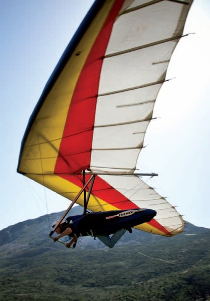
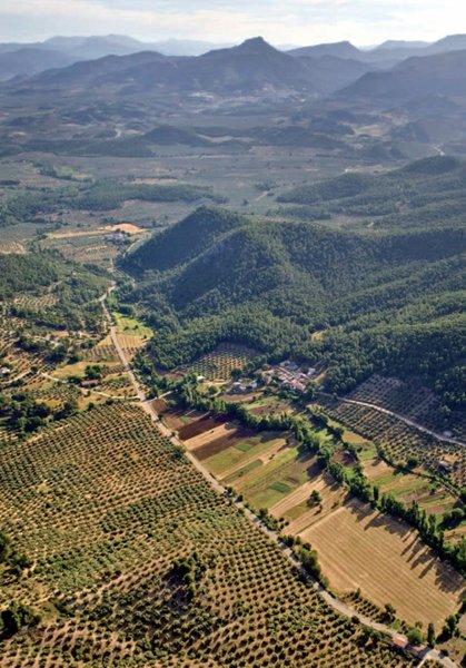
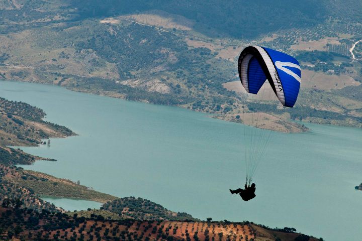
El Yelmo is the most prominent hill on the Sierra de Segura ridge. At an altitude of 1,809 metres above sea level, it is a spectacular viewpoint over Jaen province and beyond. Not only is the area very attractive, located as it is in the Sierras de Cazorla, Segura y las Villas National Park, but it offers exceptional flying conditions and the ease of surfaced access routes. The flight, which is west facing, has a 1,000-metre drop. This, together with the zone's fantastic aerological conditions, makes it one of the best sites in Spain, according to experts. The west wind allows flying all year round, except in case of adverse climate conditions.
El Yelmo holds Spain's most important air festival . This is a very original event that involves the screening of films related to the air and air sports, a fair where the best air sports products can be bought and sold, and a festival for gliding and motorised flight with a very extensive programme; it has events both for experts and beginners (first flights via tandem flying, etc.).
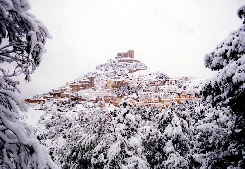
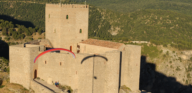
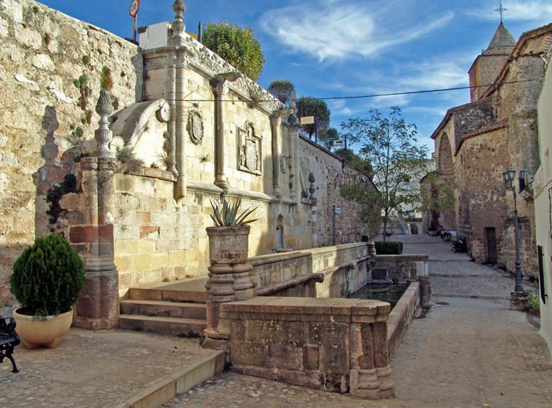
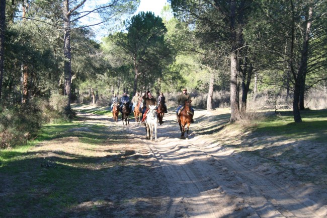
The site is located within an area of outstanding landscape, the Cazorla, Segura y Las Villas National Park, one of Europe's largest protected spaces (actually Europe's second largest park, and Spain's largest), where the rivers Guadalquivir and Segura rise, and over whose headwaters it is possible to fly. However, although these lands have ecological conditions of the first order, we should not ignore the architectural and ethnographic qualities of the area. In this regard, municipalities like Segura de la Sierra and Hornos are just the tip of the iceberg of its exceptional heritage.
Climate
Furthermore, it may be difficult getting to El Yelmo due to the presence of snow. However, it is possible to fly if there is snow on the launch site, once the weather front has passed and if conditions allow.
The flying conditions are suitable all year round, although the best thermals can be found in spring (good cross-country conditions), summer (sun at midday with strong, turbulent winds, and afternoons/evenings with unparalleled thermal and ridge lift and restitution) and autumn (long flights from midday to evening); however, winter can be a surprisingly good time, with days of good thermalling and thermal soaring, when the high Atlantic pressures predominate on the peninsula.
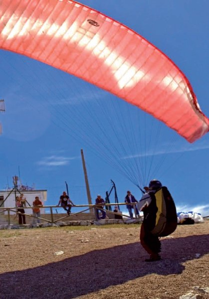
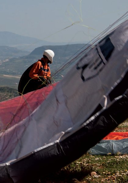
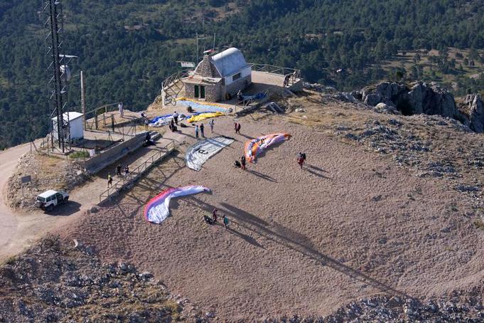
Launch sites West Coordinates: 38º 15’ 14.30’’ N / 02º3 9’ 30.88’’ W. Orientation: West Southwest-Northwest. Altitude: 1,809 metres. Drop: 1045 metres. Access: From the Cortijos Nuevos roundabout, go towards the village of El Ojuelo (3 Km), pass this, and the next village (El Robledo) and go straight on, starting to climb. Keep climbing the mountain along a surfaced forest road that is in good condition; about halfway up, you will reach a signposted junction. Go left and in less than 10 minutes you will be at the summit. The road goes in front of the East launch site, and after 500 metres it reaches the West site. Dimensions: Launch site: approx.80 mx40 m Parking: Yes. On the right of the track,40 mbefore the summit. Facilities: Windsocks. Weather station with Internet access. http://www.fiaelyelmo.com/meteo/IQ034_meteo.html Mountain hut, although in summer this is used by the Plan Infoca organisation. Drinking water from a spring next to the mountain hut. Precautions: * There is a power line to the right of the launch site that goes down the mountain parallel with the slope; it should not provide any difficulty as long as the pilot maintains sufficient altitude and a safety margin. It is worth thinking about it when you join traffic on the slope or are turning on thermals at low altitude. * Broad, clean launch that doesn't involve any problems, but please pay attention to the gravel, which is a bit loose. Be careful in strong wind, as the launch site is exposed to gusts of wind and leeward of the West launch site are a number of radio masts; it is recommended that pilots prepare their equipment low down on the launch site in order to increase the safety margin during inflation. Be careful when: * there is a likelihood of crosswinds from the south or north, lee winds or strong gusts. Very acute thermal spin to the lee of the mountain hut. * Strong thermal conditions: very turbulent at the beginning, but with good possibilities for cross-country flying. * In case of no wind: prepare equipment as high up as possible to increase the safety distance at the end of the gravel area. * Top landing (landing at launch site): Possible, but technically very difficult. With a moderate/strong breeze from SW, enter very low from the right (NE). With a moderate/strong breeze from N-NW, drift in from the S-SW, adjusting altitude and speed. Try not to complicate the situation by bringing your vehicle down; it is better to land below and go back up for the vehicle, avoiding any possible accidents. East Coordinates: 38º 15’ 16.16’’ N / 02º 39’ 22.99’’ W. Orientation: East-Northeast. Altitude: 1,750 metres. Drop: Above El Campillo (East landing site): 333 metres. Location: Along the same access road, about 500 m. before the summit. It is signposted. Dimensions: Around 50-75 m. wide and 30 m. deep, good slope but only a short run-up before the launch. Parking: At the side of the access road, either before or after the launch site. Facilities: Similar to the West launch site. Precautions: * The launch site is very narrow. When there is little wind, be careful when you reach the runway because this can interrupt the run-up and it is possible to lose wing pressure. It is recommended that flyers prepare equipment as high up as possible. * With a moderate breeze, the launch distance improves. Be careful as there are rocks in front of the launch site, and when travelling along the runway. Prepare high up, leaving a safety margin between you and the rocks behind. Top landing is very dangerous and is not recommended. This flight is generally turbulent at the beginning since the air can be stirred up by the Sierra de Segura ridge. It is possible to use this site from earlier in the day than the East site, since it is east facing. There are possibilities for cross-country flying. One possibility is to gain as much height as possible, running along the crest on the right and crossing before the Yelmo Chico for the Cortijos Nuevos valley and landing at the official west site. Landing sites West landing site (football field) Coordinates: 38º 15’ 02.12’’ N / 02º 42’ 51.91’’ W. Access: Next to the Cortijos Nuevos football field, 800 m. in the El Ojuelo direction, on the right. It can be seen from the launch site taking the square of yellow earth as a reference. For anyone who glides a shorter distance, there is the Ojuelillo landing site, a number of long fields to the right (south) of the second village, which can be seen in the direction of flight. Altitude: 760 metres. Facilities: Windsocks. Access to the sports centre (when this is open). The town of Cortijos Nuevos has shops and tourist services (restaurants, accommodation, a pharmacy, petrol station, supermarkets, car mechanics, tow service, etc.). Parking: Yes. Next to the main entrance to the Cortijos Nuevos sports centre. It is recommended that visitors do not take their vehicles onto the landing site. Careful in winter: there are muddy areas where 4x2 vehicles can become trapped. Obstacles: There are floodlights for the football field, so be careful when approaching with a SE or E breeze. There are also 2 pine trees in the centre of the landing site (although these provide shade during the day); the football field's walls and the sports centre building are the most major obstacles. There is a small electricity cable behind the football field, above the open space at the entrance to the landing site. Careful if you overshoot the landing site with an approach towards the SW; it is easy to land on the pitch itself, but there is seating and the electricity cable after this. West landing site (El Ojuelillo) Coordinates: 38º 14’ 56.15’’ N / 02º 42’ 05.77’’ W. Access: From the Fuente de El Ojuelo continue to the south along a farm track, about 500 metres. Altitude: 824 metres. Facilities: On arrival, the landing site is signposted, but the road from El Ojuelo is not. Parking: Next to the landing site, by the sign. Obstacles: There are a number of large trees on the track leading to the field, and another couple on the landing site it self, but there is enough space for a landing. The approximate dimensions are: 400 m. long x 80-100 m. wide, facing the west. Careful with S or SW breezes because the field may not provide enough space. East landing site (El Yelmo) Coordinates: 38º 15’ 13.61’’ N / 02º 38’ 39.80’’ W. Access: From El Ojuelo, take the road to El Robledo and then take the surfaced track that goes up to the top of El Yelmo. At about 5 Km. before the summit (at the third junction), turn right and go down towards El Campillo. Once out on the road to Segura dela Sierra, go left after 1200-1500 m, and drive until you get to some open spaces on the right of the road, which is the East landing site. Altitude: 1,418 metres. Facilities: Water springs nearby. Vertical signage and windsocks available. Parking: Next to the Segura dela Sierraroad, by the side of the road. Obstacles: Here, the landing site is in a clearing among pine trees, and can be seen in front of the landing site. However, it is better not to aim directly for it, but go to the right, since there are significant descending winds here.
Ideas for your trip
Services and infrastructure
Target audiences
Segments
Type of activity
Season
You may be interested


EXPLORE ANDALUSIA
EXPERIENCES


