Ibros
Ibros is a small municipality that belongs to the Úbeda-Baeza region and is situated near Baeza. The municipality's olive groves slope down towards the Guadalimar River.
It has a large extension of vegetable gardens, which are a unique location within the province thanks to its contribution to biological diversity and feeding ecology.
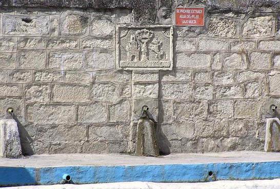
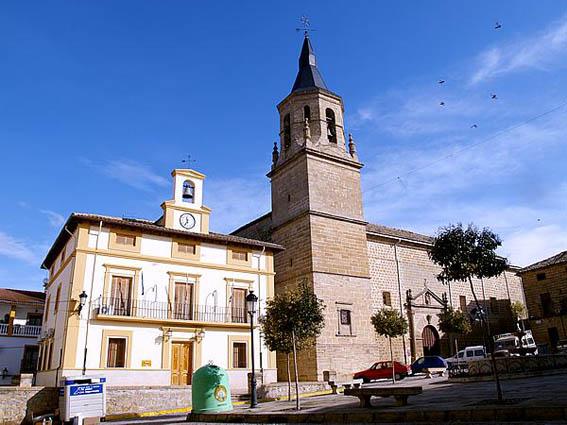
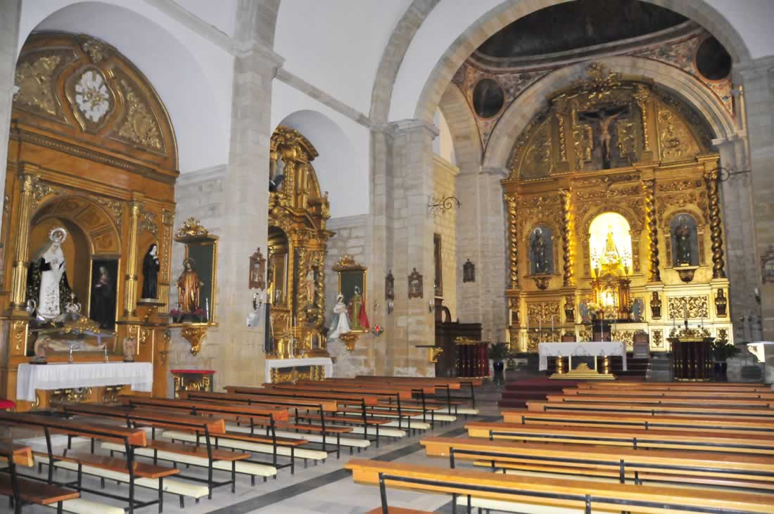
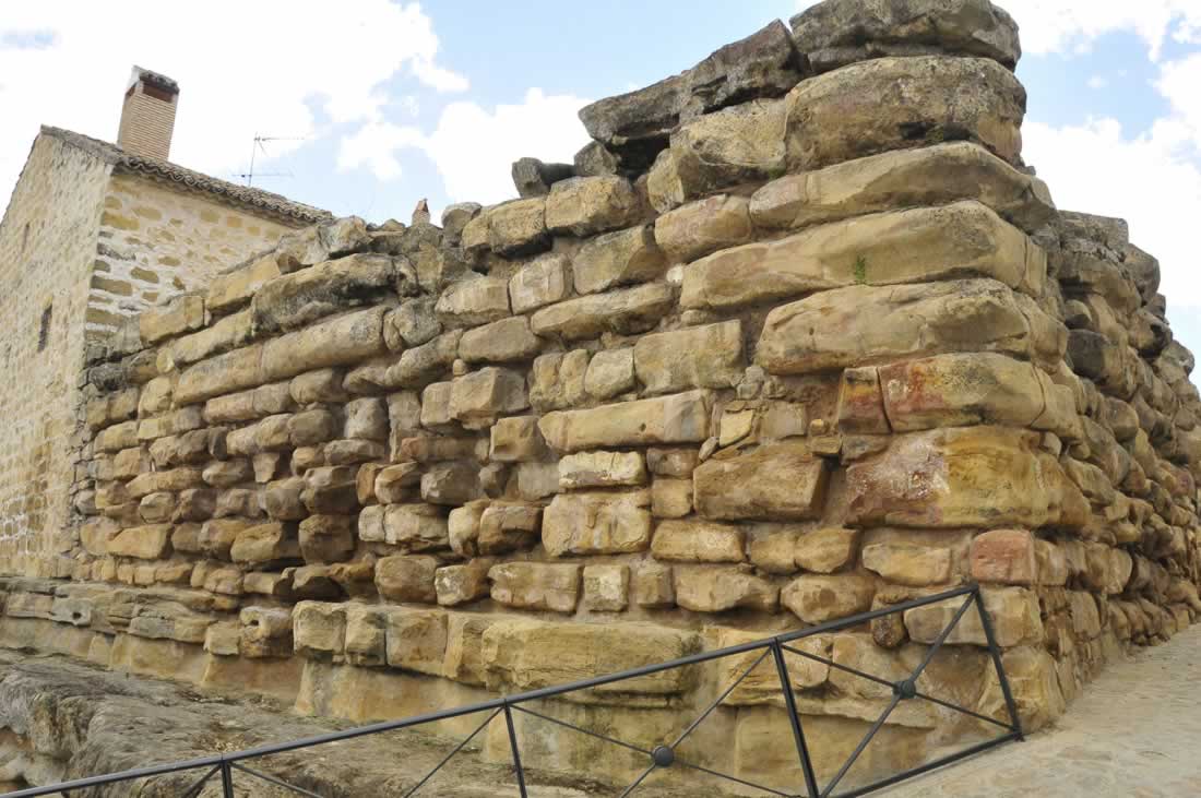
Some of the most important elements of its architectural heritage are the Cyclopean Wall, built between the 1st century BC and the 1st century AD, declared a Historic-Artistic Monument in 1931; and the Mannerist San Pedro and San Pablo parish church.
History
Some authors say that it is the ancient ‘Ibes’ or ‘Ibris’ of the Oretani people, where there was a great Iberian king who gave the municipality its name. The famous cyclopean wall in town is said to have been built in this Iberian period.
The numerous archaeological remains found in the municipality show that a large number of people inhabited the area in Roman times. There are rustic villas like the Cortijo del Álamo, Horcajo and Corral del Manchego, where a small necropolis was also discovered.
There are two inscriptions in the town from the Moorish period: the first one is a tombstone that dates from 1025, which was embedded in the cyclopean wall and was transferred to the National Archaeological Museum; the second one dates from the 12th century and can currently be found in the Jaén Provincial Museum.
The Christians conquered the town in 1157 but the Moors took over again later on, until it was finally conquered by Ferdinand III the Saint. In the 17th century, Philip IV granted a privilege that said that ‘only the wall and its fence and two towers’ were exposed. It seems as though the town's defence system consisted of a small castle and a fence that was built reusing the cyclopean wall.
After being conquered by the Castilians it was divided into two jurisdictions: ‘Ibros del Rey’ (The King's Ibros), because it belonged to the Crown, and ‘Ibros del Señorío’ (The Lord’s Ibros), because it belonged to the Duke of Santiesteban. This separation was also social-economic – the people had to pay the lord very high taxes. There were 297 people living on the Crown's side in 1561, while on the other side there were only 31 people. This separation has had an influence on the morphology of the urban area, resulting in two juxtaposed areas: Ibros del Rey, built around the parish church and the town hall, with noble houses with ashlars and cobbled streets; and Ibros del Señorío, a popular and picturesque quarter, where lower-income families used to live.
The Carlist troops who operated in La Mancha, were defeated in Ibros in 1836.
The village fortress was mentioned by Sarthou in his work Castles of Spain, because of its cyclopean stone walls from Iberian times.
Eminent citizens
Antonio Garrido, journalist.

- Max 34
- Min 31
- Max 93
- Min 87
- °C
- °F