
Landscapes of La Campiña: Route through the Tierras del Algaba and La Jara
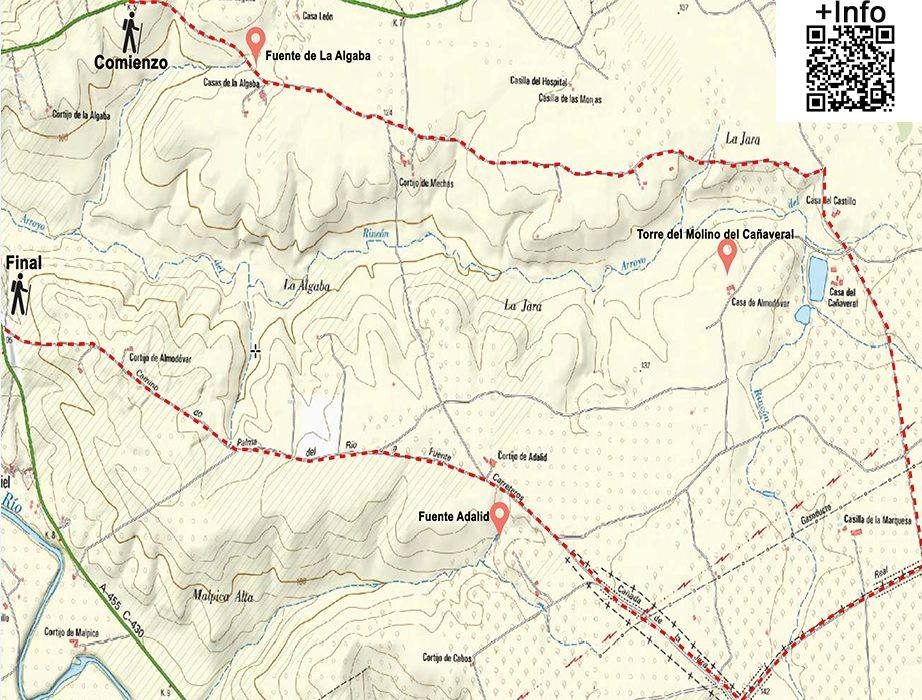
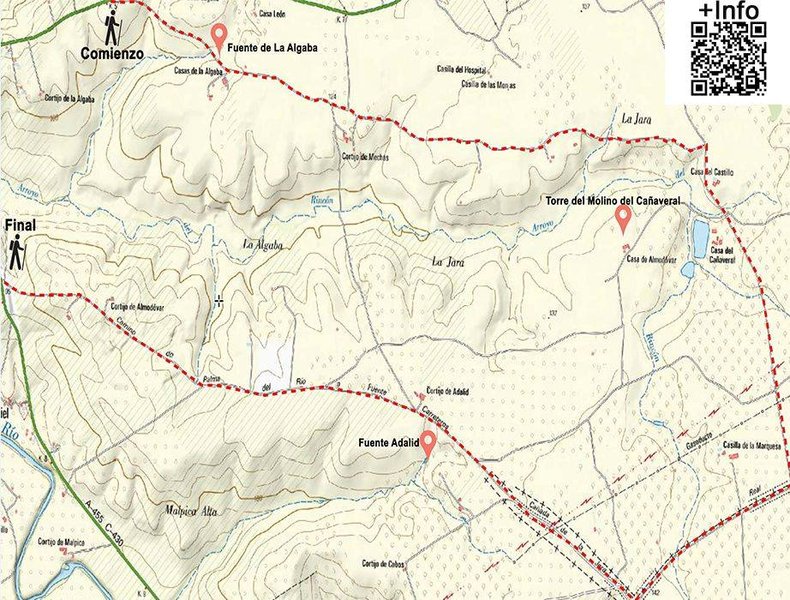
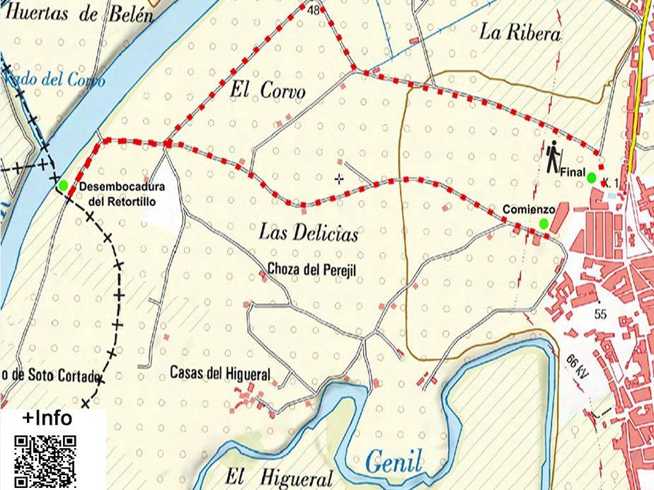
The itinerary Landscapes of the Campiña: The route through the Tierras del Algaba and La Jara begins after passing the La Algaba urbanisation, 5 km from the A - 440 or CV - 214 main road between Palma del Río and Fuente Palmera. After about 800 metres you'll come to the fountain or pillar of La Algaba, a spring located on one side of the path and rectangular in shape, measuring about seventeen metres long and six metres wide. Although there is hardly any water these days and it is covered with vegetation, the dimensions of the fountain confirm the importance that it must have had as a place for supplying water and as a drinking trough for animals. The state of neglect of this spring should make us reflect on the use of water and the over-exploitation of natural and historic springs. As an anecdote, here is an old saying featuring its waters: “You're crazier than the La Algaba pony”, supposedly because the water from this fountain produced some kind of madness in those who drank it.
We continue, but not before enjoying the excellent views of the surrounding countryside and the lands of La Algaba and La Jara. Both of these place names, of Arab origin, tell of the wealth of plant life in the area in ancient times: Algaba means “the forest “, while Jara would be “land full of vegetation “. A land with abundant Mediterranean forest and vegetation, this area, like others in the surrounding region, has undergone a major clearing process for the extension of agriculture in recent centuries. The region of La Algaba came to have a few small rural schools after the Civil War, which you can see to one side of the path, about three hundred metres from the spring.
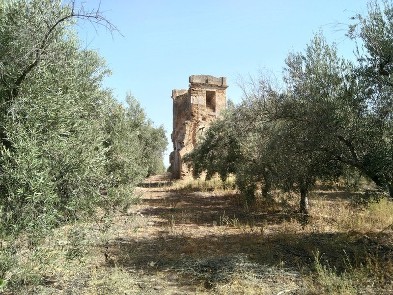
Continuing along the route, we see on the horizon the remains of the tower of an old mill called the Cañaveral. There are three other mills in this area: El Castillo, Guzmán and Molino Alí. After descending southwards along the path, between the castle farmhouse and an irrigation pond, we come to the junction of the paths that lead towards Los Silillos and Fuente Carreteros. We take the first path to the right (El Alamillo drovers trail), heading southwards. We come to another junction and take the first on the right towards the west (El Jara drovers trail). Along this path after about two kilometres we find a small turn-off to the left leading to the Adalid or Alí spring. Returning to the path we follow the route until we reach Malpica Rural Centre. Once we pass this we have a wonderful panoramic view of the Genil valley and a steep slope leading us down to the end of the route, when we reach the A - 455 main road.
Distance: 13.75 km. Route: Linear. Difficulty: medium - low. Duration: 3 hr by bike / 5 hr on foot.
Itineraries
Services and infrastructure
Target audiences
Segments
Season
You may be interested


EXPLORE ANDALUSIA
EXPERIENCES


