
Pedrera

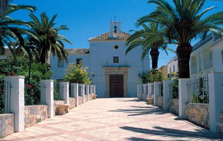
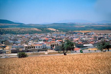
Locality belonging to the Campiña district and located at the feet of Sierra Becerrero, in back of Estepa. Its landscape comprises farmland used to cultivate olives and cereals. Its most important monuments are the Hermitage del Carmen, the Hermitage del Santo Cristo de la Sangre and the church of San Sebastián.
History
Its name comes form the quarry of high quality stone located in the vicinity. (In Spanish pedrera means stone quarry.)The first human settlements date back to the Calcolithic period, of which remains have been found in artificial caves.
During the Roman domination it was called Ilipula Minor.
At the time of Al-Andalus it dwindled to the size of a farmstead.
Following the Christian reconquest it was administered by Estepa until 1557, year in which it became independent by virtue of Royal Privilege, although it did not have its own town council until 1837, as a result of the abolition of feudal domains.
Pedrera
Municipio

The weather today in Pedrera
- Max 25
- Min 9
- Max 77
- Min 48
- °C
- °F
Pedrera
Tourist area
Distance to the capital (km)
110
Altitude above sea level (m)
458
Extension (Km 2 )
61
No. of Inhabitants
5003
Demonym
Pedrereños
Postal Code
41566
en
Read more


