
Estación de Vuelo Libre de Siete Pilillas - Pegalajar
This flying site is located in Pegalajar, Jaén province, in the south of the Sierra Mágina district, 4 kilometres from the Jaen-Granada motorway. The municipality has a broken geography which means that some unique landscape features can be found here. The Almadén peak, at an altitude of 2.032 m, is white with snow for most of the year and is a major visual reference point. Around it are the summits of Mojón Blanco, Morrón, Cerro dela Artesilla, Serrezuela, Grajales, los Tres Mancebos, los Valientes, Cerro Santín, la Atalaya,… forming a ring of mountains that delimit the municipality. These heights give way to the River Guadalbullón, which has excavated a narrow valley that was historically an important thoroughfare in Eastern Andalusia.
Located to the west of the Mágina massif, it is closely linked to the Mágina province. Its presence on what was the border with the Islamic Kingdom of Granada means that its military architecture is an outstanding feature here, while its own Islamic past has bequeathed it a culture of water.
Climate
Its altitude of 800 mabove sea level means that it has a mountain climate: cold winters, although not bitterly cold, and very pleasant summers. The temperature ranges between a minimum of 3 or 4 degrees centigrade in winter and a maximum of 30 to 35 degrees in the summer.
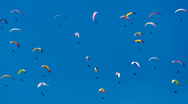
The breezes in the valley mean that spring and summer provide the best conditions, with good thermal flying and a restitution which means pilots with little experience can learn the art of slope soaring.
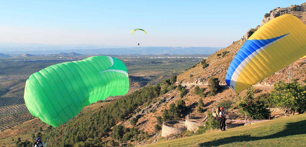
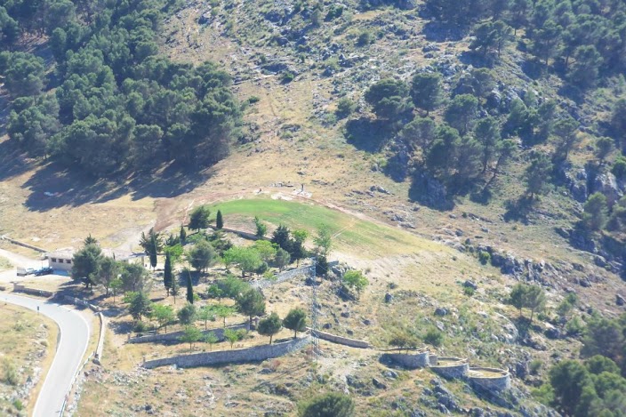
Launch sites Launch site Coordinates: 37º 45’ 07,60’’ N / 03º 38’ 45,63’’ W Orientation: North-Northwest. Altitude: 931 metres. Drop: 360 metres. Dimensions: 650 m2. Access: Once you are in Pegalajar, get to the flying site by going along the Mancha Real road, and the launch site is 2 Km from Pegalajar. Parking: 1.200 m2. Facilities: Bar-Restaurant, picnic tables and barbecues. Precautions: * Take care; there are cables to the right of the launch site. Landing sites Granada road Coordinates: 37º 45’ 08,99’’ N / 03º 40’ 59,97’’ W Access: Go down to the motorway roundabout and take the old N-323A Bailén-Motril road- pass the Puerta Mágina restaurant, after 2 Km on the left next to the road. Altitude: 448 metres. Parking: Large. Obstacles: Pay attention to the cables as you approach the landing site. At the entrance to the town of Mancha Real Coordinates: 37º 46’ 48,63’’ N / 03º 36’ 52,41’’ W Access: Going towards Mancha Real, after 5 Km turn right and go for 100 m. If the wind picks up it is recommended that pilots queue above the landing site. Altitude: 770 metres. Parking: Large. Obstacles: No. NOTICE: This flying site has airspace that is regulated and monitored by the Spanish Aviation Safety Agency and so this organisation must grant authorisation before flying.

Services and infrastructure
Target audiences
Segments
Type of activity
Season


EXPLORE ANDALUSIA
EXPERIENCES


