
Quiebrajano - Guadalbullón route
The most remote tracks in the heart of the sierras of Jaen
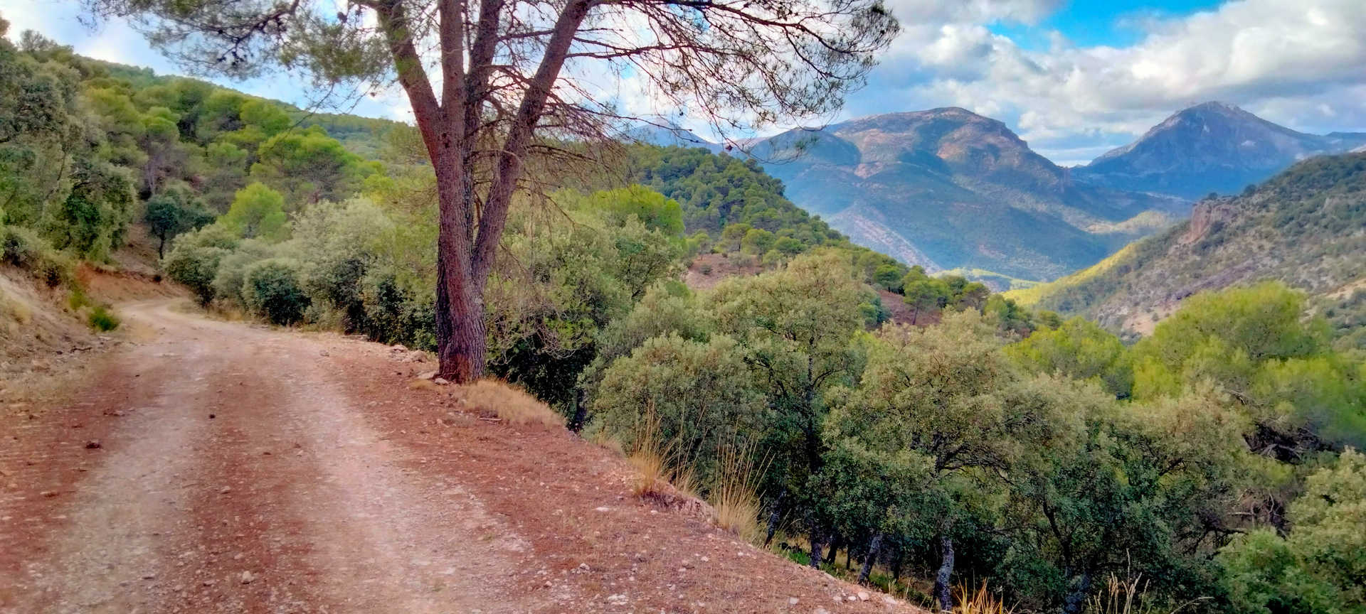
This trail route is not many kilometres long but brims with emotions; it will lead you through the most rugged, unknown and unpopulated area of Jaen’s Sierra Sur. Huge slopes among cliffs, deep valleys covered with pine forests and Mediterranean scrubland, limestone rocks and a land brimming with mysticism await you. Great altitudes and slopes in a wild and isolated environment. If you are seeking silence, solitude, to be in contact with nature and a strong dose of adventure, this is the route for you.
On route
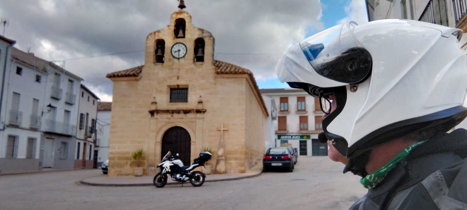
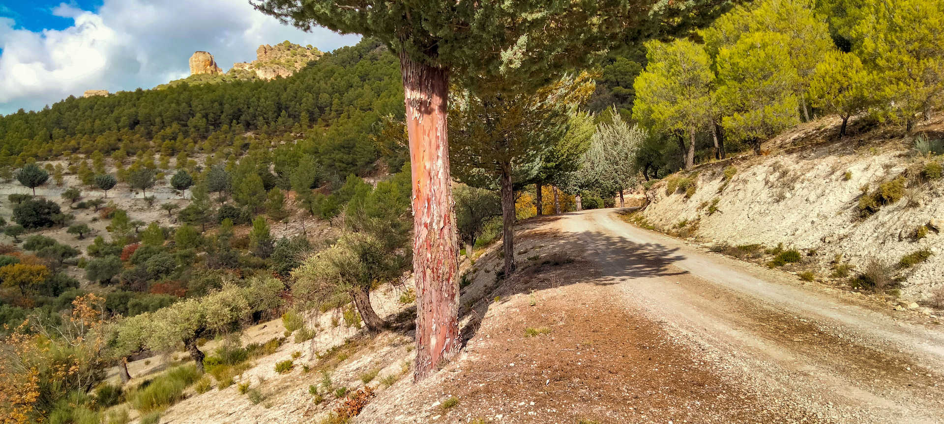
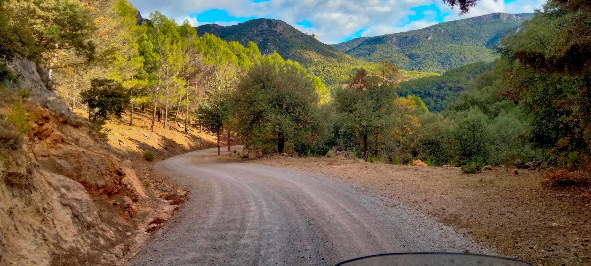
After filling up your motorbike, you will begin the route at Valdepeñas de Jaén (stop 1), but not without first visiting some of its tourist attractions, such as the Molino de Santa Ana Museum, the Cristo de los Chircales hermitage and the magnificent Las Chorreras site. Leaving behind the Valdepeñas fenster and taking one of its excellent goat’s cheeses for your rucksack in case you stop along the way, take the road that leads to the Quejigo del Carbón or del Amo natural monument, which ascends sharply to an altitude of more than 1,300 metres. The road is narrow, very winding, and the asphalt is in worse and worse condition as you ride until it becomes a gravel track with some sections having potholed asphalt. Exercise extreme caution when riding, especially from the Puerto de las Coberteras (stop 2) on.
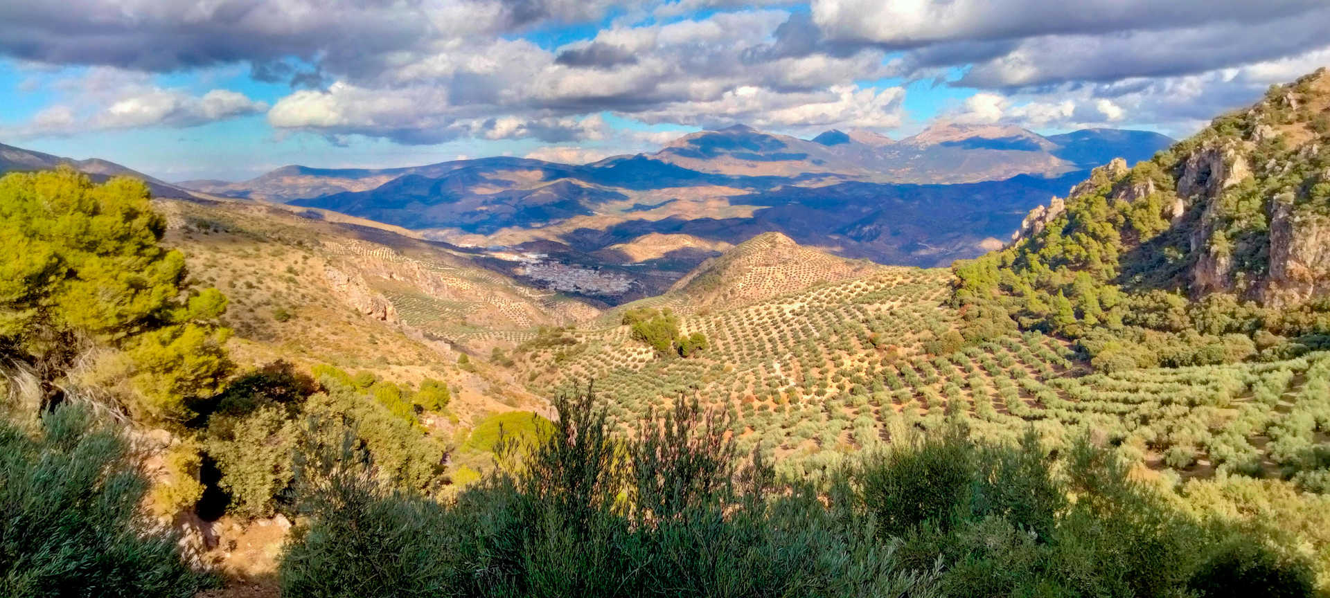
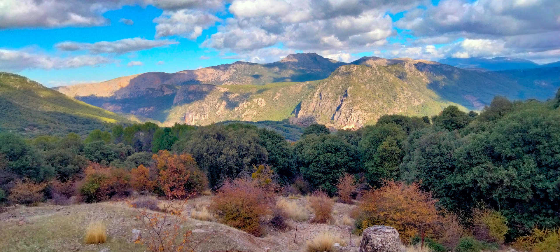
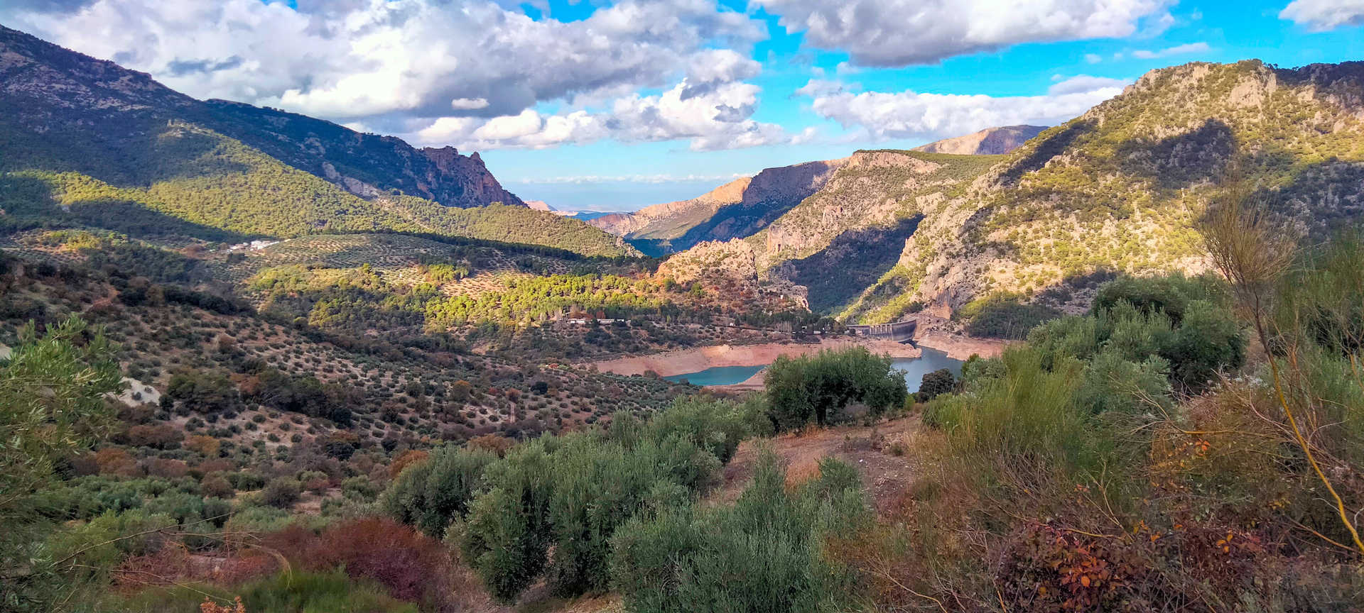
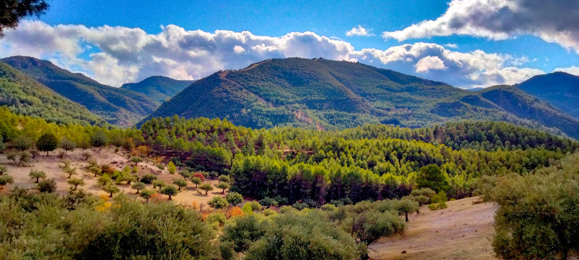
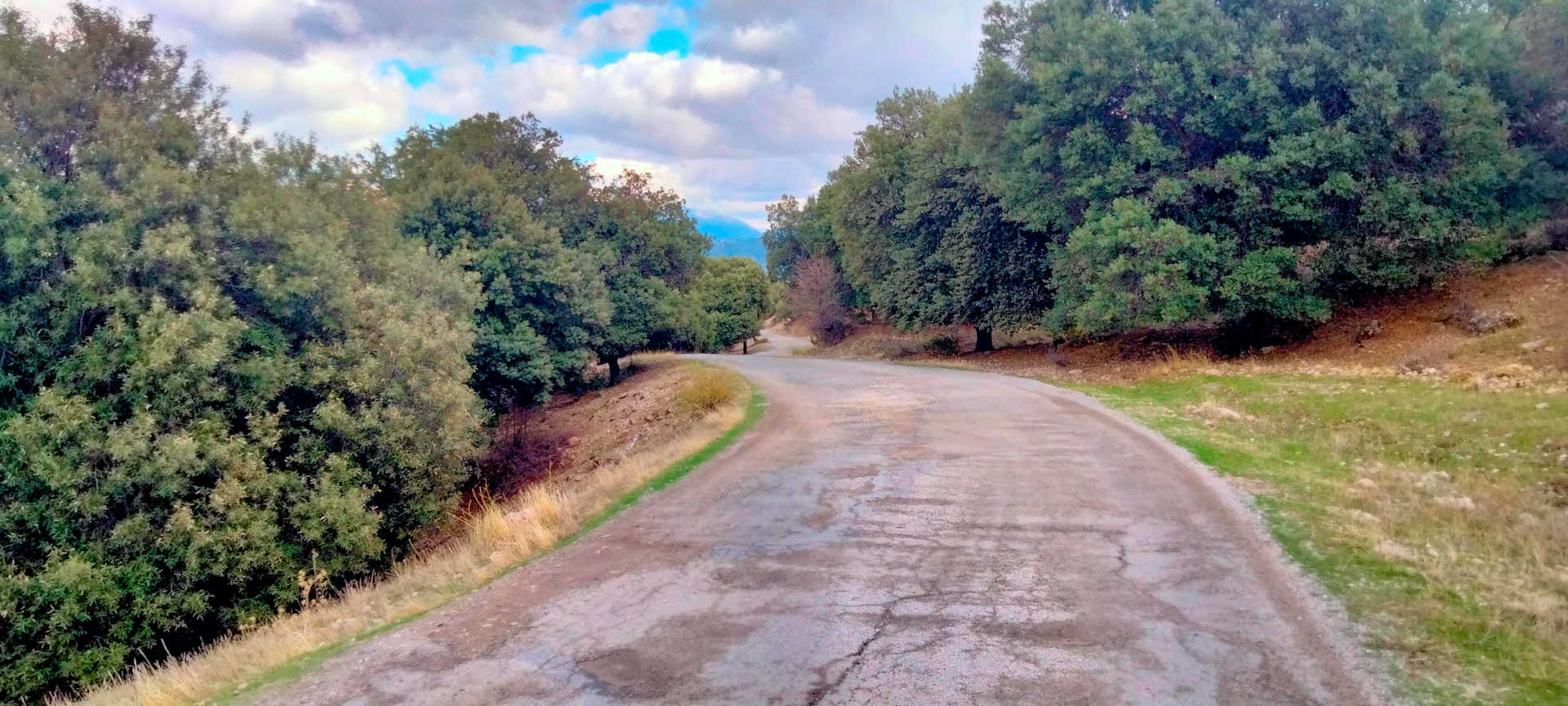
In this section you will have a spectacular view of both the mountains and the Quiebrajano reservoir, with deep valleys and enormous altitude changes. On the left is the mythical Pandera pass, which is famous for its vibrant stage finishes in the Vuelta a España cycling race. You can make out much of the Sierra Sur, with the highest peaks covered with cork oaks, gall oaks - many of which are ancient -, pines and a brushwood undergrowth. From here you can take several detours, towards the Quiebrajano reservoir dam, to the ancient Quejigo del Carbón (a large specimen of gall oak) (stop 3) or continue the route. Two gates must be opened and closed to prevent livestock, mainly cows, from escaping. The second is at the pass over the River Valdearazo, where the Sierra Mágina district begins. The track is made of compacted gravel and is in good condition, but you should be careful on some major descents, where you will need to reduce your speed due to sharp bends and surface runoff after rain.
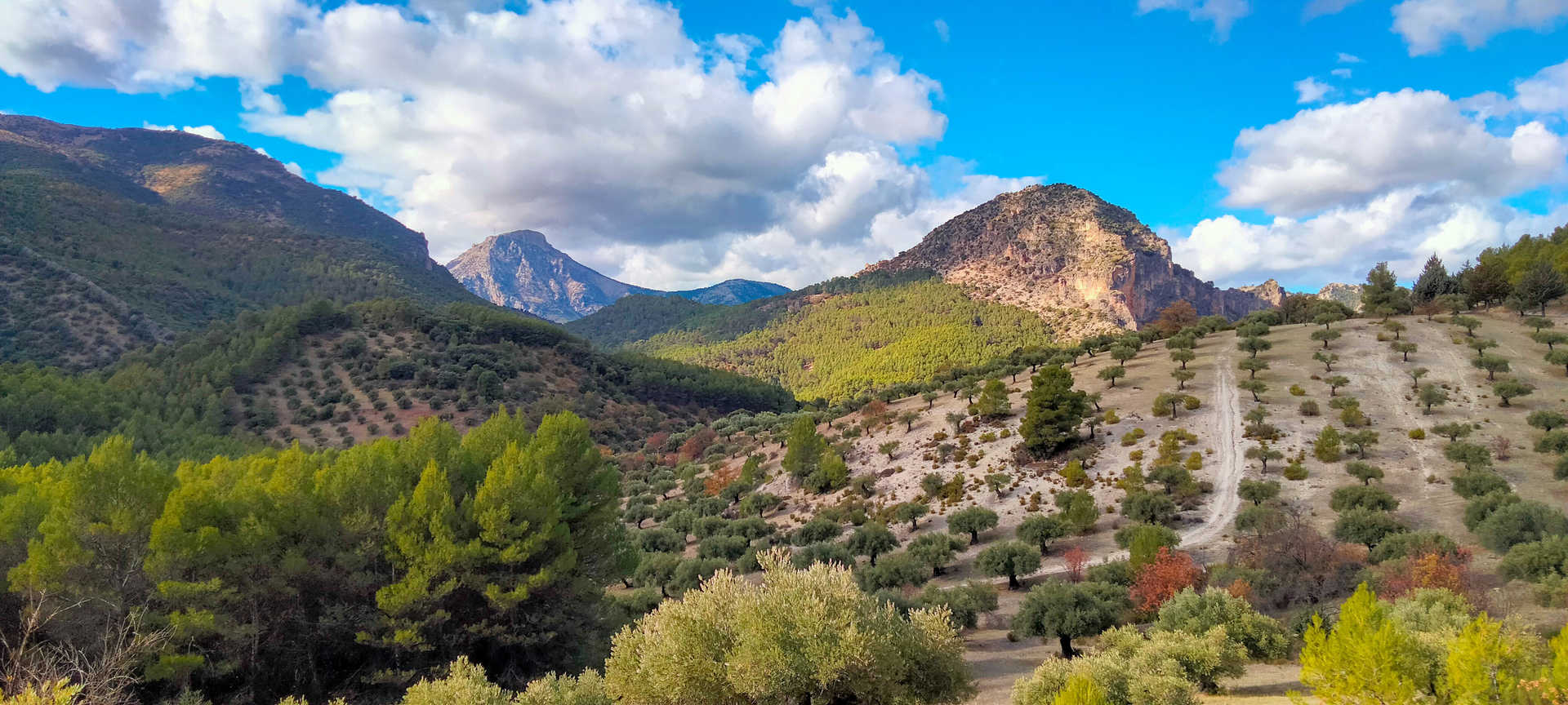
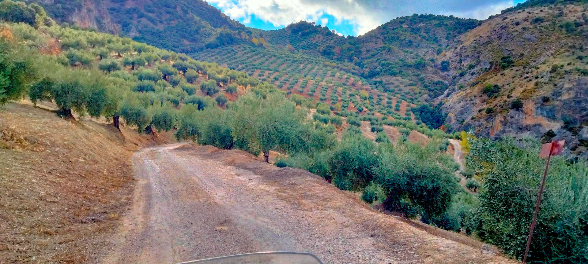
Further on, after several kilometres of solitary ascent on a narrow track with little cover, you will begin your descent of the Los Caballos pass towards Carchelejo, which affords impressive views of the Sierra Mágina massif. Below an altitude of 1,000 metres, olive trees begin again, as, bit by bit, does asphalt, which is very dirty and has gravel and holes. After passing Carchelejo you will reach Cárchel, the two villages that make up the municipality of Los Cárcheles. The beautiful church of Nuestra Señora de Los Remedios, in the Plaza de la Constitución (stop 4), is well worth visiting. The place is the perfect place to stop and recharge your batteries, sampling the traditional local cuisine of these mountains in the south of Jaen. Based on virgin olive oil, kid and sausages, excellent in the whole region, its dishes include carnerete (a mash with potatoes, bread and garlic), andrajos (a rabbit stew) and migas (breadcrumbs), cod with onions and relleno (a kind of stuffing), a hearty recipe that is the star of the carnival stew. As for desserts, you should certainly try the porridge.
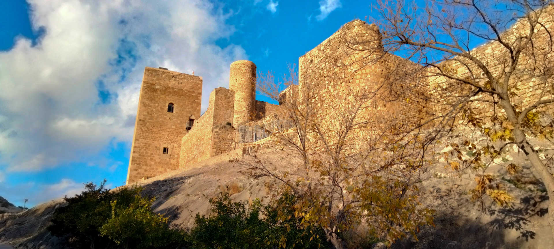
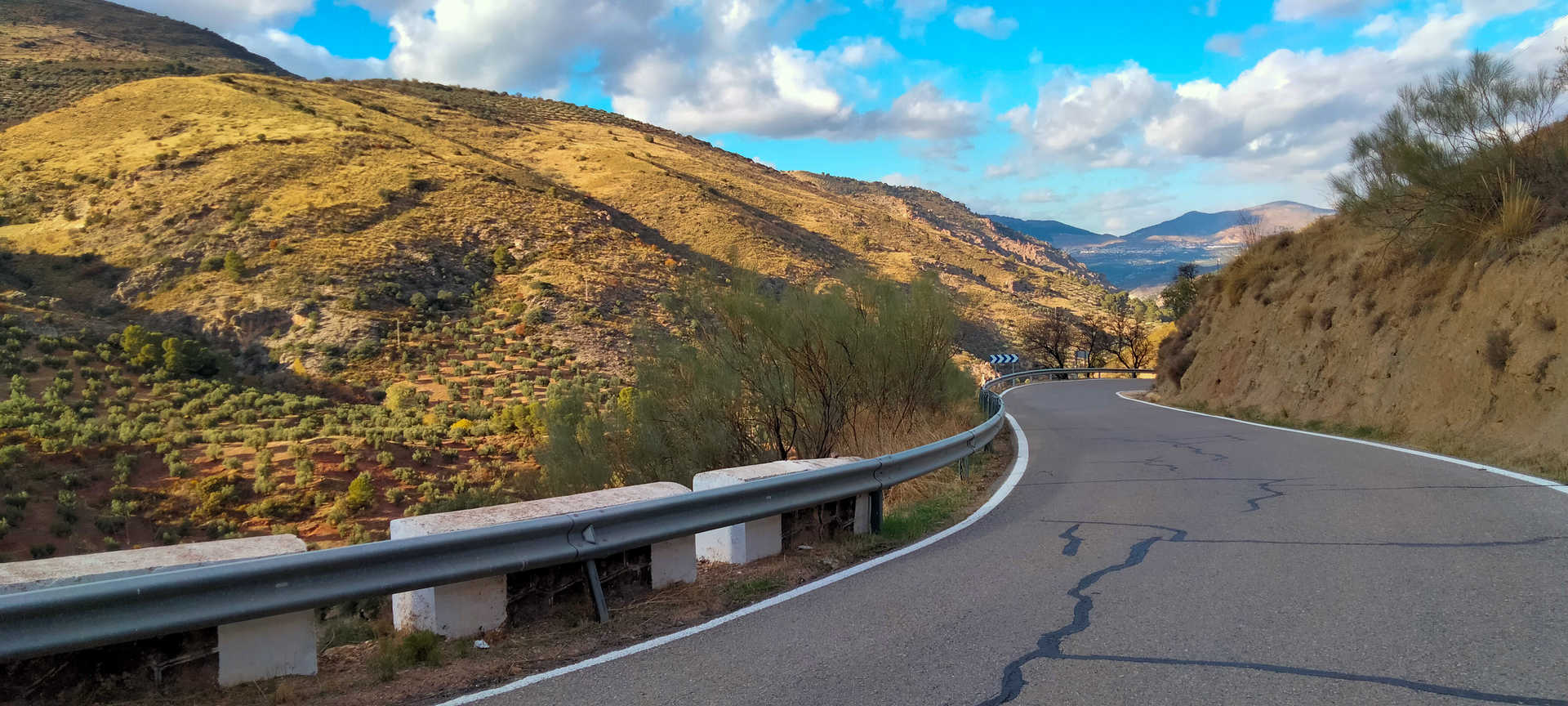
The next section is a narrow mountain road with asphalt in good condition and a steep descent with several hairpin bends. It leads you to the old N-323 Bailén-Motril road. Practically unused since the highway was built, it is only used as a service road and for access to the small yet charming village of La Cerradura. There is a very interesting Centro de Interpretación de la Caminería (Roadways Interpretation Centre) (stop 5), which is in the open air by the road; it displays mileposts, boundary stones, milestones, etc., that flank the path. You now ride along the Guadalbullón riverbed, among sheer cliffs, along a wide road with the romantic charm of abandonment. Finally, you will arrive at La Guardia de Jaén (stop 6), a beautiful mountain village which signals its presence with the magnificent silhouette of its castle crowning the horizon.
#carchel selfie spot
Parish Church of Nuestra Señora de los Remedios, in Cárchel. According to some researchers, it was built on the site of an older church, beside a possible Visigothic cemetery. Simple, not particularly adorned, but very elegant and photogenic.
After filling up your motorbike, you will begin the route at Valdepeñas de Jaén (stop 1), but not without first visiting some of its tourist attractions, such as the Molino de Santa Ana Museum, the Cristo de los Chircales hermitage and the magnificent Las Chorreras site. Leaving behind the Valdepeñas fenster and taking one of its excellent goat’s cheeses for your rucksack in case you stop along the way, take the road that leads to the Quejigo del Carbón or del Amo natural monument, which ascends sharply to an altitude of more than 1,300 metres. The road is narrow, very winding, and the asphalt is in worse and worse condition as you ride until it becomes a gravel track with some sections having potholed asphalt. Exercise extreme caution when riding, especially from the Puerto de las Coberteras (stop 2) on.
In this section you will have a spectacular view of both the mountains and the Quiebrajano reservoir, with deep valleys and enormous altitude changes. On the left is the mythical Pandera pass, which is famous for its vibrant stage finishes in the Vuelta a España cycling race. You can make out much of the Sierra Sur, with the highest peaks covered with cork oaks, gall oaks - many of which are ancient -, pines and a brushwood undergrowth. From here you can take several detours, towards the Quiebrajano reservoir dam, to the ancient Quejigo del Carbón (a large specimen of gall oak) (stop 3) or continue the route. Two gates must be opened and closed to prevent livestock, mainly cows, from escaping. The second is at the pass over the River Valdearazo, where the Sierra Mágina district begins. The track is made of compacted gravel and is in good condition, but you should be careful on some major descents, where you will need to reduce your speed due to sharp bends and surface runoff after rain.
Further on, after several kilometres of solitary ascent on a narrow track with little cover, you will begin your descent of the Los Caballos pass towards Carchelejo, which affords impressive views of the Sierra Mágina massif. Below an altitude of 1,000 metres, olive trees begin again, as, bit by bit, does asphalt, which is very dirty and has gravel and holes. After passing Carchelejo you will reach Cárchel, the two villages that make up the municipality of Los Cárcheles. The beautiful church of Nuestra Señora de Los Remedios, in the Plaza de la Constitución (stop 4), is well worth visiting. The place is the perfect place to stop and recharge your batteries, sampling the traditional local cuisine of these mountains in the south of Jaen. Based on virgin olive oil, kid and sausages, excellent in the whole region, its dishes include carnerete (a mash with potatoes, bread and garlic), andrajos (a rabbit stew) and migas (breadcrumbs), cod with onions and relleno (a kind of stuffing), a hearty recipe that is the star of the carnival stew. As for desserts, you should certainly try the porridge.
The next section is a narrow mountain road with asphalt in good condition and a steep descent with several hairpin bends. It leads you to the old N-323 Bailén-Motril road. Practically unused since the highway was built, it is only used as a service road and for access to the small yet charming village of La Cerradura. There is a very interesting Centro de Interpretación de la Caminería (Roadways Interpretation Centre) (stop 5), which is in the open air by the road; it displays mileposts, boundary stones, milestones, etc., that flank the path. You now ride along the Guadalbullón riverbed, among sheer cliffs, along a wide road with the romantic charm of abandonment. Finally, you will arrive at La Guardia de Jaén (stop 6), a beautiful mountain village which signals its presence with the magnificent silhouette of its castle crowning the horizon.
#carchel selfie spot
Parish Church of Nuestra Señora de los Remedios, in Cárchel. According to some researchers, it was built on the site of an older church, beside a possible Visigothic cemetery. Simple, not particularly adorned, but very elegant and photogenic.
en
Read more
Itineraries
Services and infrastructure
Target audiences
young people, Couples, I travel alone, Friends
Segments
Leisure and fun, Gastronomy, Sports, Culture
Specialties
Rutas off Road
Season
All year


EXPLORE ANDALUSIA
EXPERIENCES


