
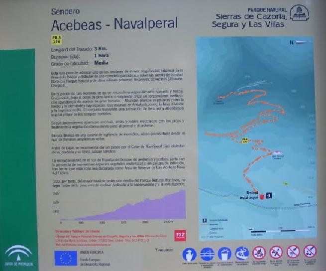
Acebeas - Cumbre del Navalperal Trail - PR-A 176

The Acebeas - Cumbre del Navalperal Trail - PR-A 176, runs through the municipal district of Siles, in the northeast of the province of Jaén.
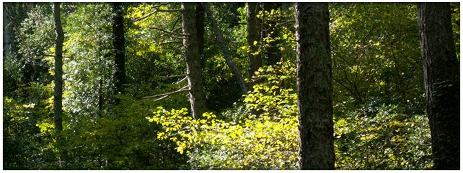
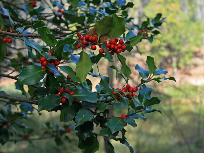
From this route you can admire one of the most unique botanical areas of the Iberian Peninsula and enjoy wonderful panoramic views. In the area of Las Acebeas there is an especially humid and cool microclimate. Thanks to this, under the canopy of Corsican pine a surprising hazelnut plantation grows - the furthest south in Spain - alongside an abundance of large holly trees. There are many climbing plants, such as ivy and clematis, and there are species that are very rare in Andalusia, such as wild strawberries and hepatica. It all gives a feeling of freshness, and of the abundance of plants normally found in northern forests.
As we ascend, holm oaks, maples and oaks appear, mixed with pines, and finally the vegetation clears away, leaving way for meadows and broom. The route ends at the monitoring hut, a viewing area overlooking expansive views. Before going down, we recommend taking a walk along the limestone rock of Navalperal to enjoy its meadows and its typical karstic landscape.
The exceptional nature in southern Spain of the forests of hazelnut and holly, together with the presence of numerous endemic or endangered plant species, have meant that this area has been declared a Holly Conservation Area - Nava del Espino. It therefore enjoys the highest level of protection in the Sierras de Cazorla, Segura y las Villas Natural Park.
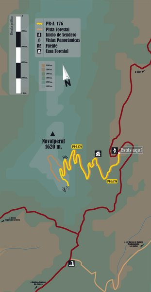
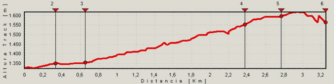
Just 600 m from the start we can find the Acebeas Forest House. These are two beautiful houses, the first is used by environment agents and the second, recently restored, was formerly used by forest engineers. There are several planted yew trees. At this point the forest track becomes narrower and turns to the left.
After 2,700 metres we leave the forest track and turn left onto a well-signposted path. (If you prefer, you can also continue along the track, which makes a large and gentle and loop around the central area of the limestone rocks, to join up again with the path). The path passes through a small open space towards some stone boundary markers.
And finally, after 3.2 km, we reach the fire surveillance hut. There are spectacular panoramic views of the provinces of Jaén, Ciudad Real, Albacete and Granada. To the north you can see the plains of La Mancha, the mountains of the Sierra de Alcaraz and the Calar del Mundo. Towards the west are the cliffs of Segura La Vieja, the upper valley of El Trujala, Orcera and the keep of Segura de la Sierra Castle. To the south we see the Yelmo and, in the distance, el Banderillas, the great mass of La Sagra and the Sierra de Cazorla. And to the east we see the Cerrico de Las Mentiras and the nearby limestone formations of Navalespino and Morillas.
Type of Trail: Linear Trail Status: Approved and signposted 2004. Total length: 3.1 Km (one way) Sections: 1 Accessibility: It can be done on foot. Download Technical Datasheet
Itineraries

Services and infrastructure
Target audiences
Segments
Season


EXPLORE ANDALUSIA
EXPERIENCES


