
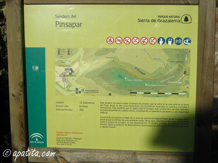
El Pinsapar Trail (NR Sierra de Grazalema) - PR-A 347

This trail takes us into a forest of Spanish firs, a unique fir that earned the declaration of these mountains as a Biosphere Reserve and Sierra de Grazalema Nature Reserve
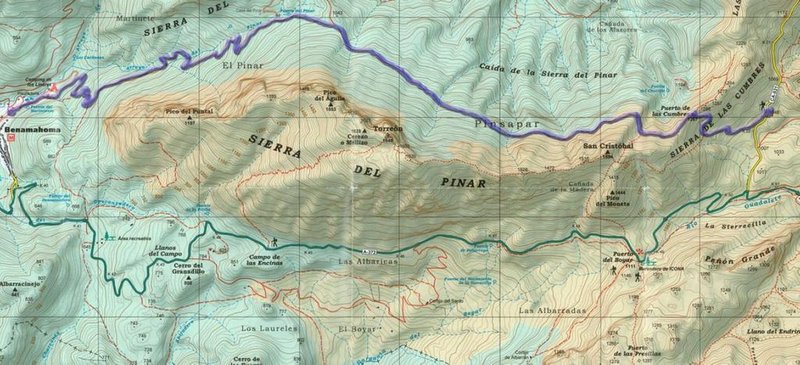
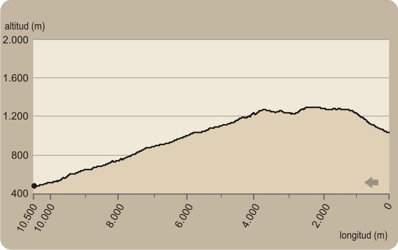
The El Pinsapar Trail - PR-A 347 starts in the place known as Las Canteras or Los Areneros due to the quarries found there, a couple of kilometres from Grazalema, on the road that goes up to the Puerto de las Palomas. It begins to ascend between repopulated pine groves which has halted the high erosion of the ground caused by intensive rain. In fact, this area has one of the highest rates of rainfall in Spain.
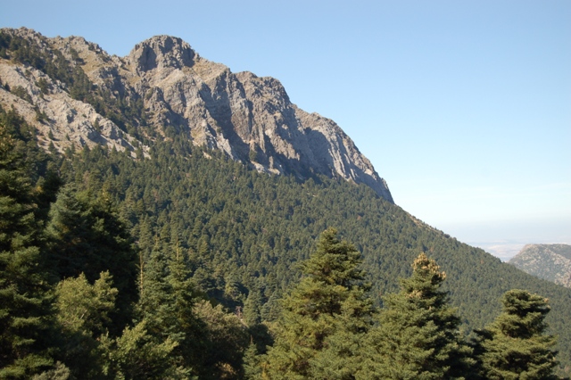
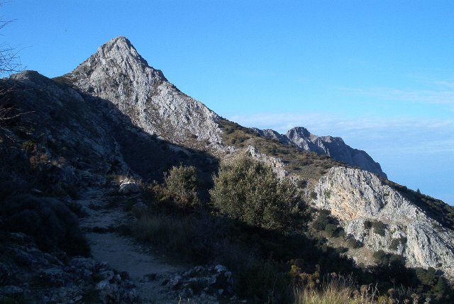
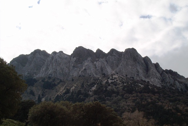
Gaining altitude, the path reaches el Puerto de las Cumbres, a natural gateway to the northern flank of the mountain range, where the view is magnificent of the Serranía de Ronda behind us and a large area of the Reserve Area in front. You can also make out El Torreón, the highest peak in the province of Cadiz, and some Spanish firs announcing the proximity of the forest.
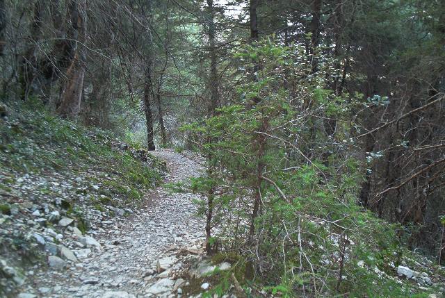
You will have the opportunity to enter the fir forest, where the scarce light penetrating in the forest catches our eye. The Spanish fir belongs to one of the nine species of fir trees that live in the mountains surrounding the Mediterranean. Specifically, it is only in Andalusia in the Serranía de Ronda and the Sierra de Grazalema, where it covers over 400 hectares on the Sierra del Pinar. They are generally located on northern slopes, protected from too much sun and the subsequent loss of humidity, thereby creating dense shady forests where the trees compete for light, leaving their lower branches without any leaves and barely any undergrowth that is just limited to a few species. Spanish fir forests were much more abundant millions of years ago, when the climatic conditions were very different from now. It is, therefore, a vestige of the period, a botanical treasure restricted to a very small area of distribution.
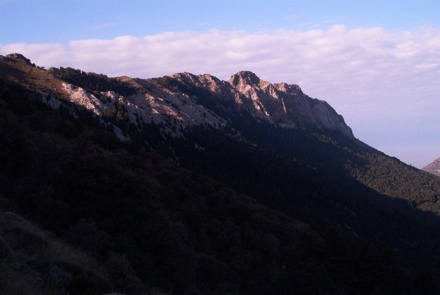
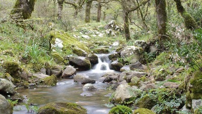
Further on, the Spanish firs give way to gall oaks, as we descend a track in search of the small village of Benamahoma. On the cliffs of the Sierra, it is possible to see crows and vultures flying in circles, as if they are observing us attentively.
Type of Trail: Linear Trail Status: Approved and Signposted 2012. Total Length: 10.5 Km (one way) Sections: 1 Accessibility: It can be done on foot. Download Topographic Guide
Itineraries
Ideas for your trip
Services and infrastructure
Target audiences
Segments
Season
You may be interested


EXPLORE ANDALUSIA
EXPERIENCES


