
Encinar de Abrucena Trail - PR-A 15
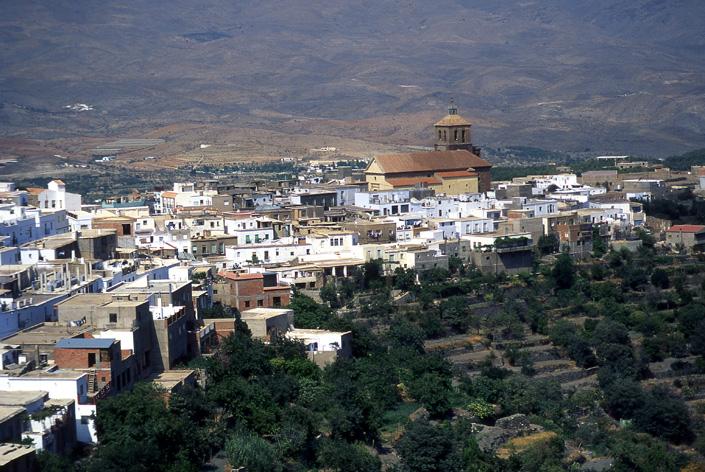
The Encinar de Abrucena Trail - PR-A 15 runs through the municipal district of Abrucena, in the Nacimiento river valley, between the slopes of the Sierra Nevada and the south-facing slope in the foothills of the Filabres. The town, nestled in the peak of a hill, is located near the A-92 motorway, surrounded by a plain where we can note terrace cultivation and numerous dense olive groves.
Nacimiento, a region of Almeria in the district of Abrucena, offers an incredible variety of ravines that are of impressive natural beauty. This area is included in the Network of Protected Natural Areas of Andalusia, as a Nature Reserve and National Park of Sierra Nevada.
Even though the Encinar de Abrucena Trail - PR-A 15 leaves from the same town of Abrucena, it really starts in Puntal del Haza Pepe Gómez, 2.5 km from the town. From here, the path follows the course of the Nacimiento river and enjoys the views of Tautila hill.
The path passes by the half-ruined “Escuelas de las Chozas” and leaves behind the Nacimiento river shortly before the spot popularly known as “Cemetery of the Moors”.
In “La Roza” Recreational Area, under the Department of the Environment, it continues towards the “Río de la Mina” and the interesting natural viewpoint of “Cuerda de la Mina”.
From “Tajo de los Cejes” natural viewpoint, you can see the Sierra de los Filabres, Vega de Abrucena, towns such as Fiñana, Escullar and Abla, and Cerro del Castillejo.
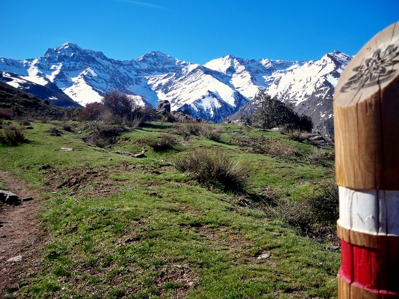
It goes into the area of the Sierra Nevada protected as a National Park. The views are spectacular in the whole section and repopulated pine predominates.
Among the leafy forest, you reach the “Barranco del Diablo” where the surrounding land is very steep, with large age-old oaks, as well as huge waterfalls, which transport the water of the thawing of the peaks. Enjoy the beauty of the area of the Nacimiento river source, the “Barranco de Piedra Horadada”.
From “Majada de Panadero”, there is a steep descent through a repopulated pine grove to “Los Puntalillos“ and “Barranco del Peral”. It passes beside the "Lorenzo" house and the "El Peral" farmhouses, again in the direction of Abrucena.
It reaches "Las Torrecillas" natural viewpoint, right above the “Escuelas de las Chozas”, and then back to Puntalillo del Haza Pepe Gómez, the starting point of the PR-A 15 trail.
Type of Trail: Circular. Trail Status: Approved and Signposted 2007. Total Length: 14.5 km. Sections: 1 Accessibility: It can be done on foot. Download Topographic Guide
Itineraries

Services and infrastructure
Target audiences
Segments
Season
You may be interested


EXPLORE ANDALUSIA
EXPERIENCES


