
Vía Verde of Odiel

Amongst a mining landscape on the banks of the Odiel
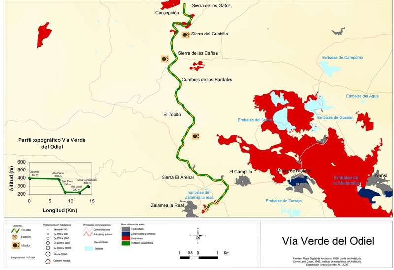
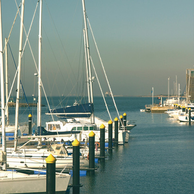
This Vía Verde starts in the Estación Vieja (Old Station) or Estación de El Buitrón station and runs along the tracks of the old mining railway the brought minerals from the Concepción, San Plato, La Esperanza, La Poderos and Angostura mines. From here, along the El Buitrón railway it ran to the wharf of San Juan del Puerto which connected with the port of Huelva.
The route runs between the districts of Zalamea la Real,El Campillo and Almonaster. The main stations or stops from Zalamea, were: Traslasierra, La Fija, Tintillo, El Canónigo, plazas Mina Poderosa, Puente Río Odiel, San Platón and Concepción. There were never passenger services, as it was exclusively a mining service.
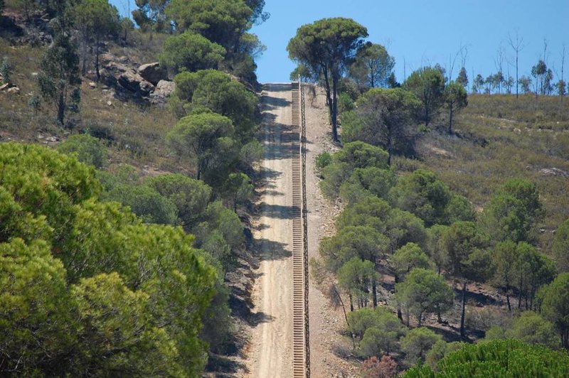
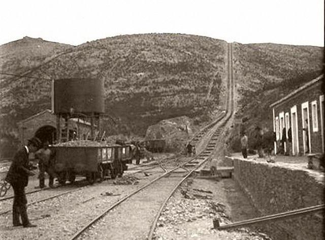
Opened in 1906 he had a very uneven land with a sloping plain called La Fija. The train had to pull the mineral wagons up a 1km hill with a maximum slope of 32%, to a height of 168 m. The mechanism was the following: whilst one lot of wagons went up, pulled by a fixed steam machine in the upper part, another train went down, using the counterweight.
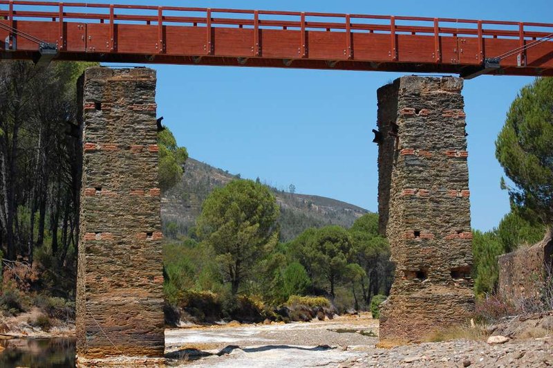
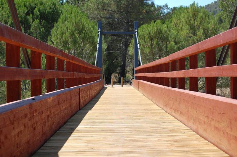
At the bottom, they crossed the Tintillo river, which sends acidic water to the Odiel from the outflow of the Corta Atalaya. This river crosses a wooden footbridge-bridge that spans 30 m, built on the structure of the original dismantled bridge.
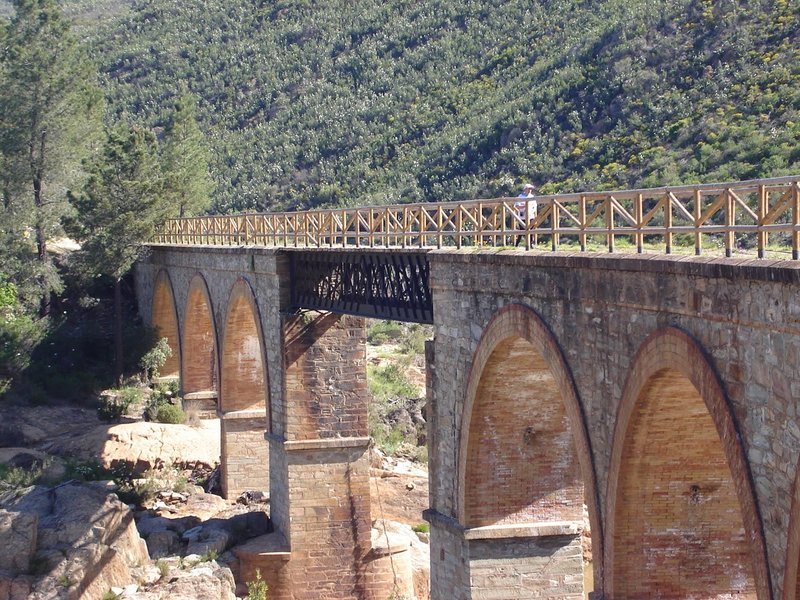
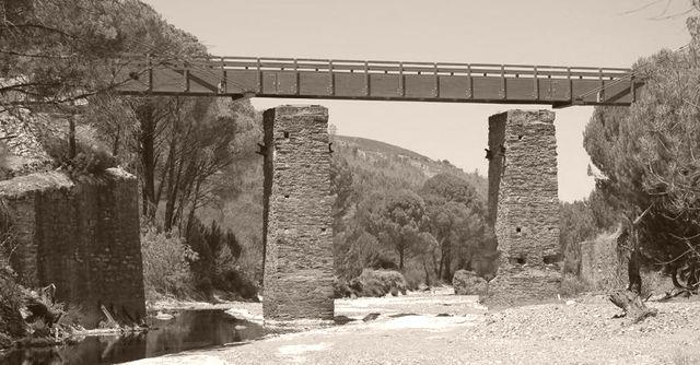
From there the route levels out, running through tunnels and passing alongside the mine loading bays until reaching the puente del Odiel or "de Chapa" bridge, as we know it today. This is a curved, composite bridge, formed by six semi-circular arches made from stone masonry and brick, solidly built, with a central section whose panel comprises a latticework double iron box girder.
After the bridge you will come across the San Platón mines and its loading bay for the mineral brought from other nearby mines. Here, the Odiel changes colour as it no longer consists of water from the mine, and its banks take on a shade of green. On the ascent, and with views of the river, you will reach the end of the route in the town of Minas Concepción.
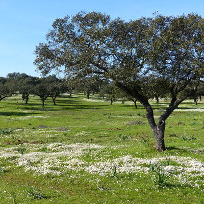
The vegetation along the route is characterised by the large pine tree plantations and repopulated eucalyptus. There are also species such as oak, cork oaks, gall oak, strawberry trees, rockrose and heather.
The fauna in the area: boar, deer, polecat, mountain cat, genete, eagle, partridge and the protected black stork.
Type of surface: Unconditioned ground and conditioned dirt tracks. Various sections by road. Total length: 17 km. Accessibility: Suitable for walking and mountain biking. * Vía Verde partially conditioned. The dirt track has been conditioned with protective fences, the installation of informative panels and the creation of recreational areas along the last section of the route, between the N 435 (Km 6) and Mina Concepción (Km 15). * Passable with little signposting or maintenance, with possible discontinuity problems. Difficulty of route: Alta, the inclined planes that span the river Tintillo force users to overcome a steep slope of 33%. Infrastructures: Platform using interruptions. Old railway stations. 1 viaduct, 1 bridge, 2 tunnels, 1 sloping plain and several loading platforms. Cartographic information: Military map of Spain. Scale 1:50.000: Page 938 Official Road Map. Ministry of Development.
Itineraries
Services and infrastructure
Target audiences
Segments
Specialties
Season


EXPLORE ANDALUSIA
EXPERIENCES


