
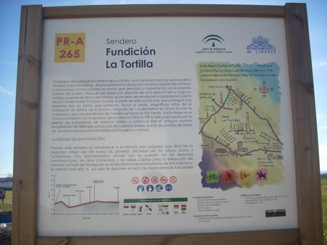
Paño Pico Trail. Mineras de Linares Routes – PR-A 260

Walk through the remains of the mines that display, among the ruins, a very representative and exceptional part of the history of the city of Linares.
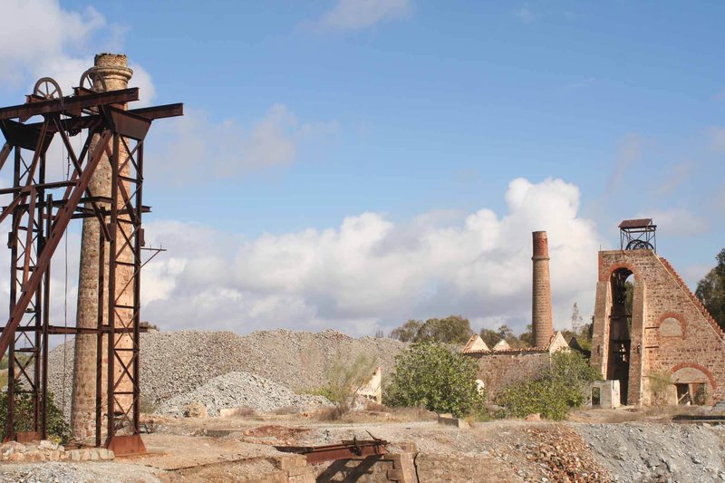
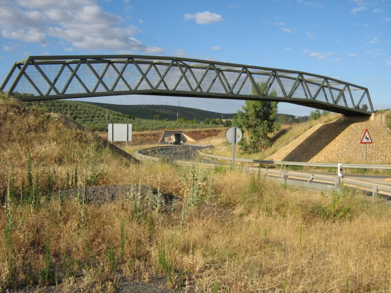
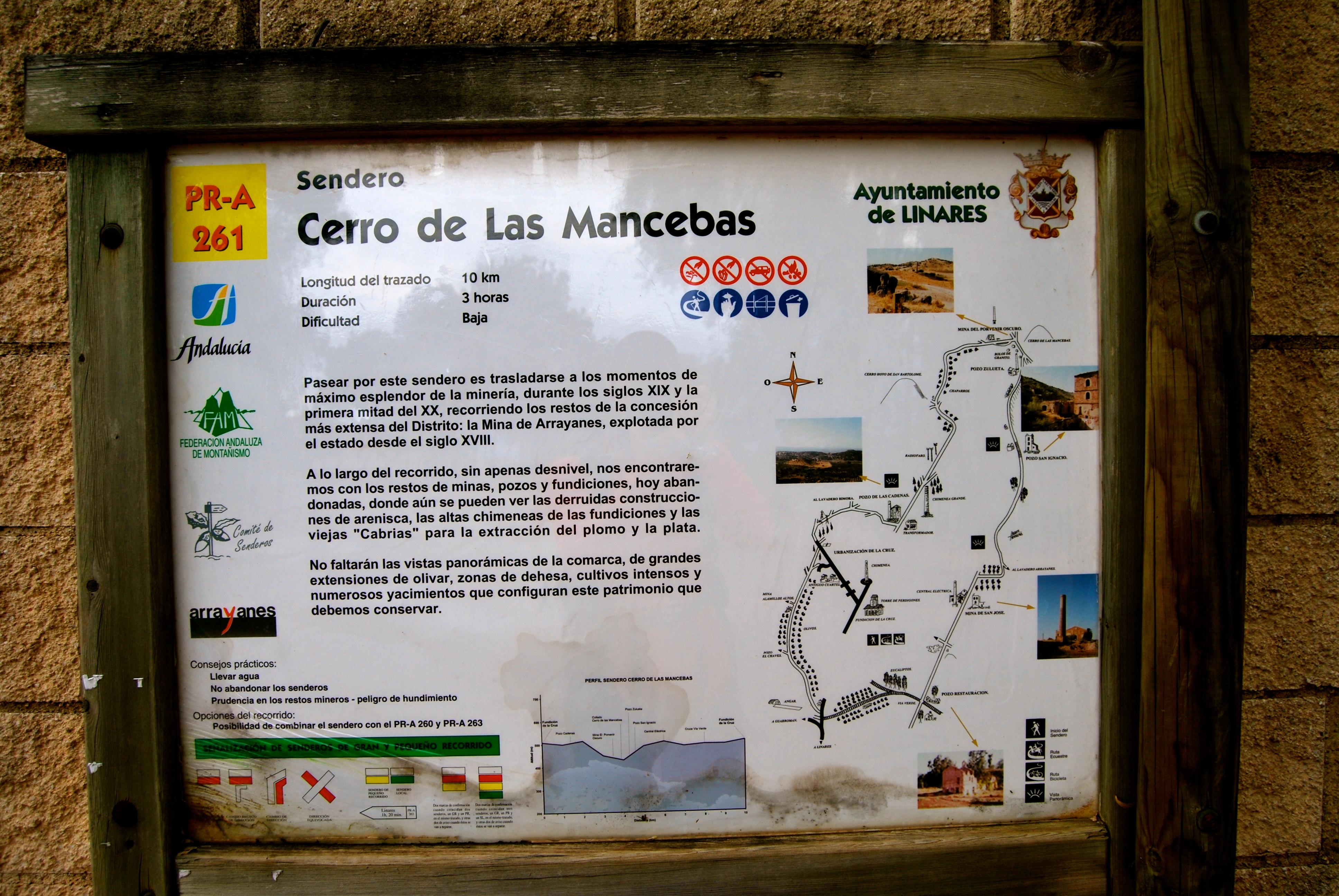
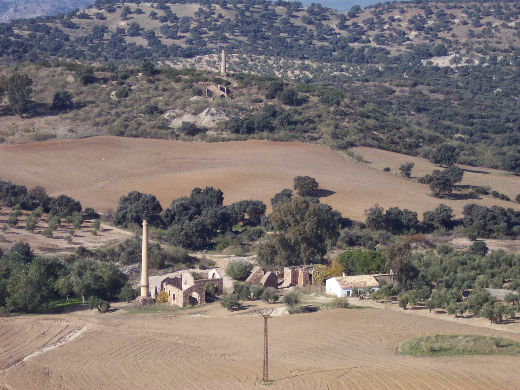
This Trail, which is practically flat, starts in the Arrayanes neighbourhood, and follows one of the most important paths that used to connect the Arrayanes Mines with Linares. The route, after passing the Pozo Acosta mine shaft, where the extraction machine, chimney and auxiliary buildings are still standing, crosses two of the old mine railways, which have now been dismantled: One, as it passes by the Restauración mine shaft, and the other, before reaching the San José shaft and the electricity plant. The stretch between the two shafts coincides with the trail PR-A 261 “Cerro de las Mancebas”, which means the routes can be combined.
At the Pozo Restauración, which was open between 1844 and 1850, one of the things that stands out is the building that housed the sheds and garage for the mine railway locomotives. At the San José shaft, next to the path, you can still see the place called the "Bajada de la Reina" ('Queen's Descent), which was constructed for a visit by Isabel II to the first gallery.
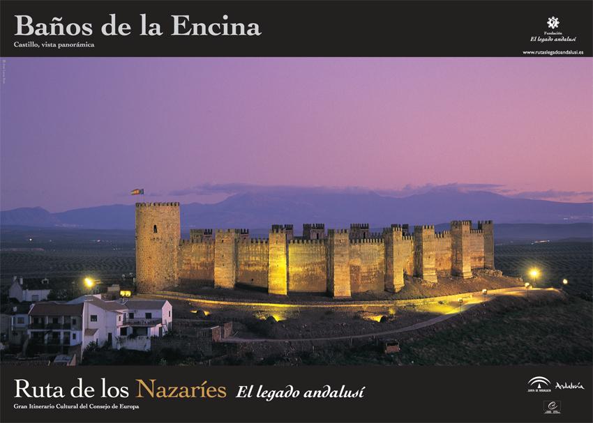
The trail carries on towards Paño Pico (triangulation station) and La Mina de La Mejicana mine, two spots where it is possible to enjoy unbeatable panoramic views of the area: in the distance, La Carolina and Baños de la Encina, and in the foreground, the San Bartolomé pit, the Cerro de las Mancebas hill, etc.
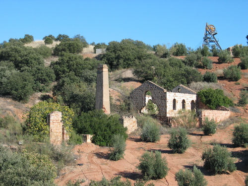
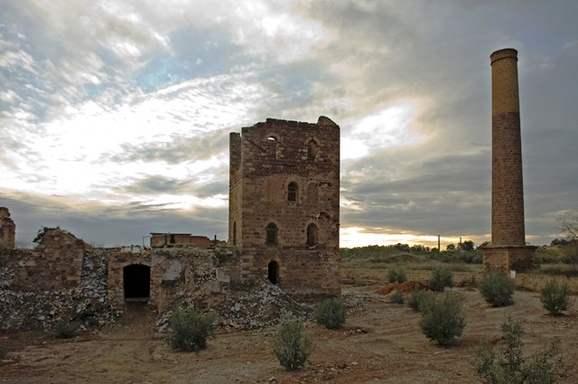
From La Mejicana, an old path that passes between holm oak trees, interrupted by an olive grove, leads to the Chimenea de la Cruz, one of the highest chimneys in the area, which reached a height of 100m (today it is 57 metres tall) and where the trail rejoins the route of the PR 261.
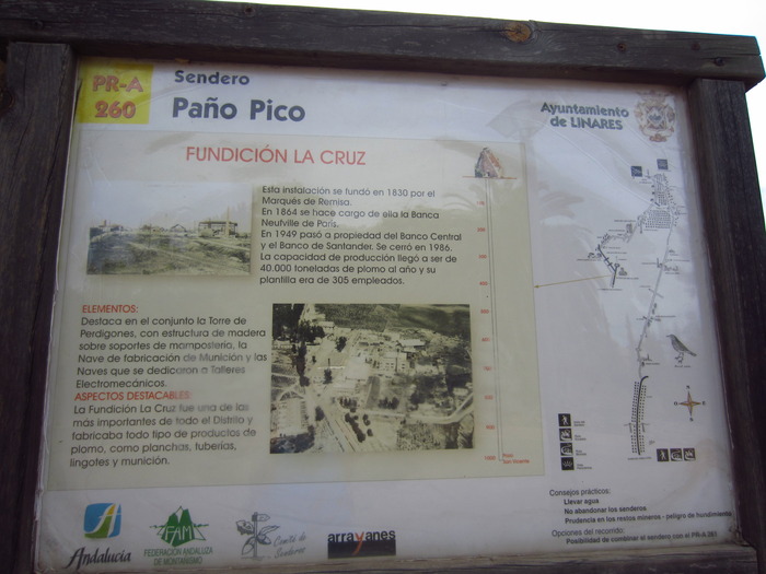
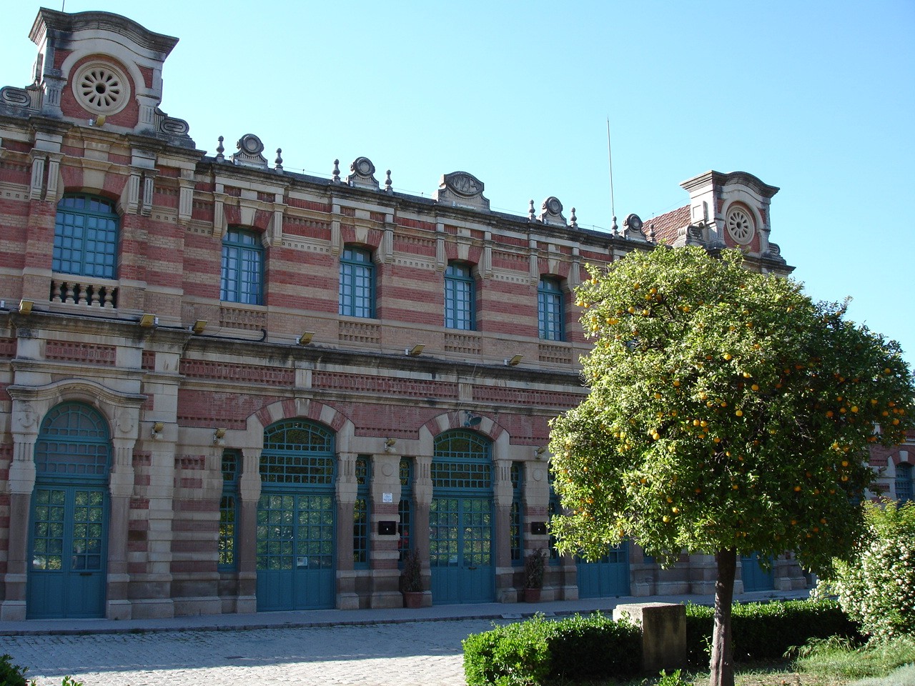
We pass by the Pozo Cadenas shaft and, further on, the Lavadero Bimora mineral processing plant, an example of natural regeneration of vegetation in the area, then circle the residential area to end up at the Fundición la Cruz foundry, where all types of lead products used to be made, before it was turned into a Research Centre.
Type of Trail: Linear. Trail Status: Approved and Signposted 2003. Total Length: 8.5 km. Sections: 1 Accessibility: Suitable for walking, mountain biking and horse riding. Download Topographic Guide
Itineraries

Services and infrastructure
Target audiences
Segments
Season
You may be interested


EXPLORE ANDALUSIA
EXPERIENCES


